5.5 km away
Beinn Dubh (642m) and the Glen Striddle Circular
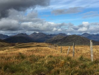
A pleasant 'wee' day out, but still packs a punch with the view!
Moderate Hiking
- Distance
- 12 km
- Ascent
- 721 m
- Descent
- 721 m
Fantastic views of Loch Lomond and beyond!
Hiking Difficult

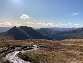
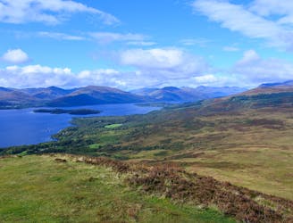
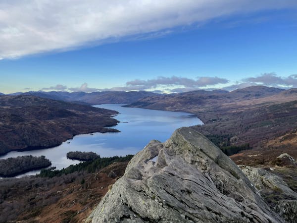
Ben Lomond (Scottish Gaelic: Beinn Laomainn, 'Beacon Peak') is a mountain in the Scottish Highlands that rises to 974 meters. It is the most southerly of the Munros, located on the eastern coast of the beautiful Loch Lomond. Due to its accessibility from the bright lights of Glasgow, around 30,000 people climb Ben Lomond every year so be prepared to hustle for a car parking space in peak season. Park the car, pay the fee, and be a good tourist by snapping photos of Loch Lomond and the metal jetty that protrudes into its dark waters. Head past the information building, stopping off at the public toilets if you so desire, and follow the path that meanders its way upwards through oak woodlands. The wooded area starts to thin out as you make your way up into more familiar highland terrain. Follow the path over a bridge and further on through a gate to reach full open terrain. Follow the well-worn path up to the summit and enjoy 360-degree views of incredible scenery.
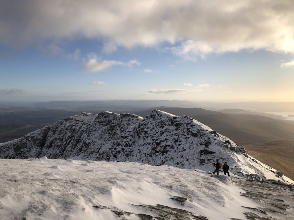
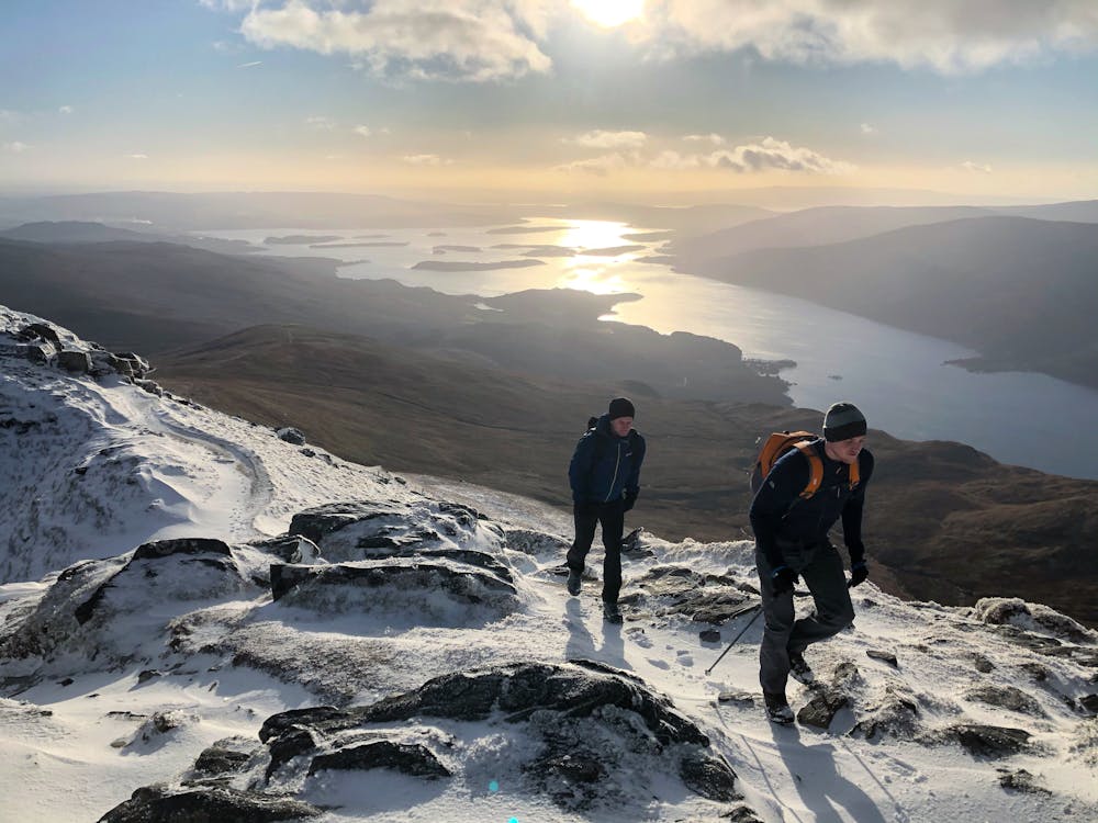
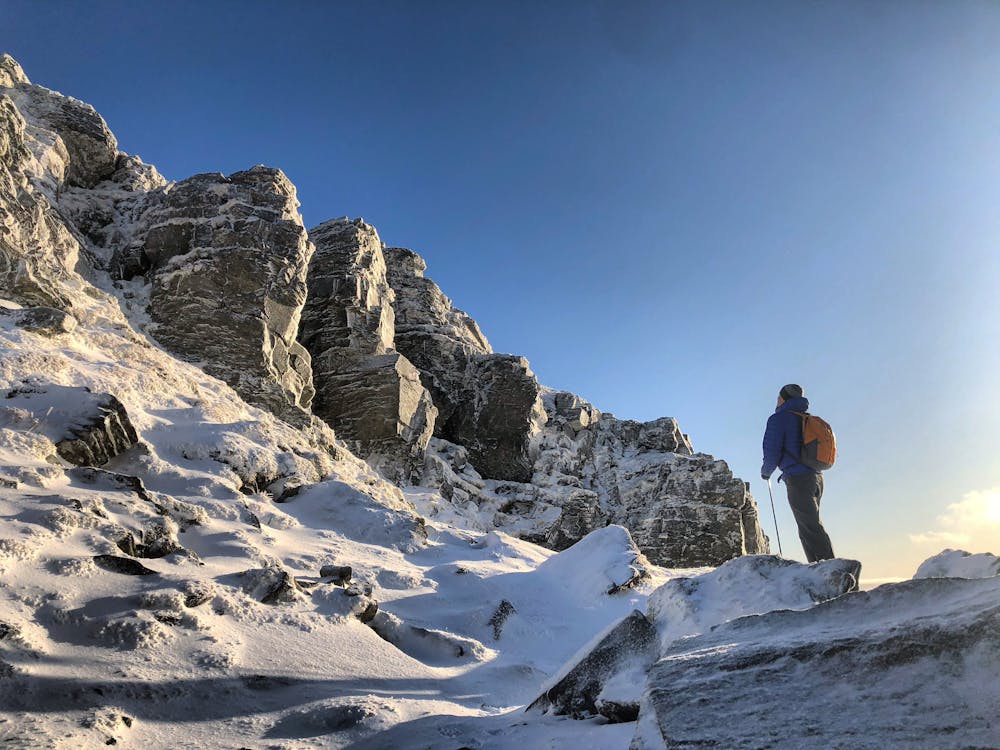
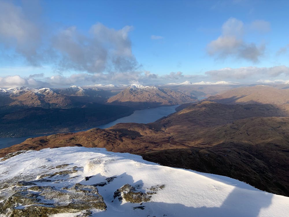
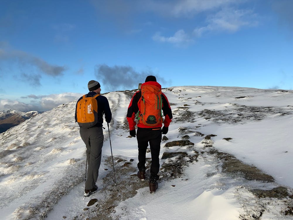
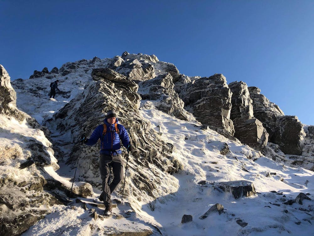
Once you’ve taken a selfie, eaten your sandwich, and gasped at various tourist’s chosen mountain apparel (trust me, you’ll see all sorts) follow the rocky path heading northwest leading towards Ptarmigan (731m) ridge. The route descends a rocky ridge that continues to provide excellent views of Loch Lomond and the Arrochar Alps. Be mindful as this area does contain cliff bands that would cause serious injury if encountered face first so stick to the path. Follow the GPX file and path back down to the car park and celebrate the fact you were one of the 30,000 people who didn’t require a mountain rescue callout because you attempted to climb a Munro in flip-flops carrying a plastic bag containing Coca-Cola. Yes, it happens.
In winter /spring conditions, the well-worn path that can be seen in the summer will be covered with snow but as this mountain receives so many visitors, tracks from other hiking parties will most likely be laid down. An ice axe and crampons may be necessary nearer the summit to contend with the rockier terrain.
This hike and guide were completed during spring weather conditions. This is just one opinion of this route. Make sure to do your own research by consulting local internet resources, mountain guides or guidebooks to evaluate other opinions so you can be best prepared for the terrain.
A Guide by Red
Difficult
Hiking trails where obstacles such as rocks or roots are prevalent. Some obstacles can require care to step over or around. At times, the trail can be worn and eroded. The grade of the trail is generally quite steep, and can often lead to strenuous hiking.

The trail contains some obstacles such as outcroppings and rock which could cause injury.
Away from help but easily accessed.
5.5 km away
A pleasant 'wee' day out, but still packs a punch with the view!
Moderate Hiking
9 km away
A justly popular up one of Scotland's most recognisable mountains
Difficult Hiking
9 km away
A big day, a big car park fee and a big load of tourists, but beat that and you'll have fantastic hike on three local area classics!
Difficult Hiking
9.9 km away
One of the most popular day hikes from Glasgow provides fabulous views over Loch Lomond
Difficult Hiking
12 routes · Hiking