1 m away
O'Malley Peak: Ballpark Trail
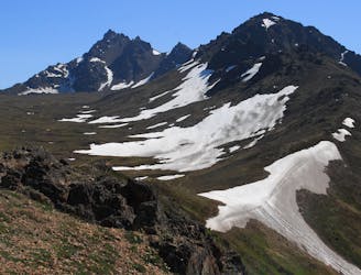
The most impressive peak rising from Anchorage, with a route to the top that's actually easier than it looks.
Severe Hiking
- Distance
- 13 km
- Ascent
- 1 km
- Descent
- 1 km
The classic hike and scramble to Alaska's #1 summit!
Hiking Difficult

It's often said that Flattop is Alaska's number one most-climbed mountain. Whether data exists on that or not, one glimpse of the parking lot on a summer afternoon will convince you that it's true. Glen Alps is certainly the busiest trailhead in Chugach State Park, with many popular trails beginning from there. Most notable among them is Flattop Mountain.
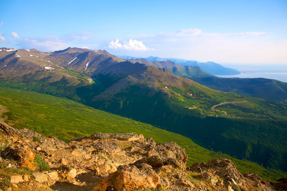
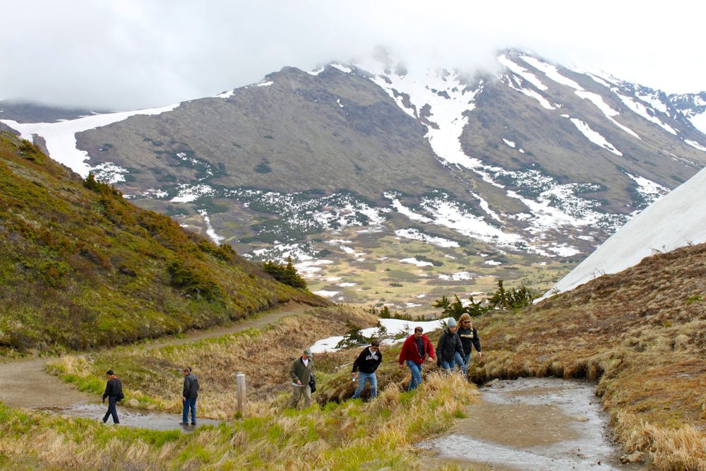
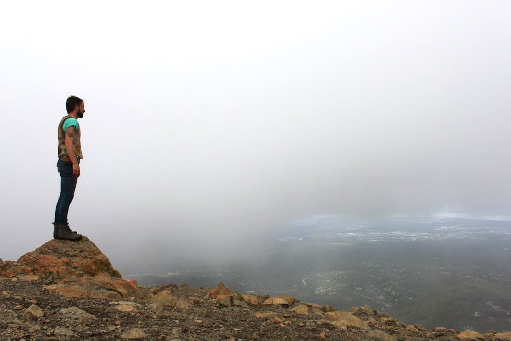
Flattop is so popular simply because it's an awesome hike with easy access from Anchorage. Beginning as a wide trail with an easy warmup, it gains elevation quickly and becomes progressively steeper––going from tall stairs to a full-on rock scramble. Danger of falling is minimal, however. Rest spots are ample, and views are incredible the whole way. The popularity is well deserved, because this really is a must-do hike in Anchorage!
If you want to avoid the crowds, just get there early in the day. In the Alaskan summer, practically endless daylight means that your hiking is limited only by your sleep schedule. On Flattop though, the lively crowd can actually be a part of the fun.
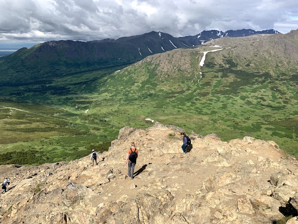
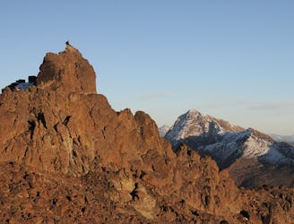
The top of the route gets quite steep and rocky, pushing some people to their limits of comfortable hiking. It's not so vertical that scrambling is required, but most will use their hands on at least a few moves. You'll need to be careful on the way up, and even more so on the way down, to keep from slipping or from kicking rocks on those below.
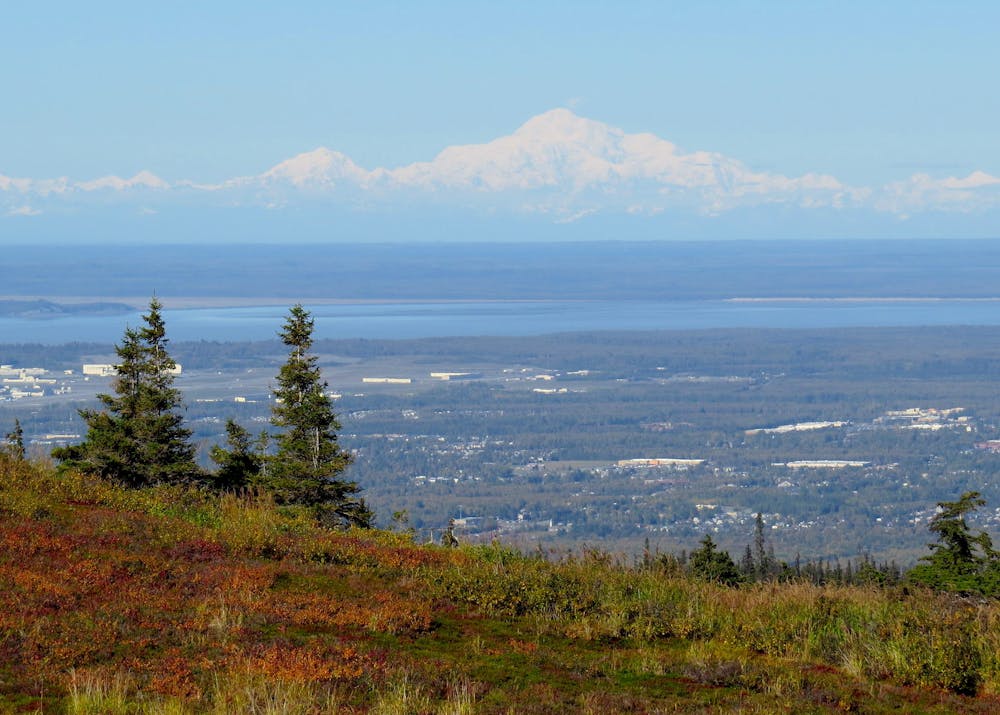
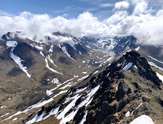
Once on top, you'll see why it's called Flattop. Walk just a bit farther to stand on the true summit––a rock mound near the center of the mesa. You can stroll the perimeter to gaze off every side of the mountain, and enjoy impressive views of Anchorage, the Cook Inlet, and peaks of the Chugach Front Range. On a clear day, you can see to snowy mountains across the inlet, and if you're really lucky with the weather you'll get an incredible view of Denali in the north.
The descent is by the same route down the rocky ridge and steep stairs. Once back at the trail junction, you might choose to switch it up and take the other side of the loop around Blueberry Knoll instead.
Difficult
Hiking trails where obstacles such as rocks or roots are prevalent. Some obstacles can require care to step over or around. At times, the trail can be worn and eroded. The grade of the trail is generally quite steep, and can often lead to strenuous hiking.

Some trail sections have exposed ledges or steep ascents/descents where falling could cause serious injury.

Close to help in case of emergency.
1 m away
The most impressive peak rising from Anchorage, with a route to the top that's actually easier than it looks.
Severe Hiking
171 m away
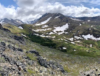
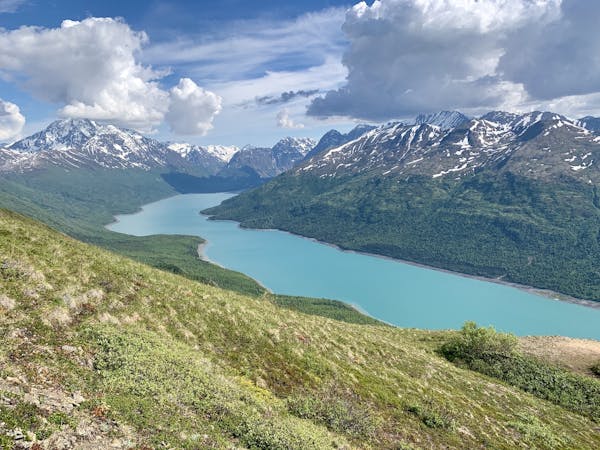
Find a variety of Chugach scenery on this long day hike or overnight trip, which begins from a popular trailhead but soon leaves the crowds behind.
Moderate Hiking
4.2 km away
A scenic hike in the hills close to town, good for getting a feel for hiking in the Chugach
Moderate Hiking
4.3 km away
A local go-to for a steep workout with rewarding views.
Difficult Hiking
4.3 km away
An enticing peak of the Chugach Front Range, making a worthy half-day objective from Anchorage.
Difficult Hiking
9.8 km away
A prominent peak above Anchorage, overlooking the city plus most of Turnagain Arm and the length of the Cook Inlet.
Severe Hiking
9.8 km away
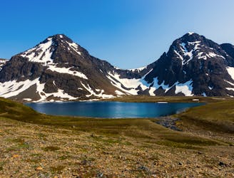
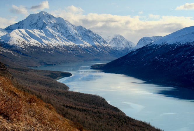
Hike all the way up from the sea to one of the prettiest alpine lakes in the Chugach, by way of a stunning glacial valley with nearly nonstop views.
Difficult Hiking
7 routes · Hiking
10 routes · Gravel Biking · Hiking · Road Biking