1 m away
Flattop Mountain

The classic hike and scramble to Alaska's #1 summit!
Difficult Hiking
- Distance
- 4.8 km
- Ascent
- 442 m
- Descent
- 442 m
The most impressive peak rising from Anchorage, with a route to the top that's actually easier than it looks.
Hiking Severe

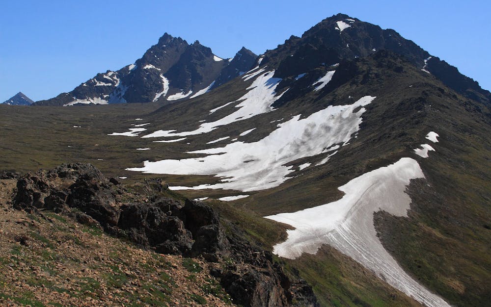
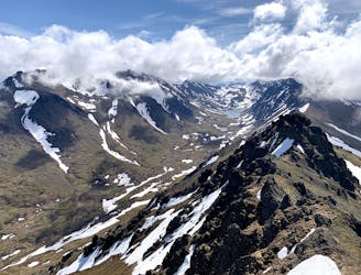
O'Malley is perhaps the most eye-catching peak on the skyline above Anchorage, with a sawtooth ridgeline rising to a craggy summit. At 5,1840 feet it's also the tallest of the peaks readily visible from town. Though it appears daunting, there are a number of moderate routes to the top. The distance and difficulty are just enough to deter most people, however, so you'll likely enjoy an uncrowded experience on this mountain. Described here is the standard route, which provides the quickest approach to the summit. But there are ample opportunities for more exciting variations for those who seek them.
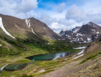
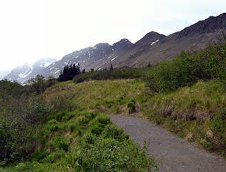
Beginning from the busy Glen Alps trailhead, take the trail toward Little O'Malley Peak. This goes through some forest and drops into a creek valley with a bridged crossing. It then punches up a gully that can hold snow well into summer. Kick up the snow or zigzag the grassy slope alongside. The top of this gully is the saddle with Little O'Malley, and the ridge leading to O'Malley is opposite. The trail drops down, however, to a broad tundra valley called the Ballpark.
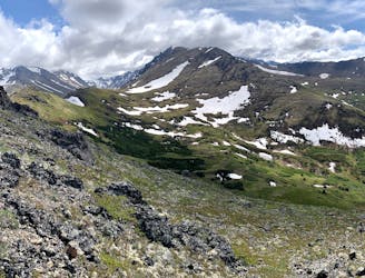
Enjoy a scenic romp gently uphill on a well-worn path, as the points on O'Malley's ridge tower overhead. The trail forks near the upper end of the Ballpark, and the way to go is to the right, toward a scree-filled gully leading up the mountain.
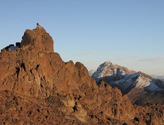
The trail more or less disappears into the rocks and possibly snow, but the only way to go is up. A few hundred feet of slogging and boulder hopping will get you to the notch in the ridge at the top. From there, a dirt trail reappears and leads along the south face of the mountain, bypassing rock bulges and one false summit on the way to the peak.
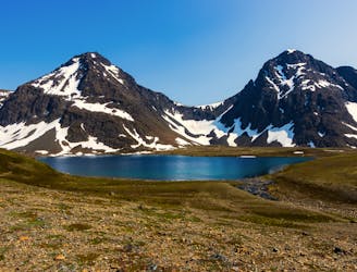
After one final scramble, you're there––overlooking all of the Anchorage bowl with mountains on every horizon, if the weather is clear. Nearer sights include lakes in the valleys on either side, and craggy ridgelines spanning in between.
Unless you want to explore a loop with another route, simply return the way you came. Glissading may aid your descent, depending on snow conditions in the gullies.
Sources: https://www.alaska.org/detail/omalley-peak-trail https://www.summitpost.org/o-malley-peak/536178
Severe
Hiking challenging trails where simple scrambling, with the occasional use of the hands, is a distinct possibility. The trails are often filled with all manner of obstacles both small and large, and the hills are very steep. Obstacles and challenges are often unexpected and can be unpredictable.

Some trail sections have exposed ledges or steep ascents/descents where falling could cause serious injury.
Little chance of being seen or helped in case of an accident.
1 m away
The classic hike and scramble to Alaska's #1 summit!
Difficult Hiking
172 m away
Find a variety of Chugach scenery on this long day hike or overnight trip, which begins from a popular trailhead but soon leaves the crowds behind.
Moderate Hiking
4.2 km away
A scenic hike in the hills close to town, good for getting a feel for hiking in the Chugach
Moderate Hiking
4.3 km away
A local go-to for a steep workout with rewarding views.
Difficult Hiking
4.3 km away
An enticing peak of the Chugach Front Range, making a worthy half-day objective from Anchorage.
Difficult Hiking
9.8 km away
A prominent peak above Anchorage, overlooking the city plus most of Turnagain Arm and the length of the Cook Inlet.
Severe Hiking
9.8 km away
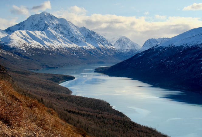
Hike all the way up from the sea to one of the prettiest alpine lakes in the Chugach, by way of a stunning glacial valley with nearly nonstop views.
Difficult Hiking
7 routes · Hiking
10 routes · Gravel Biking · Hiking · Road Biking