3.4 km away
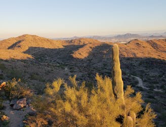
The Corona Loop

An easy, scenic hike in the South Mountain trail system.
Moderate Hiking
- Distance
- 5.8 km
- Ascent
- 68 m
- Descent
- 69 m
Hike through mountaintop saguaro forest to a natural playground of boulders.
Hiking Moderate

When viewing South Mountain from the city, it seems to be a singular ridgeline topped with radio towers. Drive or hike toward the top, however, and you'll discover it's actually quite complex, with many valleys and ridges furrowing the top of the mountain, and many trails crisscross throughout.
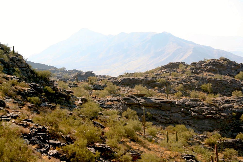
One of the best short hikes on the mountain is National Trail to Fat Man's Pass. The pass is a tight squeeze between rocks, found in a jumble of large boulders with plenty of other nooks and crannies to explore. It's especially fun for families with children, and dogs are allowed if kept on leash.
Though the hike is not too difficult, it shouldn't be taken lightly because of rocky terrain and the danger of desert heat. National Trail takes some short but steep ups and downs as it follows a shallow valley on the mountaintop, all the while among impressively tall saguaros and a diversity of other desert plants. In places you'll get nice views over the city and surrounding mountains.
This elevation stays slightly cooler and breezier than the Phoenix Valley, but still becomes dangerously hot in the summer. Do this hike early in the day to beat the heat, and of course bring snacks and lots of water. There is nowhere to fill up once you're at the trailhead.
Moderate
Hiking along trails with some uneven terrain and small hills. Small rocks and roots may be present.

The trail contains some obstacles such as outcroppings and rock which could cause injury.
Away from help but easily accessed.
3.4 km away
An easy, scenic hike in the South Mountain trail system.
Moderate Hiking
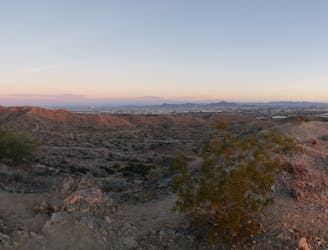
5.9 km away
A demanding, short hike with incredible views of Ahwatukee.
Difficult Hiking
5.9 km away
A short hike originating from the Pima Canyon Trailhead.
Moderate Hiking

16 routes · Hiking

6 routes · Hiking