1.7 km away
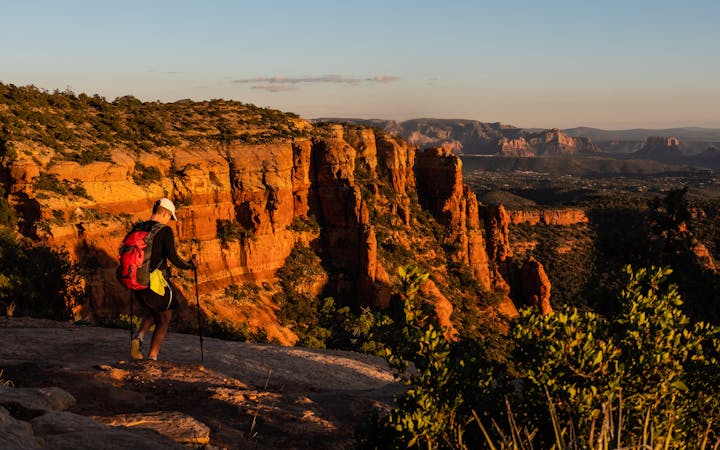
Wilson Mountain
A view-heavy hike to the highest point in the Sedona area
Difficult Hiking
- Distance
- 16 km
- Ascent
- 787 m
- Descent
- 787 m
A lightly-populated Sedona route that's a must-do hike in the fall.
Hiking Severe

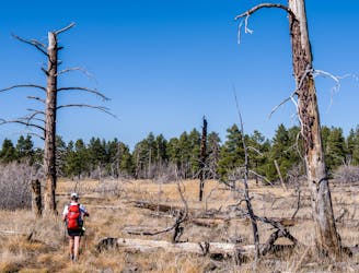
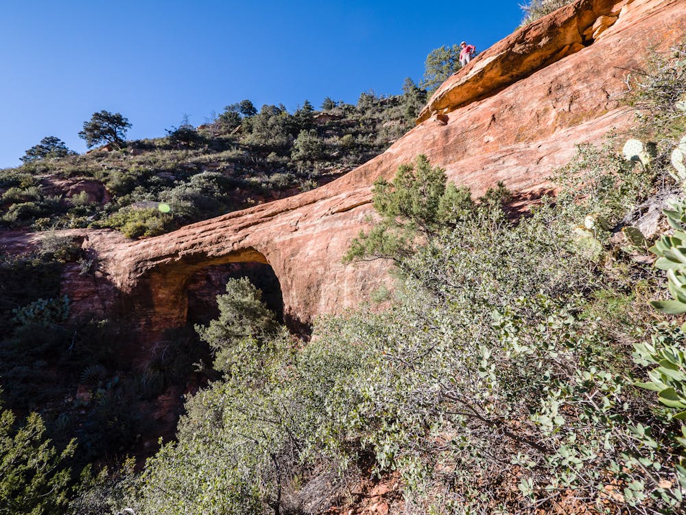
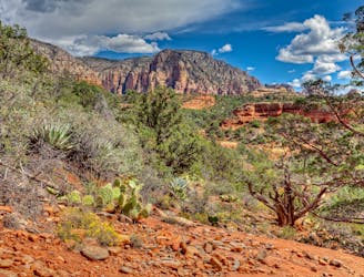
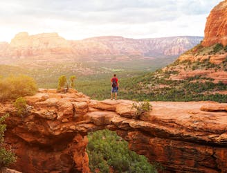
For those who love solitude, this 5-mile round trip hike provides plenty of it, with breathtaking views and an arch included. There is no specified trailhead; parking and trail access is on the side of Oak Creek Canyon road.

Be prepared... this is a stiff climb! With 1,100 feet of elevation gain over 1.25 miles to attain Sterling Pass high up at the end of the canyon, it is best to know ahead of time that you will lose (only to re-gain) 800 feet on the other side.
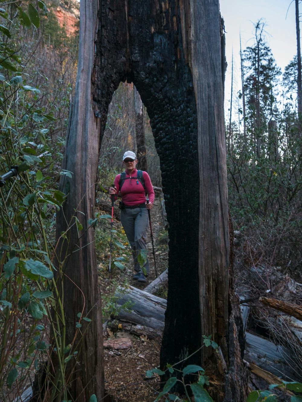
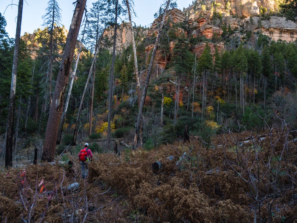
The trail in this gorgeous canyon is well-built, but obviously not frequently maintained. Expect some downed trees to clamber over as the trail switchbacks steeply up to the pass, which looks like a U-shaped notch way up at the right end of the canyon. The route up consists of many, many narrow switchbacks with many, many big rocks to step up; trekking poles are a huge help here!
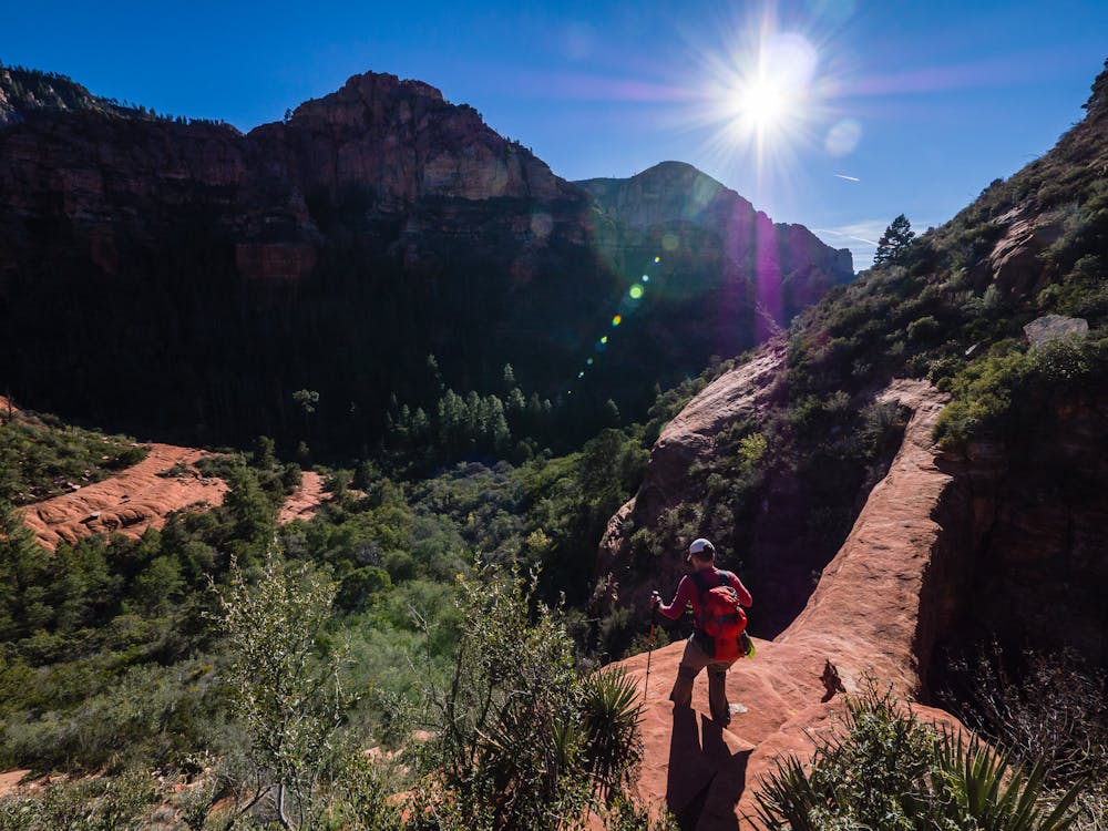
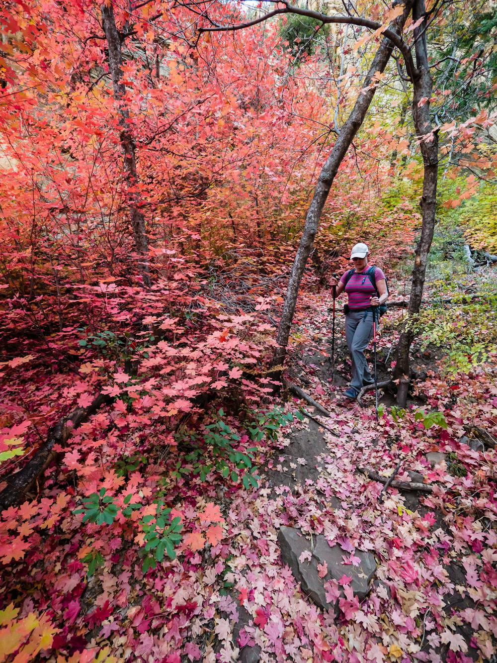
The actual pass is just a quick up-and-over, then drops immediately into a spectacular display of color when the leaves are at autumn peak. After climbing the other side, it is a relief to find that the trail that drops down the far side of the pass is immensely different. This side is a much gentler grade, and the trail is primarily smooth tread. That also means that regaining the pass on the return is less daunting.
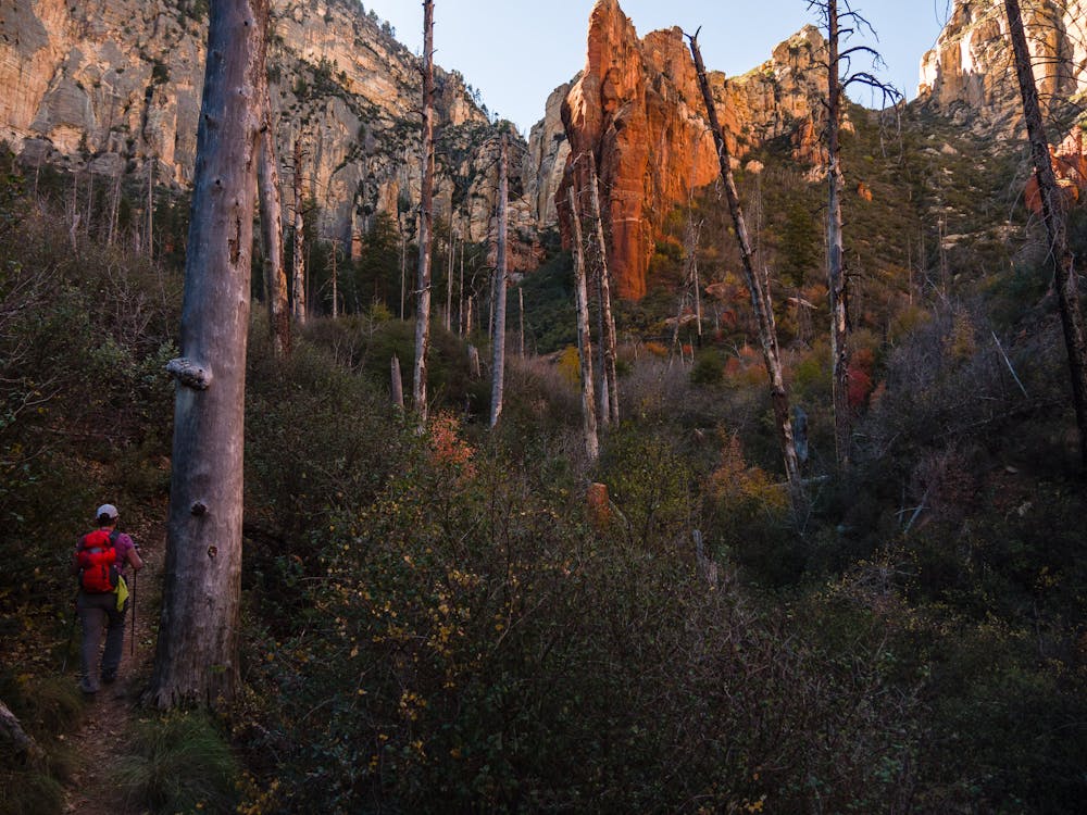
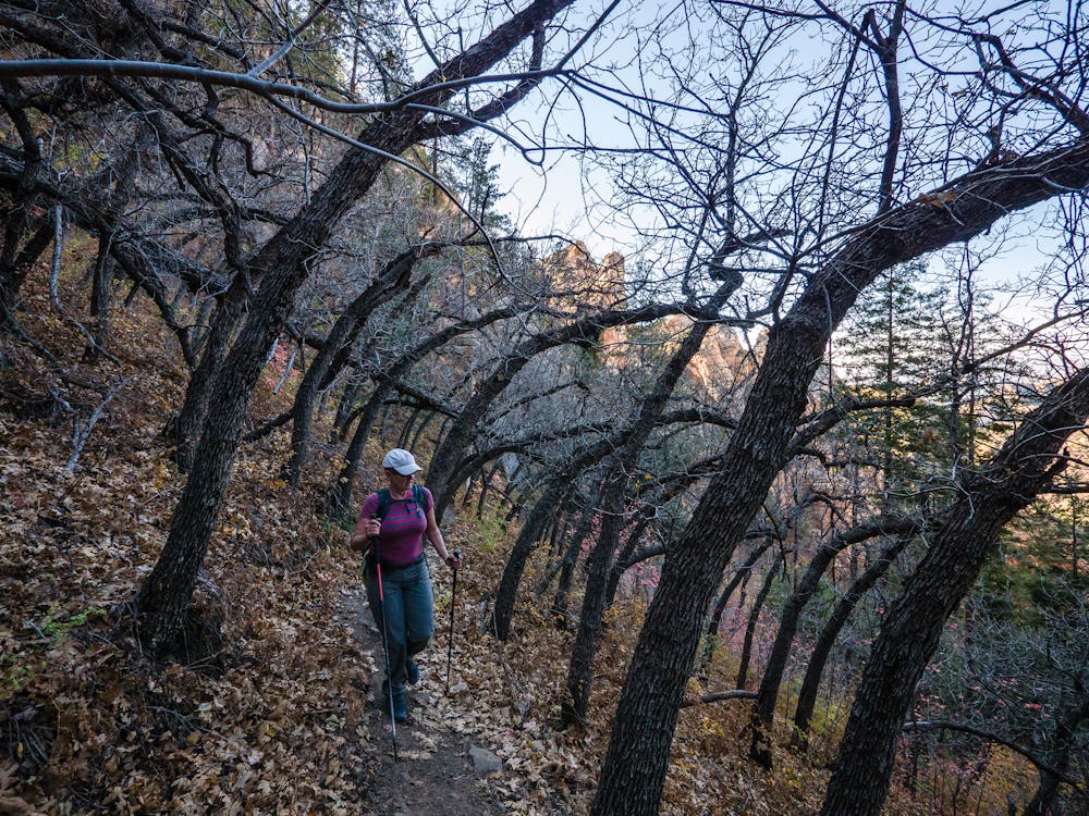
The terrain on this side is completely different, with gorgeous trees and colorful canyon walls. There is a short stretch of trail that passes through some uniquely curved, spooky-looking trees as it makes its way to the bottom of the canyon.
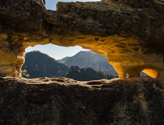
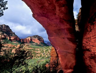
Once at the bottom, enjoy the relatively flat stretch that continues to the sign for Vultee Arch. Go right on the less-defined Vultee Arch Trail to an expanse of slickrock where a nice view of Vultee Arch opens up. If desired, take the little “social” trail up higher, to get adjacent to the top of Vultee Arch. The actual arch may not be stable, so it wouldn't be prudent to test it, regardless of how tempting it may be.
After spending ample time soaking in the splendor of the arch, turn around and begin the re-ascent to Sterling Pass. Once at the pass, take a last look back at the arch side and carefully descend the many big rock steps that take you steeply back down-canyon to the trailhead.
Severe
Hiking challenging trails where simple scrambling, with the occasional use of the hands, is a distinct possibility. The trails are often filled with all manner of obstacles both small and large, and the hills are very steep. Obstacles and challenges are often unexpected and can be unpredictable.

The trail contains some obstacles such as outcroppings and rock which could cause injury.

In the high mountains or remote conditions, all individuals must be completely autonomous in every situation.
1.7 km away
A view-heavy hike to the highest point in the Sedona area
Difficult Hiking
6.1 km away
This short, steep route is a rare Sedona hike providing solitude.
Severe Hiking
6.7 km away
A fantastic 5-mile loop around Brin's Butte.
Difficult Hiking
6.7 km away
Hike and scramble to one of the most beautiful caves in Sedona.
Severe Hiking
7.8 km away
A hike that follows an exciting expert-level mountain bike route.
Severe Hiking
8.2 km away
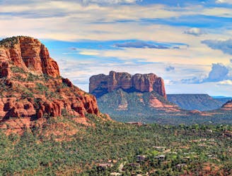
Hike to arguably Sedona's most famous tourist site.
Moderate Hiking
9.5 km away
Gorgeous loop around Airport Butte offering spectacular views of the valley.
Moderate Hiking
14 routes · Hiking