2.8 km away
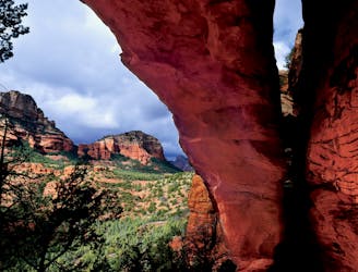
Fay Canyon Arch
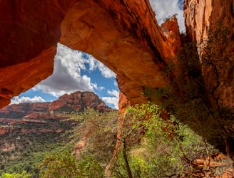
Hike to a stunning 90-foot arch!
Difficult Hiking
- Distance
- 2.4 km
- Ascent
- 75 m
- Descent
- 75 m
Hike to arguably Sedona's most famous tourist site.
Hiking Moderate

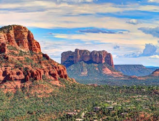
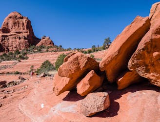
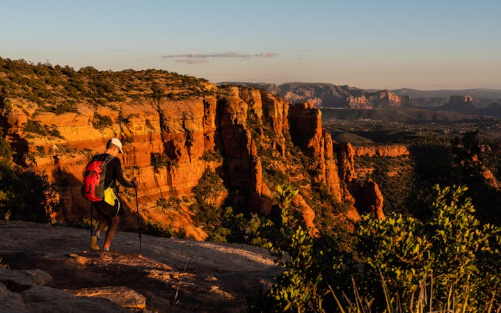
The Devil's Bridge is a beautiful elevated red rock arch—the largest natural arch in the Sedona area. Since the top of the "arch" is quite flat and easily accessible from the nearby mountainside, it's easy to walk out onto the arch and enjoy a spectacular vista.
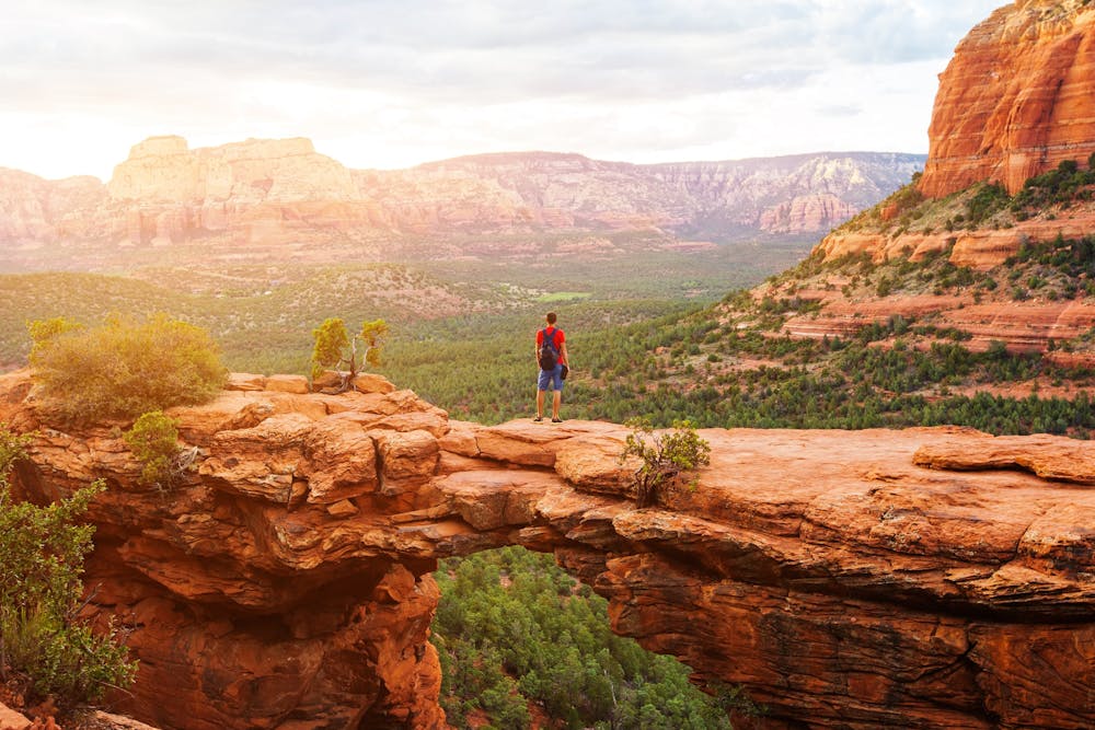
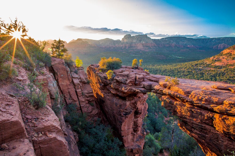
Standing on the arch has become such a common photo op that Devil's Bridge is now quite likely the most famous and most popular destination in all of Sedona. If you're trying to get a classic standing-on-the-arch photo, it's not uncommon to wait in line for over an hour to get your chance to stand on the arch without anyone else present. The swarms of tourists flocking to the arch have created absolute mayhem in this area. If you want to visit this beautiful geological formation, you'll need to brace yourself to deal with hundreds of other tourists.
Making the hike even more popular is the fairly easy approach. While you can expect to encounter some rock ledges, rock gardens, and moderate climbs, most any hiker will be able to negotiate the hike to Devil's Bridge.
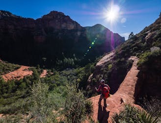
There are a few different ways to reach the arch, but the route shown here is one of the most logical, beginning from the Mescal Trailhead. The Mescal Trailhead is an easily-accessible trailhead that even two-wheel drive vehicles can reach. However, again, the popularity of this hike can pose problems. It might be impossible to find a parking spot if you don't arrive at sunrise. To avoid this difficulty, try taking the Sedona trailhead shuttle bus that departs from downtown.
Sources: https://www.fs.usda.gov/recarea/coconino/recarea/?recid=55292 https://www.earthtrekkers.com/hike-devils-bridge-sedona-arizona/
Moderate
Hiking along trails with some uneven terrain and small hills. Small rocks and roots may be present.

The trail contains some obstacles such as outcroppings and rock which could cause injury.
Away from help but easily accessed.
2.8 km away
Hike to a stunning 90-foot arch!
Difficult Hiking
3.6 km away
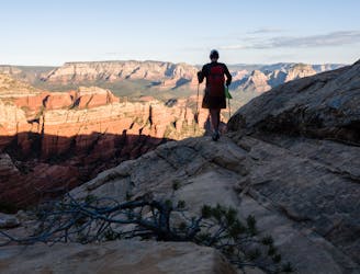
This short hike to a high plateau provides 360° views.
Severe Hiking
3.6 km away
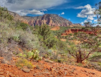
This Sedona hike provides gorgeous views of canyons & red rock formations.
Severe Hiking
4.4 km away
Hike and scramble to one of the most beautiful caves in Sedona.
Severe Hiking
4.4 km away
A fantastic 5-mile loop around Brin's Butte.
Difficult Hiking
6.2 km away
Short hike to a stunning overlook.
Difficult Hiking
6.7 km away
Gorgeous loop around Airport Butte offering spectacular views of the valley.
Moderate Hiking
8.1 km away
A hike that follows an exciting expert-level mountain bike route.
Severe Hiking
8.2 km away
A lightly-populated Sedona route that's a must-do hike in the fall.
Severe Hiking
8.7 km away
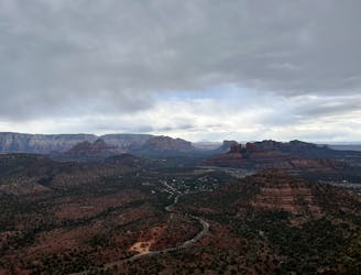
A view-heavy hike to the highest point in the Sedona area
Difficult Hiking
14 routes · Hiking