1 m away
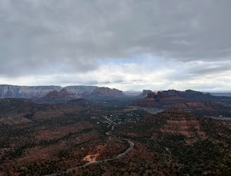
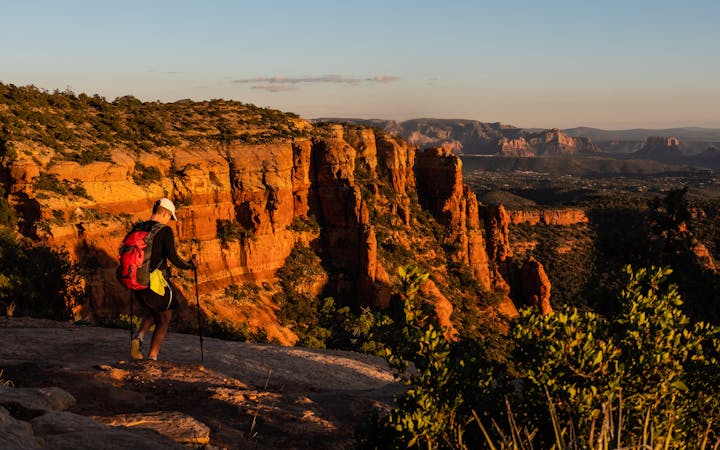
Soldier Pass -> Brin's Mesa Loop
A fantastic 5-mile loop around Brin's Butte.
Difficult Hiking
- Distance
- 8 km
- Ascent
- 264 m
- Descent
- 264 m
Hike and scramble to one of the most beautiful caves in Sedona.
Hiking Severe
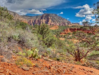
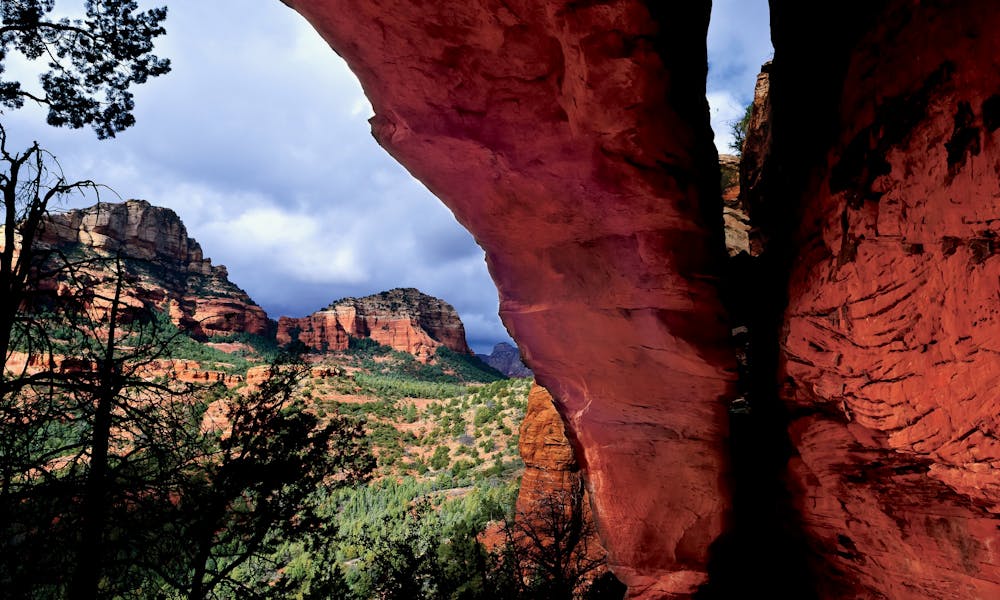
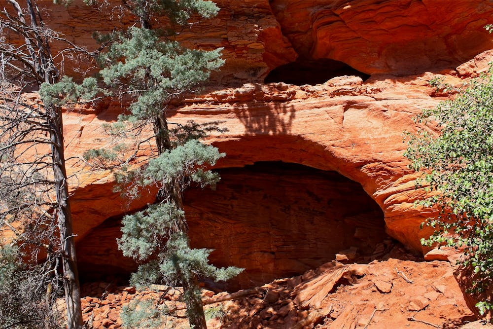
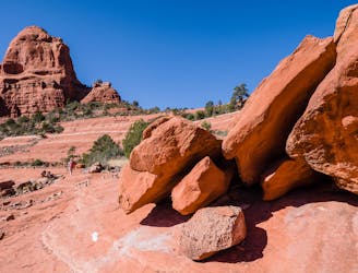
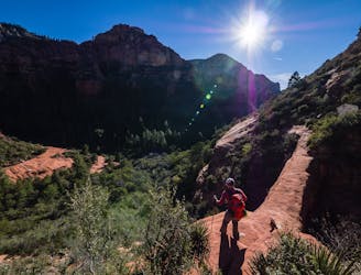
The Soldier Pass Trail is one of the most famous in Sedona, thanks to the unique rock formations along the route, including the Devil's Kitchen sinkhole, the Seven Sacred Pools, and the ultimate destination of this hike: the Soldiers Pass Cave.
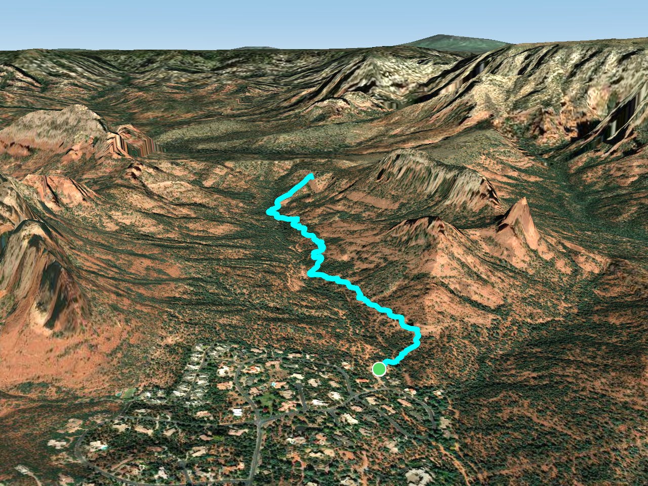
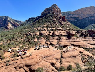
Several route combinations are available in this area, but the route shown here is a simple out-and-back to the cave. This hike begins at the Soldier Pass Trailhead, but this trailhead parking lot is tiny and constantly filled with cars regardless of the time of day or the day of the week. In fact, some sources report that this parking lot might be closed, but it's unclear if that closure is temporary or permanent. In order to guarantee a fun start to the Soldier Pass trail, plan to take the free Sedona Shuttle from Dog Park and Posse Ground Park & Ride.
Most of this hike is fairly easy and non-technical, despite traversing some red rock slabs. However, the final pitch to reach the cave is steeper and rockier, and it can be quite slick when wet. To get into the cave, you'll have to scramble up a rocky rubble pile that earns this hike a "Severe" FATMAP difficulty rating. Remember that coming back down is always more difficult than going up.
If you haven't had enough hiking yet, you can also extend this hike by making it a loop with the Brin's Mesa trail. However, the loop option extends the hike from 3 miles to 5.5 miles, so only add on the bonus mileage if you've packed enough supplies.
Sources: https://www.backcountrycow.com/blog/hiking-to-soldier-pass-cave-sedona https://www.earthtrekkers.com/how-to-hike-soldier-pass-trail-cave/ https://sedonashuttle.com/ https://wherearethosemorgans.com/hike-soldier-pass-cave-trail-sedona/
Severe
Hiking challenging trails where simple scrambling, with the occasional use of the hands, is a distinct possibility. The trails are often filled with all manner of obstacles both small and large, and the hills are very steep. Obstacles and challenges are often unexpected and can be unpredictable.

Some trail sections have exposed ledges or steep ascents/descents where falling could cause serious injury.

Away from help but easily accessed.
1 m away
A fantastic 5-mile loop around Brin's Butte.
Difficult Hiking
3.2 km away

Gorgeous loop around Airport Butte offering spectacular views of the valley.
Moderate Hiking
3.8 km away
A hike that follows an exciting expert-level mountain bike route.
Severe Hiking
4.4 km away
Hike to arguably Sedona's most famous tourist site.
Moderate Hiking
5 km away
Hike to a beautiful and wildly-popular overlook.
Difficult Hiking
5.8 km away
Enjoy a 360-degree red rock sensory experience on this incredible hike!
Difficult Hiking
5.9 km away
Short hike to a stunning overlook.
Difficult Hiking
6.3 km away
A view-heavy hike to the highest point in the Sedona area
Difficult Hiking
6.7 km away
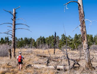
A lightly-populated Sedona route that's a must-do hike in the fall.
Severe Hiking
7 km away
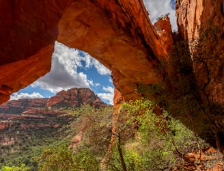
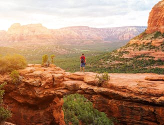
Hike to a stunning 90-foot arch!
Difficult Hiking
14 routes · Hiking

10 routes · Alpine Climbing · Canyoning · Hiking