2.4 km away
Broken Arrow Trail to Chicken Point
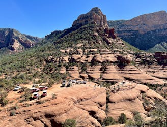
Hike to a beautiful and wildly-popular overlook.
Difficult Hiking
- Distance
- 4.6 km
- Ascent
- 120 m
- Descent
- 120 m
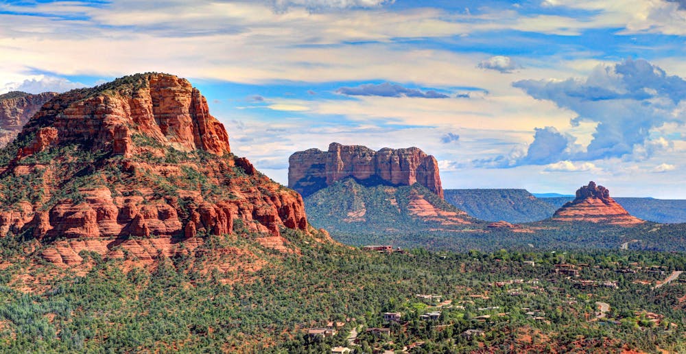
Gorgeous loop around Airport Butte offering spectacular views of the valley.
Hiking Moderate

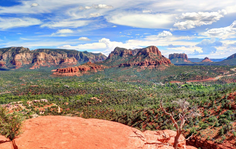
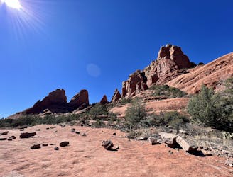
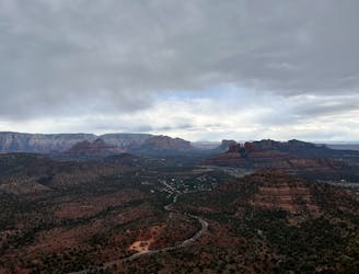
The overlook of the Sedona valley from the flanks of Airport Butte is one of the most incredible vistas—and most easily accessible—you’ll find in Sedona. With a paved road to the trailhead and epic views after just a short walk up the hill, you could easily roll up, snap some photos, and move on. But the more adventurous will want to hike all the way around the top of the mountain.
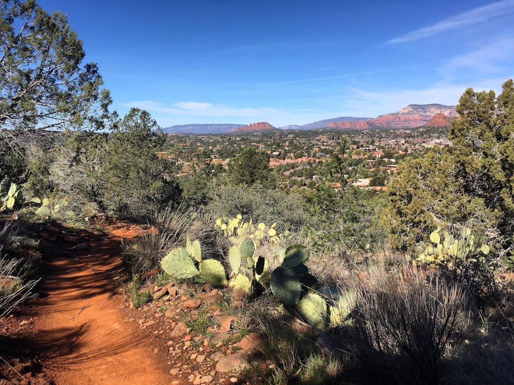
The beginning of this loop yields the best views as it wraps around the ridge on a slickrock shelf, with some significant exposure. If you’re not interested in hiking the entire loop, you could easily hike an out-and-back on this section.
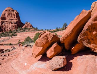
Soon, the trail begins to ascend, with the trail tread getting even rougher and rockier. No obstacles will require the use of hands to navigate, but the Airport Loop is most definitely not a smooth route.
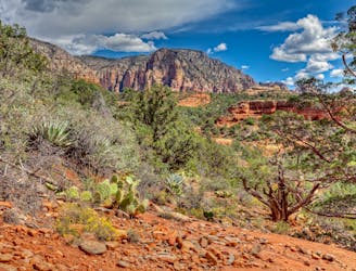
The back side of the loop drops into a lush forested area—a rarity in Sedona. The trail is still rocky, but slightly less so than on the front side.
Finally, you’ll finish the route on a smooth downhill back to the trailhead. This quick loop is easy to access and is stunningly-beautiful, making it one of the most popular hikes in Sedona.
Moderate
Hiking along trails with some uneven terrain and small hills. Small rocks and roots may be present.

Some trail sections are extremely exposed where falling will almost certainly result in serious injury or death.

Close to help in case of emergency.
2.4 km away
Hike to a beautiful and wildly-popular overlook.
Difficult Hiking
2.7 km away
Enjoy a 360-degree red rock sensory experience on this incredible hike!
Difficult Hiking
3.1 km away
A hike that follows an exciting expert-level mountain bike route.
Severe Hiking
3.2 km away
A fantastic 5-mile loop around Brin's Butte.
Difficult Hiking
3.2 km away
Hike and scramble to one of the most beautiful caves in Sedona.
Severe Hiking
4.6 km away
Short hike to a stunning overlook.
Difficult Hiking
6.7 km away

Hike to arguably Sedona's most famous tourist site.
Moderate Hiking
8.7 km away
A view-heavy hike to the highest point in the Sedona area
Difficult Hiking
8.7 km away
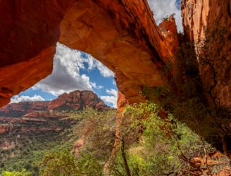
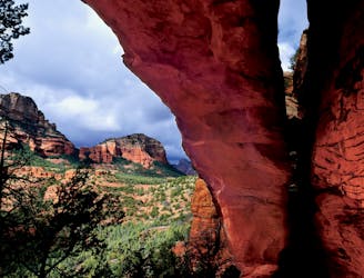
Hike to a stunning 90-foot arch!
Difficult Hiking
8.8 km away

This short hike to a high plateau provides 360° views.
Severe Hiking
14 routes · Hiking

10 routes · Alpine Climbing · Canyoning · Hiking