361 m away
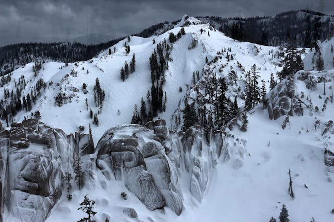
Cornice

A large Cornice atop Sawtooth Ridge
Severe Freeride Skiing
- Distance
- 650 m
- Ascent
- 0 m
- Descent
- 180 m
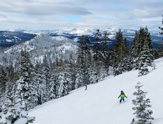
Drop after drop after drop
Freeride Skiing Difficult

In order to reach the Drops area you need to make it 3/4 of the way up to the peak of Sawtooth Ridge. Once you reach this point you will see a wide open couloir (not an extremely difficult couloir) that has a few drops in a row that are very fun to challenge yourself on. The more vertical feet you cover the less trees there are but once you start to ski down and hit all the drops you will find yourself in heavily wooded tree skiing again.
Difficult
Serious gradient of 30-38 degrees where a real risk of slipping exists.

As well as the slope itself, there are some obstacles (such as rock outcrops) which could aggravate injury.
Away from help but easily accessed.
361 m away
A large Cornice atop Sawtooth Ridge
Severe Freeride Skiing
490 m away

A popular locals spot on Sawtooth Ridge
Severe Freeride Skiing
977 m away
The best hike-to terrain at Northstar when conditions permit
Difficult Freeride Skiing
2 km away

A perfect spot for powder photoshoots
Severe Freeride Skiing
2 km away

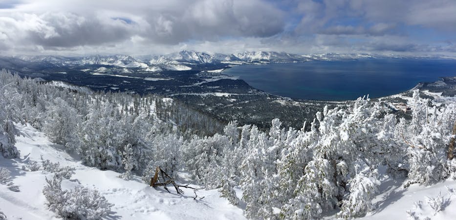
Great views of Lake Tahoe and large boulders to drop off of.
Difficult Freeride Skiing
2 km away

Large boulder/cliff drop area
Difficult Freeride Skiing
2 km away

Great Views of Lake Tahoe Basin on the Mountain
Difficult Freeride Skiing
9.6 km away

One of the "Squallywood" zones
Extreme Freeride Skiing
8 routes · Freeride Skiing
3 routes · Freeride Skiing