2 m away
Tuolumne Meadows to Yosemite Valley
Multi-day tour from the Sierra Nevada high country to the famous Valley in Yosemite National Park.
Difficult Hiking
- Distance
- 27 km
- Ascent
- 861 m
- Descent
- 2.1 km
Wilderness hike to one of the highest and most panoramic viewpoints in Yosemite National Park
Hiking Difficult

Clouds Rest is a large granite dome on the rim of Yosemite Valley, and its summit grants one of the best views in the entire park. It is guarded by an arduous hike, but the rewards are certainly no secret. This trail remains popular as a day hike despite its difficulty and vertigo-inducing exposure on the dome’s sloping spine. There are multiple ways to reach Clouds Rest, but this route from Tioga Road is the easiest and most direct.
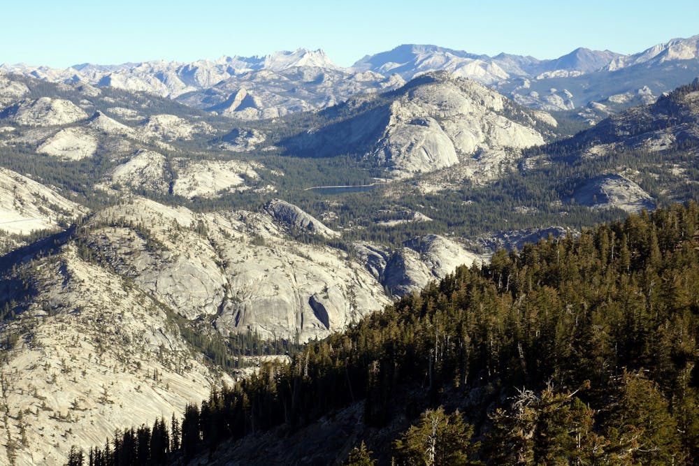
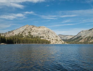
From the Sunrise Lakes Trailhead at Tenaya Lake, you’ll cross the outflow stream and marshy terrain among many trees, but in less than a mile move into more open, rocky terrain. Tenaya Canyon opens up to the west, and you can peer over the rim to see natural water slides as the creek tumbles into its granite gorge.
The grade is gentle at first, but after a few miles climbs steeply on a bouldery, forested mountainside. At the top of this ascent, a trail junction leads east to Sunrise Lakes and a backcountry camp. You can take a side trip here if you want to visit the lakes, but south is the way to Clouds Rest. Beyond the junction, the trail turns downhill, passing in and out of shady glades with rocky clearings in between.
The pleasant downhill soon ends, and the climb up Clouds Rest begins. The climb is casual at first, with rolling ups and downs through the same rocky forests as before. This changes abruptly when the trail breaks from the trees and emerges on a clifftop. A mountainside of bare rock falls away to the right of the trail, into the depths of Tenaya Canyon below.
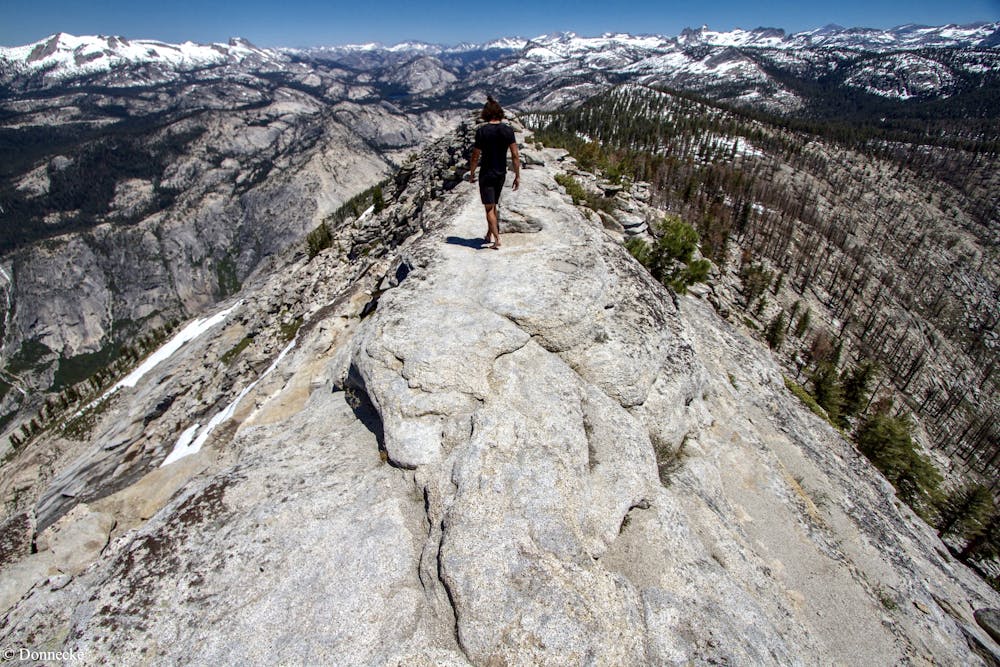
Straight ahead is the narrow ridgeline of Clouds Rest, and the only way to proceed is up. As you climb, slopes become steeper on either side, and soon the trail threads an airy ridge less than 20 feet wide, with serious drop-offs on either side. This section is safe with careful foot placements, but probably unnerving for those afraid of heights.
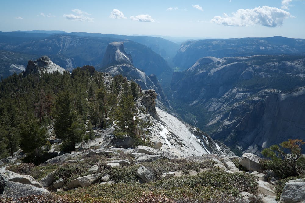
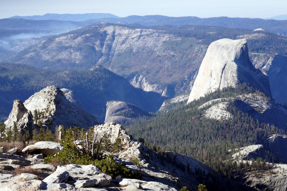
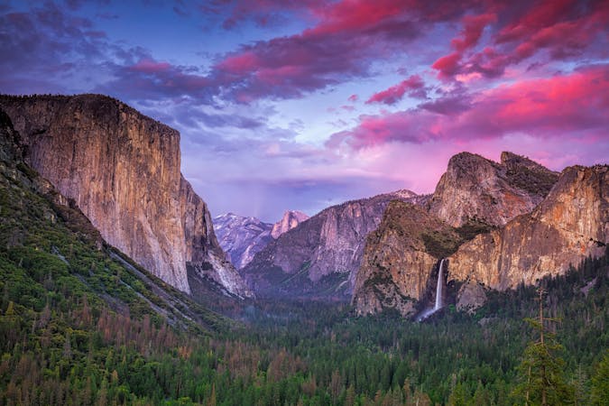
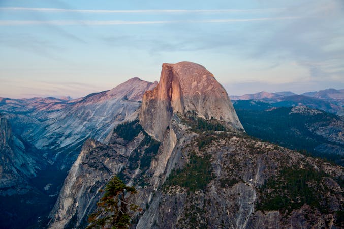
At the summit (9,926 feet elevation), the ridge widens significantly, and any fears are blown away by the huge view that appears. Yosemite Valley unfolds before you, including Half Dome in perfect profile. With binoculars, you can even see people climbing the cables route. Other formations visible in the 360-degree panorama are Tenaya Lake, North Dome, Sentinel Dome, and many distant peaks of the Sierra Nevada.
Sources: https://www.nps.gov/yose/planyourvisit/upload/wildernesstrailheads.pdf https://www.yosemitehikes.com/tioga-road/clouds-rest/clouds-rest.htm
Difficult
Hiking trails where obstacles such as rocks or roots are prevalent. Some obstacles can require care to step over or around. At times, the trail can be worn and eroded. The grade of the trail is generally quite steep, and can often lead to strenuous hiking.

The trail contains some obstacles such as outcroppings and rock which could cause injury.
Away from help but easily accessed.
2 m away
Multi-day tour from the Sierra Nevada high country to the famous Valley in Yosemite National Park.
Difficult Hiking
7 km away
Forest hike to the rim of Yosemite Valley at one of its greatest viewpoints
Moderate Hiking
9.3 km away
Hike and rock climb to one of the most impressive summits in Tuolumne Meadows.
Extreme Hiking
13 routes · Hiking
6 routes · Hiking · Road Biking
9 routes · Hiking