7 km away
Tuolumne Meadows to Yosemite Valley
Multi-day tour from the Sierra Nevada high country to the famous Valley in Yosemite National Park.
Difficult Hiking
- Distance
- 27 km
- Ascent
- 861 m
- Descent
- 2.1 km
Forest hike to the rim of Yosemite Valley at one of its greatest viewpoints
Hiking Moderate

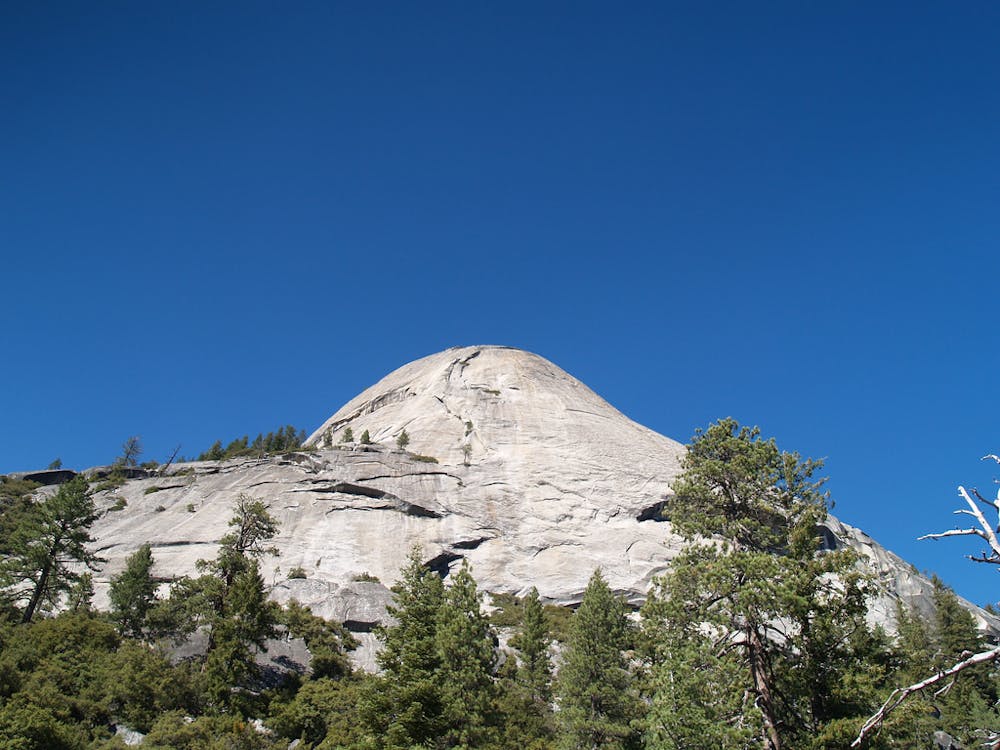
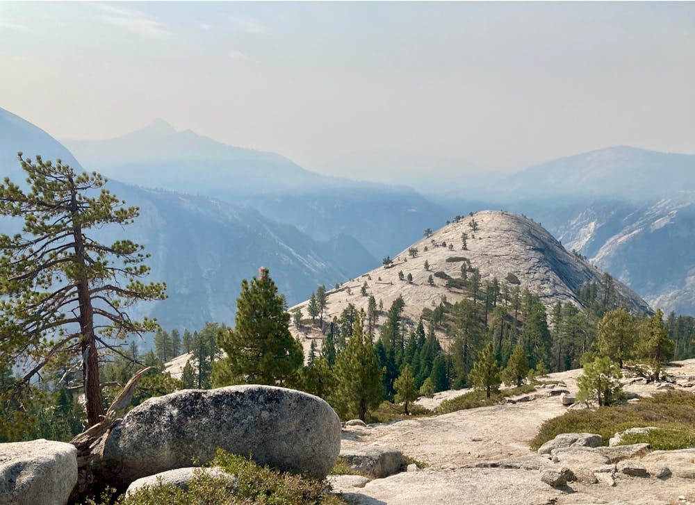
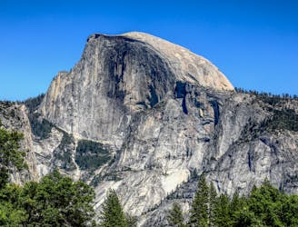
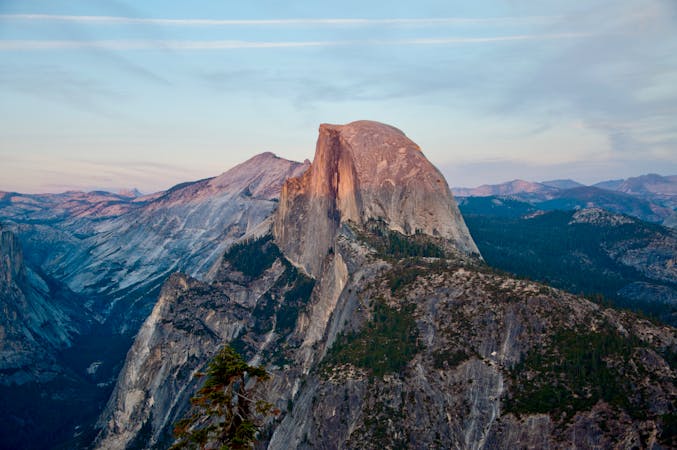
North Dome is one of Yosemite’s lesser-known but more spectacular viewpoints. It is a granite dome perched on the north rim of the Valley that stares directly across at the vertical face of Half Dome. The hike is not especially long or difficult, but begins from a rather nondescript trailhead along Tioga Road, that for some reason does not receive the same attention as other trails in the area.

The journey to North Dome is mapped here as a lariat loop that returns through the Lehamite Creek Valley, but the simple out-and-back is a fine option too, resulting in a slightly shorter hike. Hiking the loop provides the option for a side-trip extension to Yosemite Point and/or Yosemite Falls, both highly worthwhile if you have the time and energy.
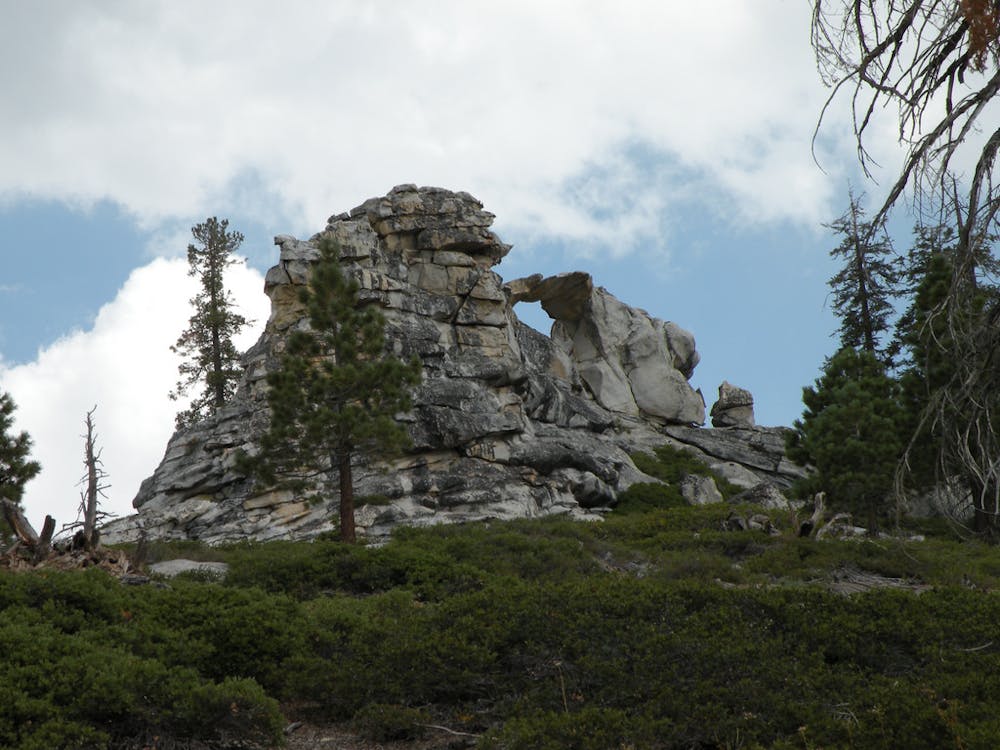
Begin from Porcupine Creek Trailhead, where a sign marks the mileage to North Dome, Yosemite Falls, and the floor of the Valley. This wide dirt path leads through shady conifer forest over rolling terrain, with a few small stream crossings. An uphill portion leads to more open forest and glimpses to the Valley rim ahead through the trees. At a signed trail junction, you’ll have the option to take a steep side trail up Indian Rock (not mapped), where you can find a view of Half Dome through the window of a natural arch.
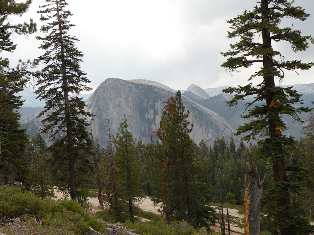
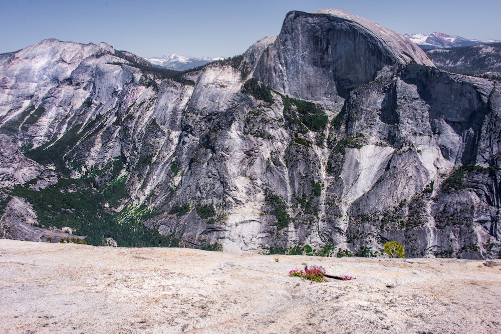
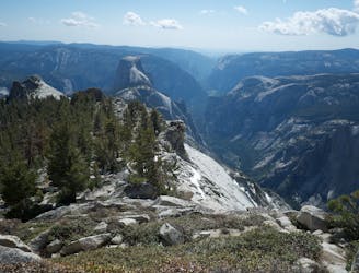
Continuing toward North Dome, the trail goes through more forest on mellow terrain before emerging to a panorama on a sloped spine of granite. This is where you’ll stare Half Dome right in the face. It stands in stalwart counterpoise directly across the Valley. This is the trail’s highpoint and makes a good turnaround point if you’re satisfied with the view, but a more expansive view of the Valley awaits by descending the ridge then making the short ascent of North Dome. From there you’ll look directly across to Glacier Point and Sentinel Dome, and you’ll see the Valley to the west in perfect frame between to Eagle Peak on the north rim and Cathedral Rocks on the south rim.
Backtrack from North Dome to the main ridgeline, then turn left to complete the lasso loop. A downhill jaunt leads to Lehamite Creek, close to, but not in view of, the top of Lehamite Falls. Cross the creek and hit the Yosemite Falls Trail. Left leads to the falls and more viewpoints along the rim, right completes the loop by gently ascending through the forested creek valley.
Sources: https://www.nps.gov/yose/planyourvisit/upload/trailheads.pdf https://californiathroughmylens.com/north-dome-yosemite/
Moderate
Hiking along trails with some uneven terrain and small hills. Small rocks and roots may be present.

The trail contains some obstacles such as outcroppings and rock which could cause injury.
Away from help but easily accessed.
7 km away
Multi-day tour from the Sierra Nevada high country to the famous Valley in Yosemite National Park.
Difficult Hiking
7 km away
Wilderness hike to one of the highest and most panoramic viewpoints in Yosemite National Park
Difficult Hiking
8.1 km away
An exciting hike to the summit of one of North America's most iconic peaks.
Extreme Hiking
8.1 km away
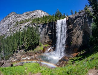
Connect two of Yosemite's great waterfalls in a concise but strenuous loop
Difficult Hiking
8.1 km away
Thru hike of the California’s Sierra Nevada, linking the most impressive alpine scenery from Yosemite National Park to Mount Whitney.
Difficult Hiking
8.2 km away
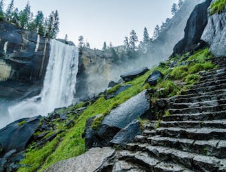
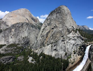
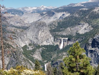
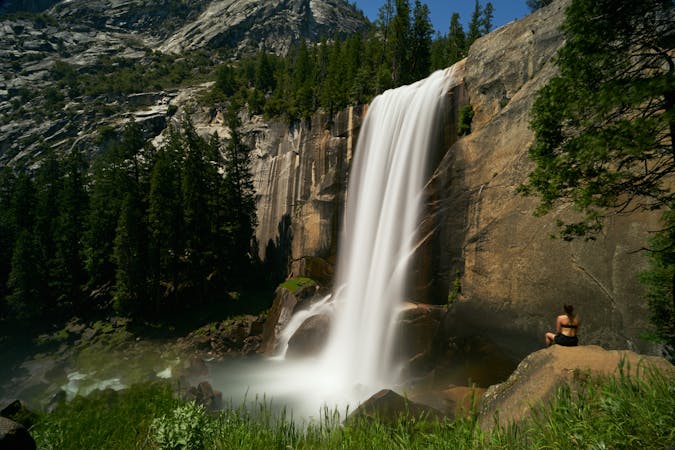
A stunning hike up steep climbs, passing close to Vernal and Nevada Falls.
Difficult Hiking
8.7 km away
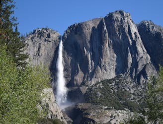
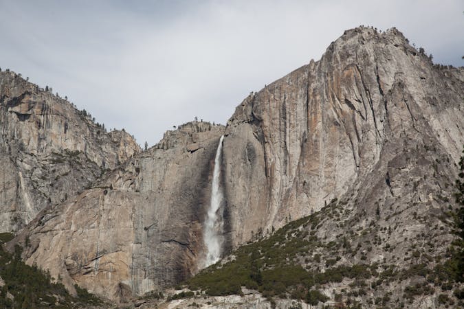
Steep hike to the top of North America's tallest waterfall.
Difficult Hiking
8.7 km away
Make the arduous climb to Upper Yosemite Falls, then go even farther to find the highest point on this side of Yosemite Valley.
Difficult Hiking
9.1 km away
Hike at the brink of a huge waterfall and along the precipitous rim of Yosemite Valley.
Difficult Hiking
13 routes · Hiking
6 routes · Hiking · Road Biking
7 routes · Hiking
9 routes · Hiking

25 routes · Alpine Climbing · Hiking

5 routes · Alpine Climbing · Hiking
7 routes · Hiking

63 routes · Alpine Climbing · Hiking