4 m away
Yosemite Falls Trail
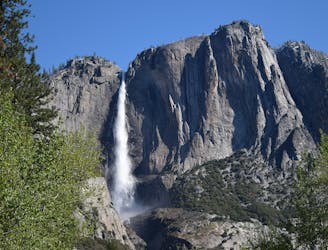
Steep hike to the top of North America's tallest waterfall.
Difficult Hiking
- Distance
- 9.3 km
- Ascent
- 939 m
- Descent
- 939 m
Make the arduous climb to Upper Yosemite Falls, then go even farther to find the highest point on this side of Yosemite Valley.
Hiking Difficult

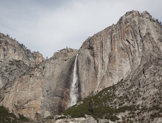
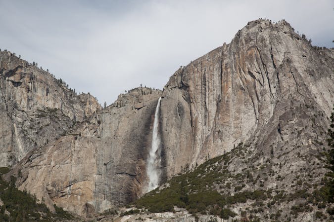
Eagle Peak is the highest point on the north rim of Yosemite Valley and grants an astounding view to those who reach it. It’s the top of the Three Brothers formation, a stair-stepped trio of towering promontories. The hike begins at the popular Yosemite Falls Trailhead. The falls are, of course, the destination for most, but for those with sights set on Eagle Peak, the Yosemite Falls Trail is only the first part of the journey.
More than 100 switchbacks and seemingly endless stairs make the approximately 3-mile ascent from the valley floor to the top of Upper Yosemite Falls. A side trail leads down to the brink of the waterfall, but the Eagle Peak Trail branches off and continues uphill. The slope is gentle, however, compared to what it takes to get there.
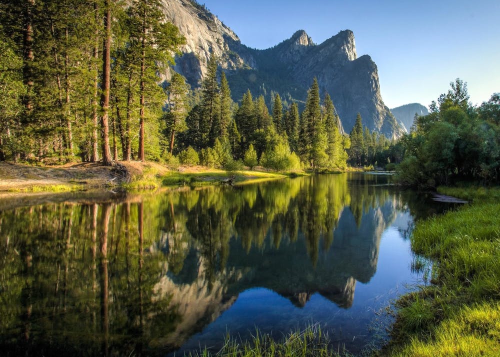
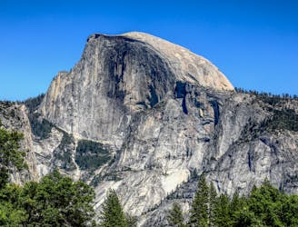
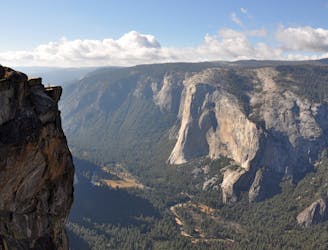
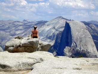
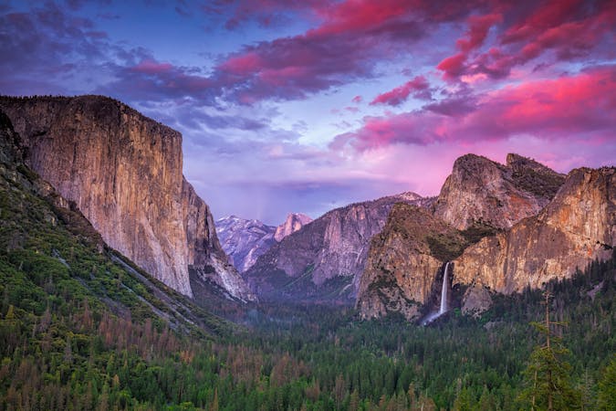
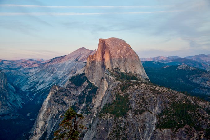
The rest of the way to Eagle Peak is mostly in the forest, sometimes crossing rocky clearings and grassy meadows. It’s hilly terrain with various ups and downs, culminating in a steady uphill to reach the peak. The final stretch is a boulder-strewn ridge with an airy vantage down to the valley floor. It feels almost as if you’re “walking the plank” over the abyss below, but you can stay a safe distance from the edge. The panorama includes the heart of Yosemite Valley, with its broad meadows and the meandering Merced River, plus Half Dome and Clouds Rest rising above. To the other side, you’ll see the top of El Capitan in profile, with its domed summit tipping suddenly to a vertical face.
This route from Yosemite Falls Trailhead is not the only way to reach Eagle Peak, but it is the most direct and, because of the waterfalls, provides the most bang for your buck as a day hike. If you prefer to do Eagle Peak as a multi-day backpacking trip (wilderness permit required), consider starting from Tamarack Flat or Tuolumne Meadows instead, making a longer hike with less elevation gain.
Sources: https://www.nps.gov/yose/planyourvisit/yosemitefallstrail.htm
Difficult
Hiking trails where obstacles such as rocks or roots are prevalent. Some obstacles can require care to step over or around. At times, the trail can be worn and eroded. The grade of the trail is generally quite steep, and can often lead to strenuous hiking.

Some trail sections have exposed ledges or steep ascents/descents where falling could cause serious injury.
Little chance of being seen or helped in case of an accident.
4 m away
Steep hike to the top of North America's tallest waterfall.
Difficult Hiking
3 km away
Hike at the brink of a huge waterfall and along the precipitous rim of Yosemite Valley.
Difficult Hiking
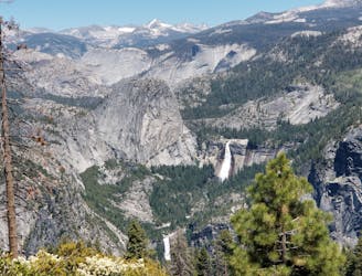
3.2 km away
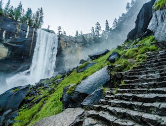
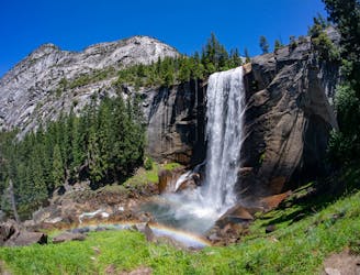
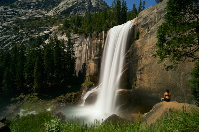
A stunning hike up steep climbs, passing close to Vernal and Nevada Falls.
Difficult Hiking
3.2 km away
Thru hike of the California’s Sierra Nevada, linking the most impressive alpine scenery from Yosemite National Park to Mount Whitney.
Difficult Hiking
3.2 km away
An exciting hike to the summit of one of North America's most iconic peaks.
Extreme Hiking
3.2 km away
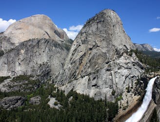
Connect two of Yosemite's great waterfalls in a concise but strenuous loop
Difficult Hiking
3.6 km away
A hike through the forest to a panoramic viewpoint over Yosemite Valley.
Easy Hiking
3.6 km away
Birds-eye view of the Valley atop one of Yosemite's higher granite domes.
Moderate Hiking
5.2 km away
Paved trail to the base of a 620-foot waterfall.
Easy Hiking
8.3 km away

A sun-dappled 1.8 mile stroll through the woods leading you to a meadow filled with wildflowers and a babbling brook.
Easy Hiking
13 routes · Hiking
6 routes · Hiking · Road Biking
7 routes · Hiking
9 routes · Hiking

25 routes · Alpine Climbing · Hiking

5 routes · Alpine Climbing · Hiking
7 routes · Hiking

63 routes · Alpine Climbing · Hiking