5.5 km away
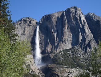
Bridalveil Fall Trail
Paved trail to the base of a 620-foot waterfall.
Easy Hiking
- Distance
- 697 m
- Ascent
- 27 m
- Descent
- 27 m
A sun-dappled 1.8 mile stroll through the woods leading you to a meadow filled with wildflowers and a babbling brook.
Hiking Easy

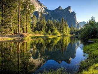
A sun-dappled 1.8 mile stroll through the woods leading you to a meadow filled with wildflowers and a babbling brook. As one of the lesser known walking routes in Yosemite, McGurk’s Meadow remains unspoilt by crowds, its peaceful and picturesque.
To start the route you’ll need to drive to Glacier Point Road, travelling east for 7.5 miles to the trailhead. About a mile past Summit Meadow you’ll spot a sign for McGurk Meadow on the north (left) side of the road. There is no carpark so you’ll need to find a spot to pull up on the side of the road. The hard shoulder widens about 100 metres downhill (east) so there’s space for about 10 cars to park. If you get to the Bridalveil Creek Campground you’ve just gone passed the McGurk’s Meadow sign.
The trail begins by taking you through a shady patch of lodgepole pines. It passes by Peregoy Meadow and then gently meanders up to a low divide. The trail eventually drops down to the south edge of McGurk Meadow, leading you across a babbling creek. In the meadow you’ll spot a charming old log cabin, built by Mr McGurk in the 1800s, which is great fun for kids to explore.
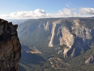
Following the path across the meadow, you’ll be taken back into the forest in a northward direction, eventually meeting a trail junction where you have the opportunity to jump onto the Pohono Trail. Either turn back along the way you came, or extend the walk along the Pohono Trail, turning left and going along to Dewey Point. Here you’ll be greeted with wonderful views of Yosemite Valley, El Capitan and the High Sierras.
If you visit the meadow between June and July, the wild flowers will be in full bloom. You may also be lucky enough to spot deer along the trail. Something to keep in mind: like any lush meadow, in damp conditions there will most likely be mosquitos lurking, so have some insect repellent at the ready.
Easy
Walking along a well-kept trail that’s mostly flat. No obstacles are present.

Close to help in case of emergency.
5.5 km away
Paved trail to the base of a 620-foot waterfall.
Easy Hiking
5.9 km away
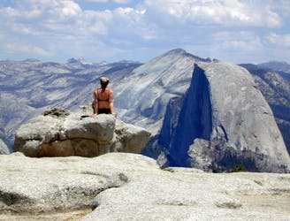
Birds-eye view of the Valley atop one of Yosemite's higher granite domes.
Moderate Hiking
5.9 km away
A hike through the forest to a panoramic viewpoint over Yosemite Valley.
Easy Hiking
7.9 km away
Hike at the brink of a huge waterfall and along the precipitous rim of Yosemite Valley.
Difficult Hiking
8.3 km away
Make the arduous climb to Upper Yosemite Falls, then go even farther to find the highest point on this side of Yosemite Valley.
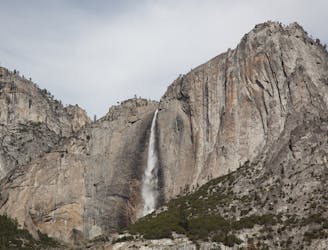
Difficult Hiking
8.3 km away
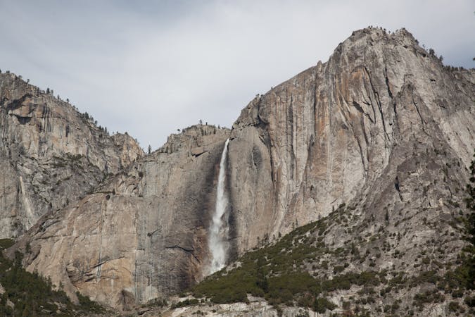
Steep hike to the top of North America's tallest waterfall.
Difficult Hiking
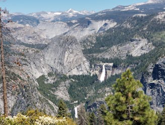
9 km away
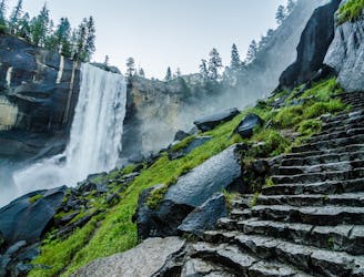
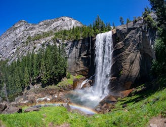
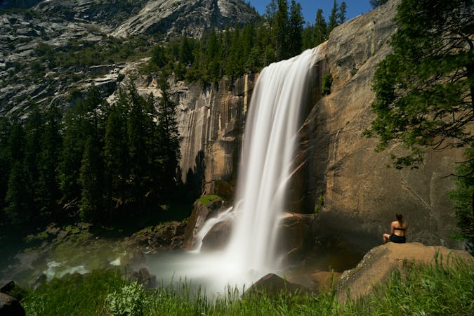
A stunning hike up steep climbs, passing close to Vernal and Nevada Falls.
Difficult Hiking
9 km away
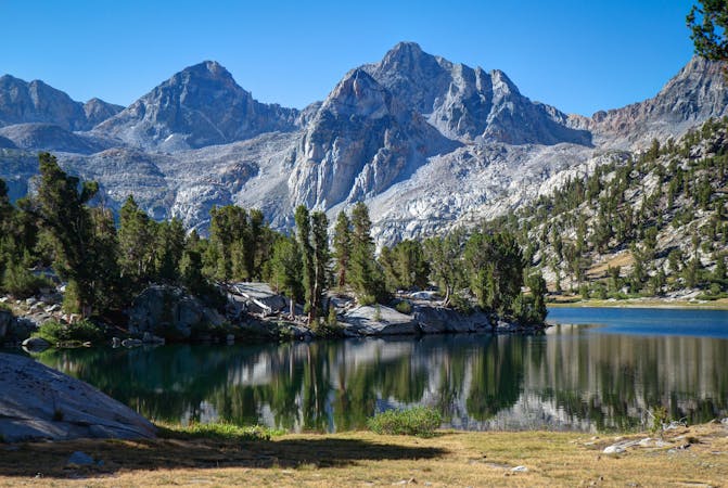
Thru hike of the California’s Sierra Nevada, linking the most impressive alpine scenery from Yosemite National Park to Mount Whitney.
Difficult Hiking
9 km away
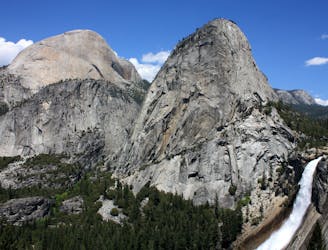
Connect two of Yosemite's great waterfalls in a concise but strenuous loop
Difficult Hiking
9 km away
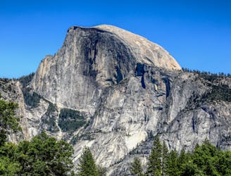
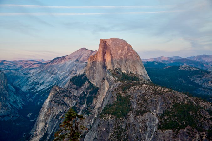
An exciting hike to the summit of one of North America's most iconic peaks.
Extreme Hiking
13 routes · Hiking
6 routes · Hiking · Road Biking
7 routes · Hiking
9 routes · Hiking

25 routes · Alpine Climbing · Hiking

5 routes · Alpine Climbing · Hiking
7 routes · Hiking

63 routes · Alpine Climbing · Hiking