26 m away
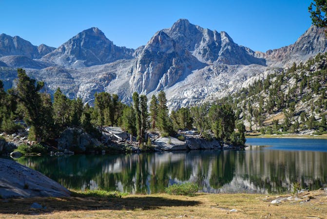
John Muir Trail
Thru hike of the California’s Sierra Nevada, linking the most impressive alpine scenery from Yosemite National Park to Mount Whitney.
Difficult Hiking
- Distance
- 339 km
- Ascent
- 13 km
- Descent
- 12 km
A stunning hike up steep climbs, passing close to Vernal and Nevada Falls.
Hiking Difficult

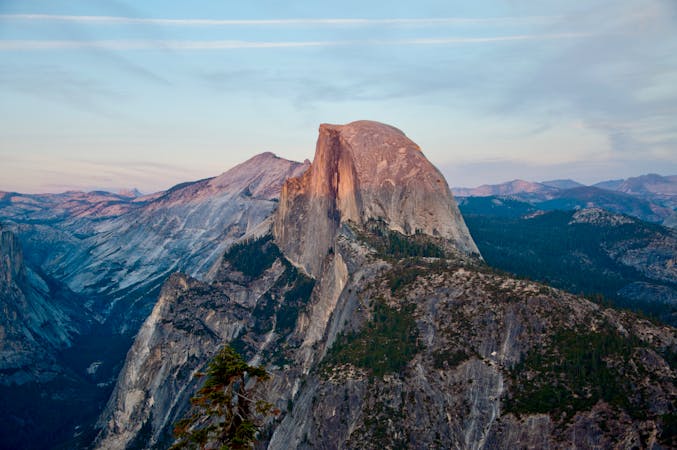
This trail is a mellower yet still amazingly-stunning alternate to the Half Dome Trail. Furthermore, it is a great option for a shorter day if you haven't been able to secure a permit for the Half Dome route.
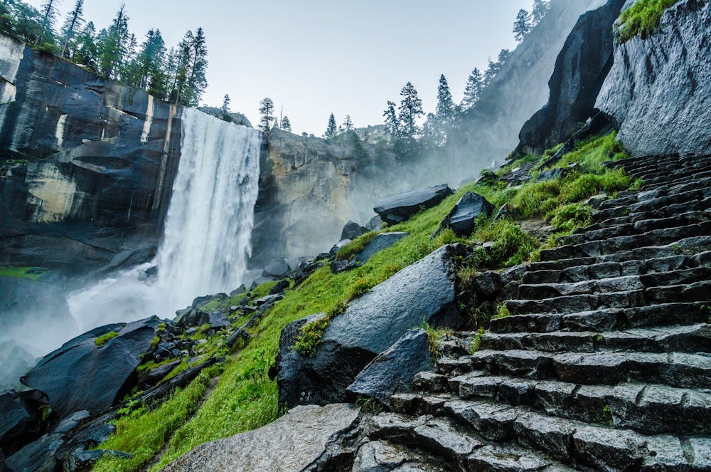
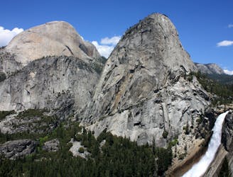
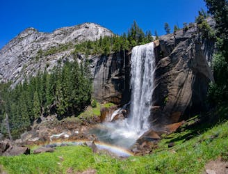
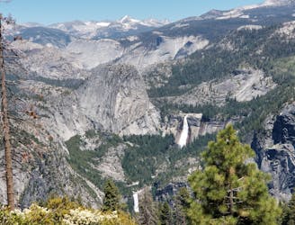
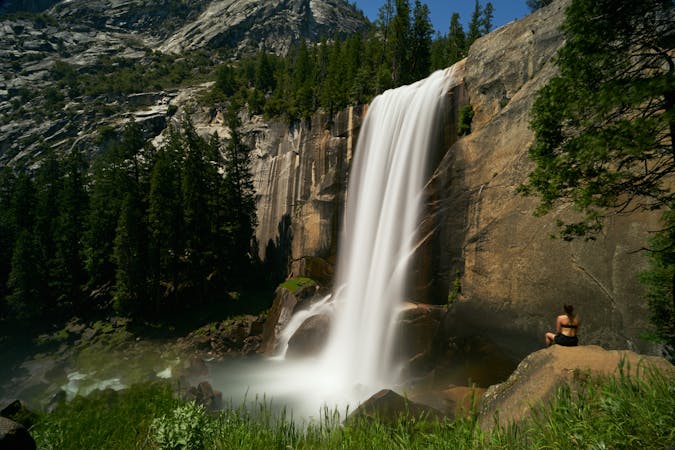
The Mist Trail ascends steeply to Vernal and Nevada Falls. The beauty of the two falls provides a fitting opportunity to break and rest while along the course of your hike. The name of the trail comes from the fact that the trail is in such proximity to Vernal and Nevada Falls that it is nearly impossible to avoid being misted by the cascading water. This particular route is ideal for those who only want to or only have the time to be out for 1.5-2 hours. There are stairs along the route, so runners should expect some stair running!
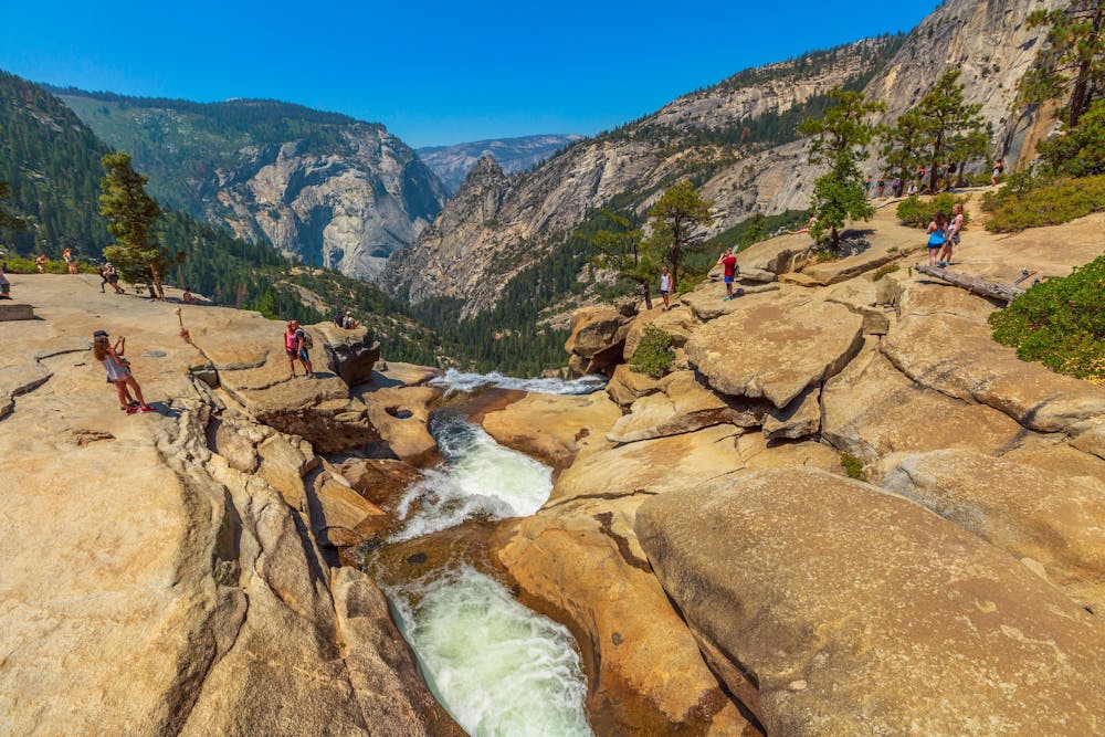
After ascending to the trail’s high point above Nevada Falls, you can either return on the same path or take an alternative trail for the descent, providing a loop option rather than an out-and-back. The alternate return trail is the John Muir Trail. You could reconnect with the Mist Trail at a few different points lower down on the route.
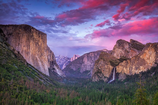
It is not surprising that this route is one of the most popular routes to run or hike in the Yosemite Valley.
Difficult
Hiking trails where obstacles such as rocks or roots are prevalent. Some obstacles can require care to step over or around. At times, the trail can be worn and eroded. The grade of the trail is generally quite steep, and can often lead to strenuous hiking.

The trail contains some obstacles such as outcroppings and rock which could cause injury.
Away from help but easily accessed.
26 m away
Thru hike of the California’s Sierra Nevada, linking the most impressive alpine scenery from Yosemite National Park to Mount Whitney.
Difficult Hiking
28 m away
Connect two of Yosemite's great waterfalls in a concise but strenuous loop
Difficult Hiking
28 m away
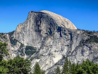
An exciting hike to the summit of one of North America's most iconic peaks.
Extreme Hiking
1.1 km away
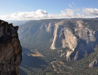
Hike at the brink of a huge waterfall and along the precipitous rim of Yosemite Valley.
Difficult Hiking
3.1 km away
A hike through the forest to a panoramic viewpoint over Yosemite Valley.
Easy Hiking
3.1 km away
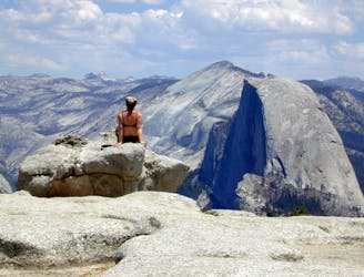
Birds-eye view of the Valley atop one of Yosemite's higher granite domes.
Moderate Hiking
3.2 km away
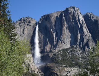
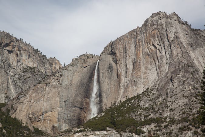
Steep hike to the top of North America's tallest waterfall.
Difficult Hiking
3.2 km away
Make the arduous climb to Upper Yosemite Falls, then go even farther to find the highest point on this side of Yosemite Valley.
Difficult Hiking
7.7 km away
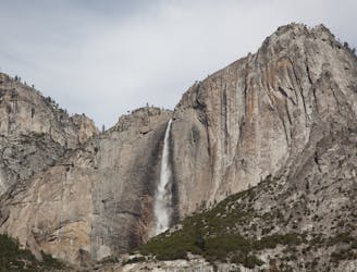
Paved trail to the base of a 620-foot waterfall.
Easy Hiking
8.2 km away
Forest hike to the rim of Yosemite Valley at one of its greatest viewpoints
Moderate Hiking
13 routes · Hiking
6 routes · Hiking · Road Biking
7 routes · Hiking
9 routes · Hiking

25 routes · Alpine Climbing · Hiking

5 routes · Alpine Climbing · Hiking
7 routes · Hiking

63 routes · Alpine Climbing · Hiking