1 m away
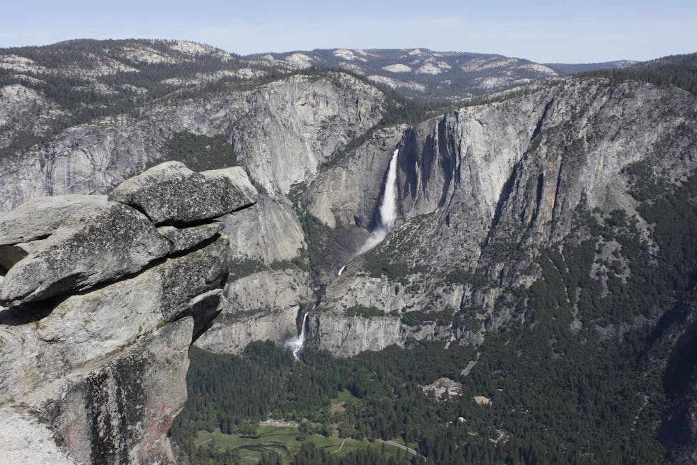
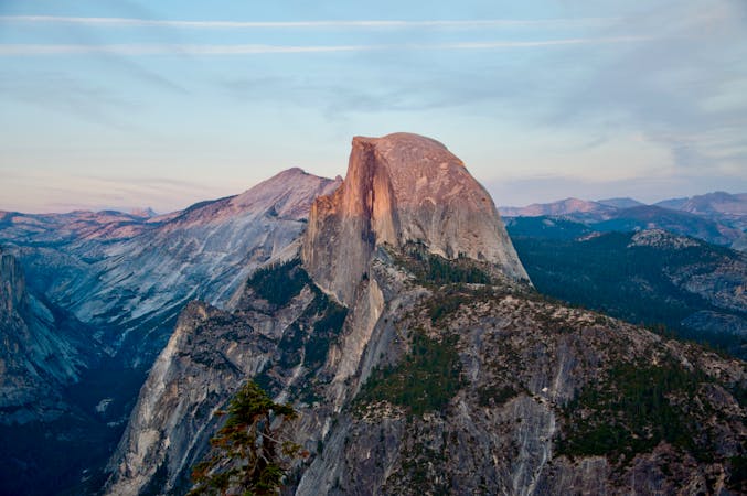
Sentinel Dome
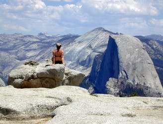
Birds-eye view of the Valley atop one of Yosemite's higher granite domes.
Moderate Hiking
- Distance
- 3.6 km
- Ascent
- 161 m
- Descent
- 161 m
A hike through the forest to a panoramic viewpoint over Yosemite Valley.
Hiking Easy

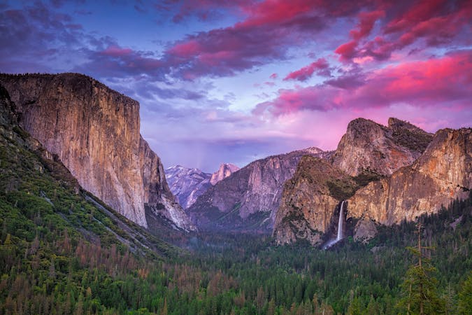
Along the road to Yosemite’s famous Glacier Point is the trailhead for an equally spectacular vista—Taft Point. From the Taft Point/Sentinel Dome Trailhead, hike first through forest and fields, then emerge suddenly at a jaw-dropping perch on a clifftop. At Taft Point, the precipice tumbles 1,000 feet straight down to the floor of Yosemite Valley, and the wide-open panorama includes El Capitan, Yosemite Falls, and the Merced River.
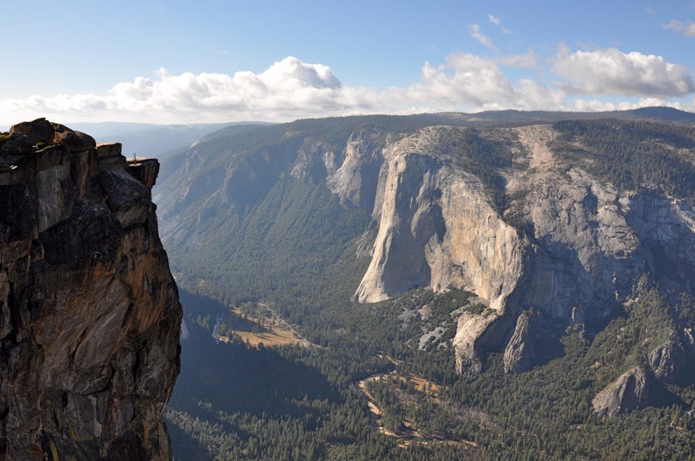
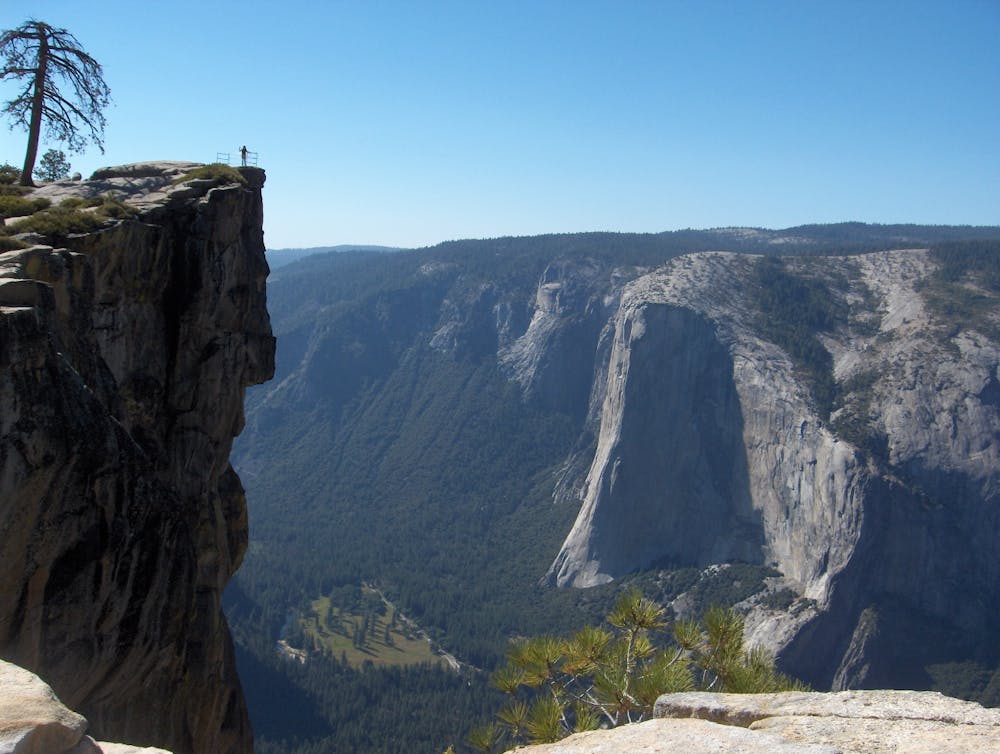
There is one small guardrail at the very apex of the point, but most of the rim is unprotected, so use caution. There is no reason to get too close to the edge; the views are perfectly satisfying from a safe distance away.
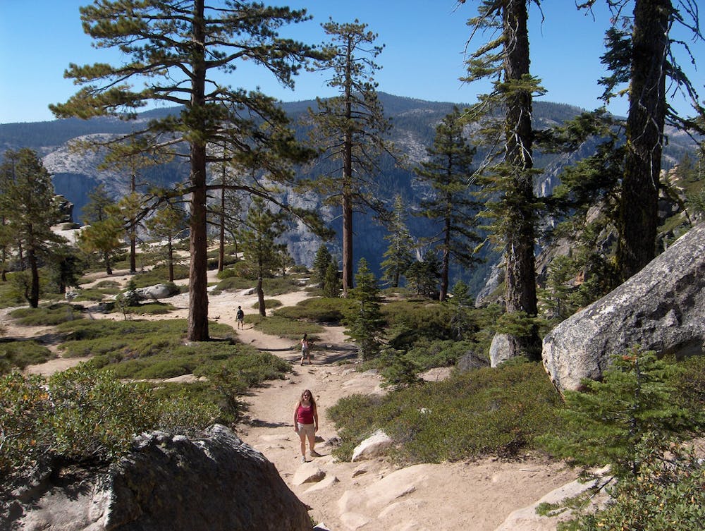
The hike to reach the point is a slight uphill, then a gradual downhill on a well-traveled trail. Tall pines and firs provide a mix of sun and shade, and wildflowers bloom in the meadows during July.
As the rim comes into view, so do some peculiar geologic formations called The Fissures. These are eroded cracks in the cliff, so deep in some places that they form a narrow slot all the way to the valley floor. The Fissures, which are of various shapes and sizes, make the cliff here particularly angular and dramatic, with many different elevations and perspectives to reach. Photo opportunities are abundant and impressive.
You can walk freely on the bare rock and dirt around Taft Point, but be careful not to trample any vegetation. Return the way you came or continue on a longer hike east or west along Pohono Trail, which holds more cliff-top views in either direction.
Sources: https://www.nps.gov/yose/planyourvisit/glacierhikes.htm https://www.nps.gov/yose/planyourvisit/upload/glacierhikes.pdf
Easy
Walking along a well-kept trail that’s mostly flat. No obstacles are present.

The trail contains some obstacles such as outcroppings and rock which could cause injury.

Close to help in case of emergency.
1 m away
Birds-eye view of the Valley atop one of Yosemite's higher granite domes.
Moderate Hiking
2 km away
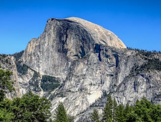
Hike at the brink of a huge waterfall and along the precipitous rim of Yosemite Valley.
Difficult Hiking
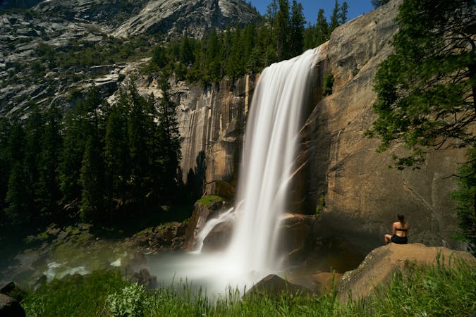
3.1 km away
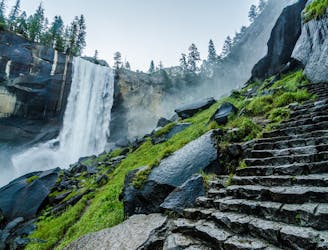
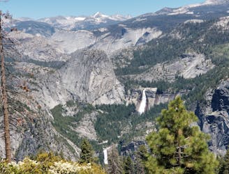
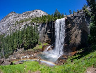
A stunning hike up steep climbs, passing close to Vernal and Nevada Falls.
Difficult Hiking
3.1 km away
Thru hike of the California’s Sierra Nevada, linking the most impressive alpine scenery from Yosemite National Park to Mount Whitney.
Difficult Hiking
3.1 km away
An exciting hike to the summit of one of North America's most iconic peaks.
Extreme Hiking
3.1 km away
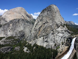
Connect two of Yosemite's great waterfalls in a concise but strenuous loop
Difficult Hiking
3.6 km away
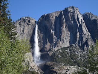
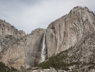
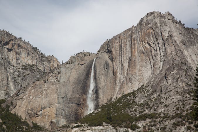
Steep hike to the top of North America's tallest waterfall.
Difficult Hiking
3.6 km away
Make the arduous climb to Upper Yosemite Falls, then go even farther to find the highest point on this side of Yosemite Valley.
Difficult Hiking
5.7 km away
Paved trail to the base of a 620-foot waterfall.
Easy Hiking
5.9 km away

A sun-dappled 1.8 mile stroll through the woods leading you to a meadow filled with wildflowers and a babbling brook.
Easy Hiking
13 routes · Hiking
6 routes · Hiking · Road Biking
7 routes · Hiking
9 routes · Hiking

25 routes · Alpine Climbing · Hiking

5 routes · Alpine Climbing · Hiking
7 routes · Hiking

63 routes · Alpine Climbing · Hiking