1.1 km away
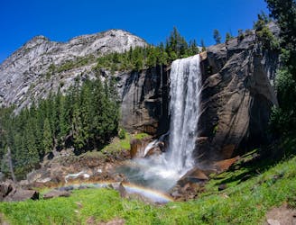
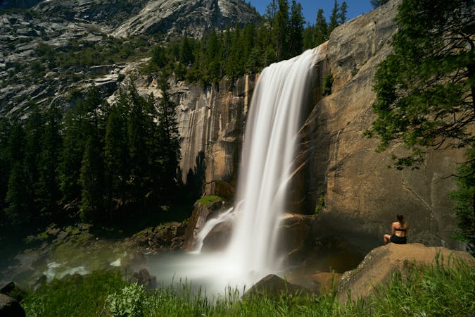
Mist Trail to Vernal and Nevada Falls
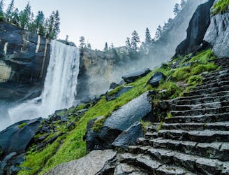
A stunning hike up steep climbs, passing close to Vernal and Nevada Falls.
Difficult Hiking
- Distance
- 11 km
- Ascent
- 753 m
- Descent
- 752 m
Hike at the brink of a huge waterfall and along the precipitous rim of Yosemite Valley.
Hiking Difficult

Panorama Trail begins at Glacier Point and traverses the Valley rim to meet the John Muir Trail near Nevada Falls. It is often done as an out-and-back, but it’s possible to hike a one-way to the floor of the Valley by continuing down John Muir Trail or Mist Trail and riding the bus tour to Glacier Point.
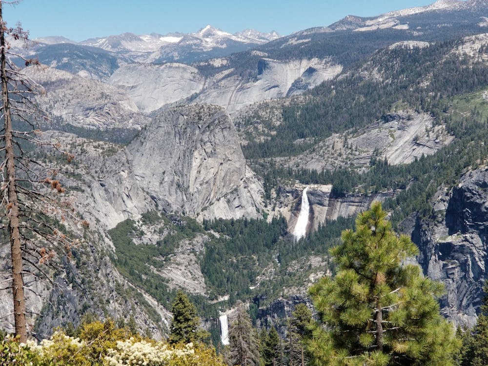
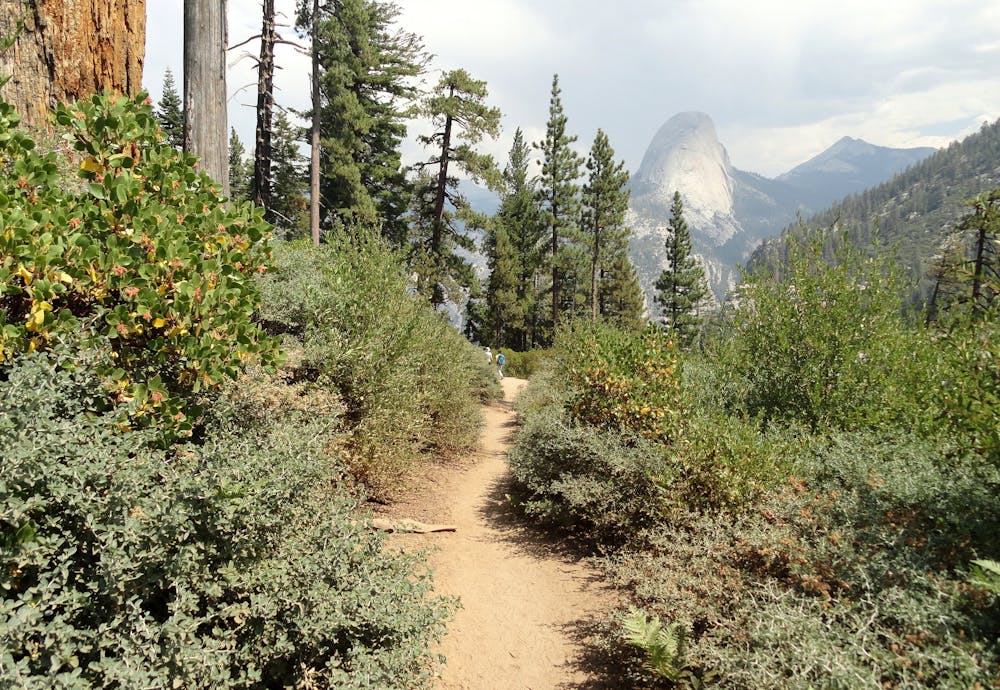
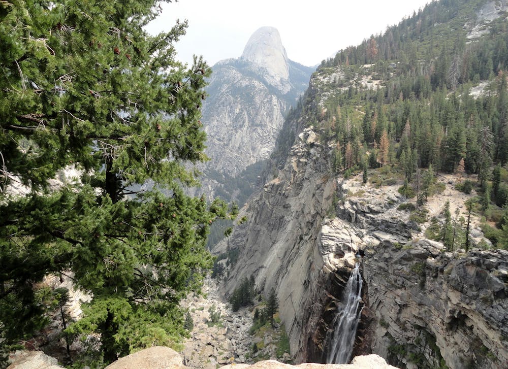
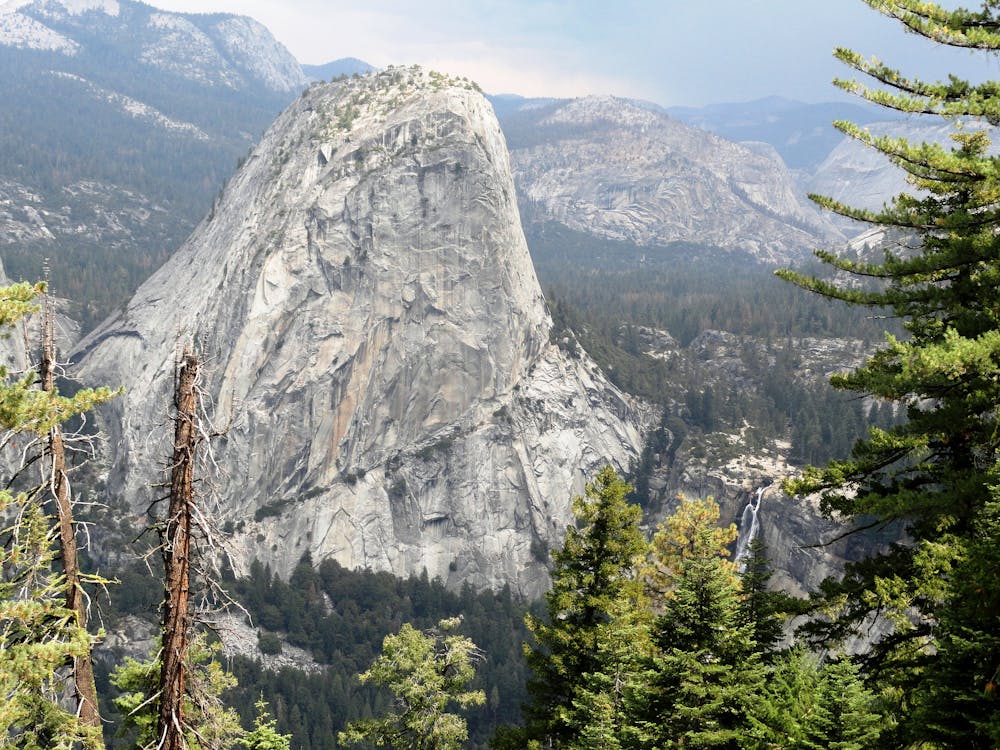
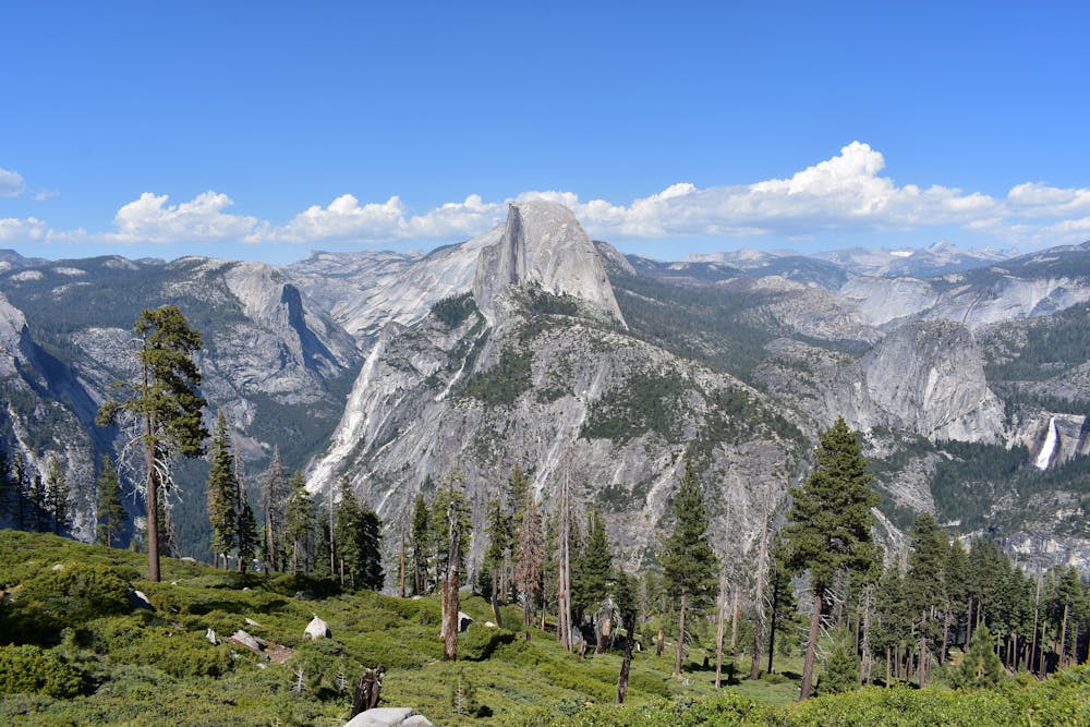
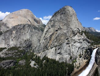
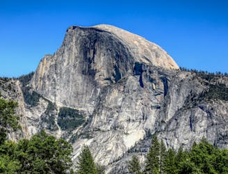
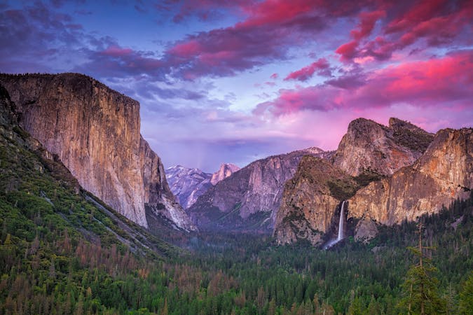
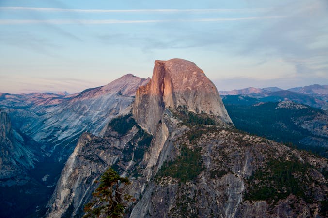
From Glacier Point, Panorama Trail drops dramatically down a sparsely wooded hillside, which pops with wildflowers in spring and early summer. You’ll enjoy constant views of Half Dome and other granite giants in the valley below, as well as the two torrents of Vernal Fall and Nevada Fall gushing with meltwater from distant snowy peaks. The trail’s determined descent of this open hillside finally ends at the brink of Illilouette Fall, which plunges into a narrow side canyon to meet the Merced River farther down. It flows reliably in spring but may dry up in summer. When the flow is not too high, pools upstream of the footbridge are safe for swimming.
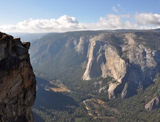
After crossing the creek, the trail takes a few switchbacks upward through a denser forest than before and gains the rim of Panorama Cliff. This eye-popping precipice falls sheerly away for 1000 feet to the Valley floor. The trail itself remains a safe distance from the edge, but precarious viewpoints are only steps away. Use caution. The panorama is of the Merced River Gorge where it joins the main Yosemite Valley. Glacier Point rises directly across the Illilouette Gorge, the Great Arches and North Dome form the far rim of the Valley, while Half Dome and Clouds Rest dominate the eastern periphery.
The Panorama Trail ends at a junction with the John Muir Trail near the top of Nevada Fall. Complete the one-way route to the Valley by taking either the John Muir Trail (mapped) or the Mist Trail, which is reached by crossing the Merced River on the John Muir Trail. To avoid setting your own vehicle shuttle for the one-way, you can purchase a ticket for the Glacier Point Tour (reservation required). Reserve the earliest bus you can for the day you want to hike, and leave your car near the Happy Isles Trailhead, where the one-way hike finishes. Alternatives to the one-way are an out-and-back on Panorama Trail or a long loop with Four Mile Trail to return to Glacier Point.
Sources: https://www.nps.gov/yose/planyourvisit/glacierhikes.htm https://www.nps.gov/yose/planyourvisit/upload/glacierhikes.pdf https://www.travelyosemite.com/things-to-do/guided-bus-tours/
Difficult
Hiking trails where obstacles such as rocks or roots are prevalent. Some obstacles can require care to step over or around. At times, the trail can be worn and eroded. The grade of the trail is generally quite steep, and can often lead to strenuous hiking.

The trail contains some obstacles such as outcroppings and rock which could cause injury.
Away from help but easily accessed.
1.1 km away
A stunning hike up steep climbs, passing close to Vernal and Nevada Falls.
Difficult Hiking
1.1 km away
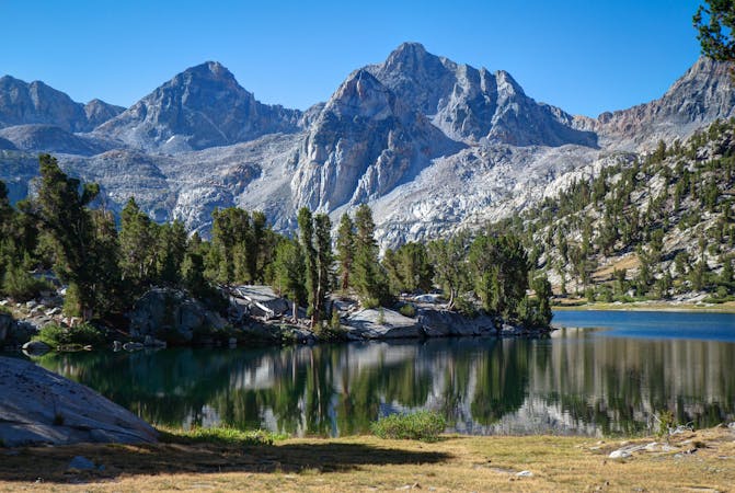
Thru hike of the California’s Sierra Nevada, linking the most impressive alpine scenery from Yosemite National Park to Mount Whitney.
Difficult Hiking
1.1 km away
An exciting hike to the summit of one of North America's most iconic peaks.
Extreme Hiking
1.1 km away
Connect two of Yosemite's great waterfalls in a concise but strenuous loop
Difficult Hiking
2 km away
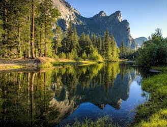
A hike through the forest to a panoramic viewpoint over Yosemite Valley.
Easy Hiking
2 km away
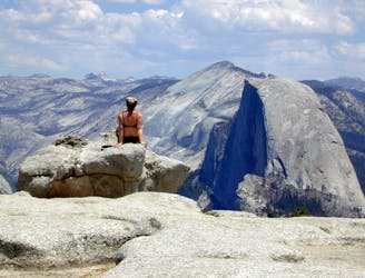
Birds-eye view of the Valley atop one of Yosemite's higher granite domes.
Moderate Hiking
3 km away
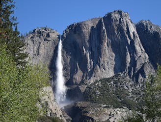
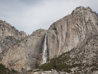
Steep hike to the top of North America's tallest waterfall.
Difficult Hiking
3 km away
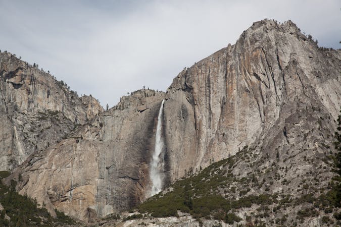
Make the arduous climb to Upper Yosemite Falls, then go even farther to find the highest point on this side of Yosemite Valley.
Difficult Hiking
6.9 km away
Paved trail to the base of a 620-foot waterfall.
Easy Hiking
7.9 km away

A sun-dappled 1.8 mile stroll through the woods leading you to a meadow filled with wildflowers and a babbling brook.
Easy Hiking
13 routes · Hiking
6 routes · Hiking · Road Biking
7 routes · Hiking
9 routes · Hiking

25 routes · Alpine Climbing · Hiking

5 routes · Alpine Climbing · Hiking
7 routes · Hiking

63 routes · Alpine Climbing · Hiking