2 m away
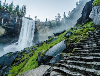
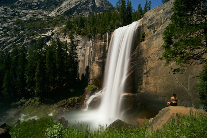
Vernal Fall and Nevada Fall Loop
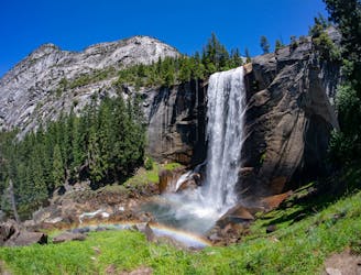
Connect two of Yosemite's great waterfalls in a concise but strenuous loop
Difficult Hiking
- Distance
- 11 km
- Ascent
- 740 m
- Descent
- 740 m
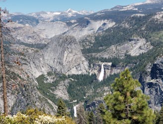
Thru hike of the California’s Sierra Nevada, linking the most impressive alpine scenery from Yosemite National Park to Mount Whitney.
Hiking Difficult

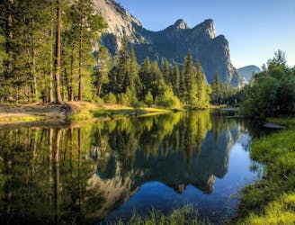
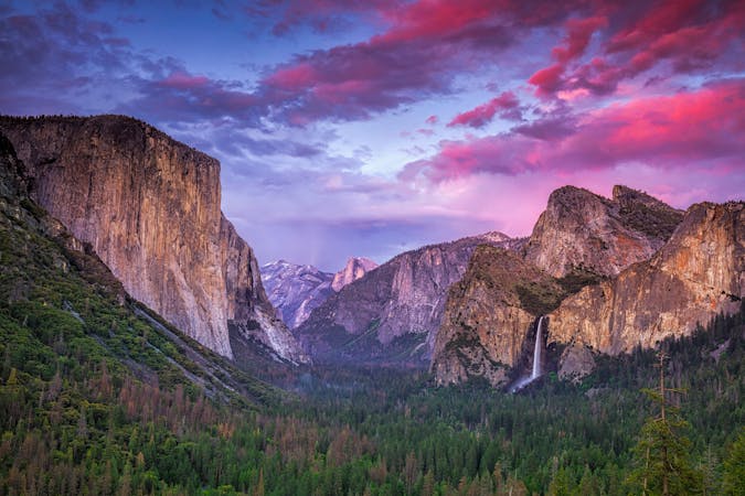
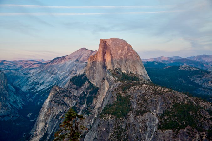
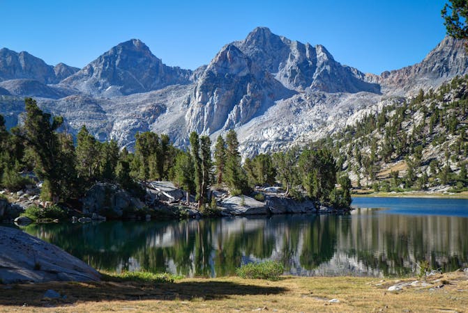
The John Muir Trail follows the crest of the Sierra Nevada through the most impressive stretch of this extensive range. The trail is named for the legendary 19th-century naturalist John Muir, who helped explore this formerly trackless wilderness and raised a resounding voice for its conservation. Beginning in Yosemite National Park and finishing on Mount Whitney, the 210-mile thru-hike is revered for epic scenery and sublime solitude among alpine peaks and basins that are hard to reach any other way.
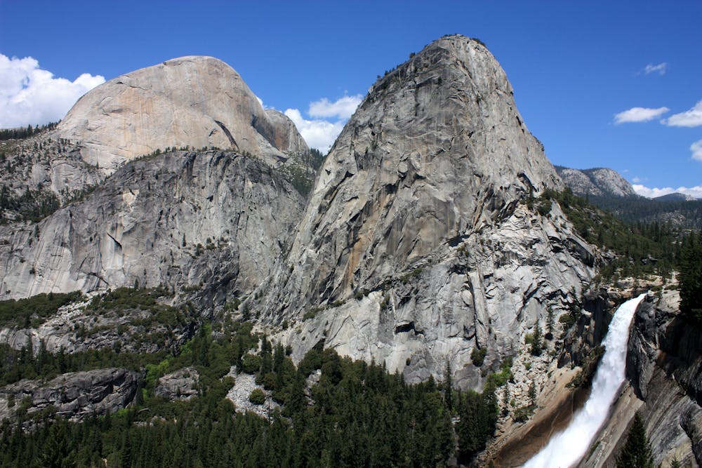
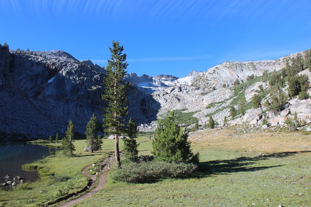
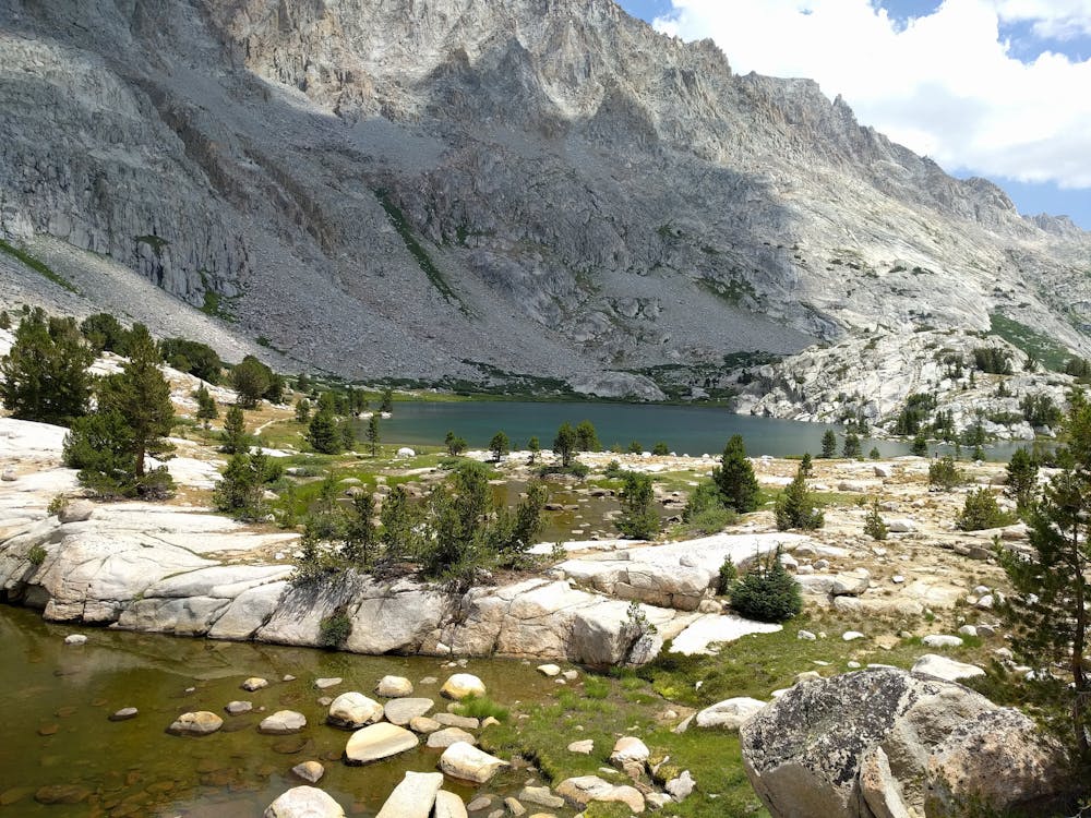
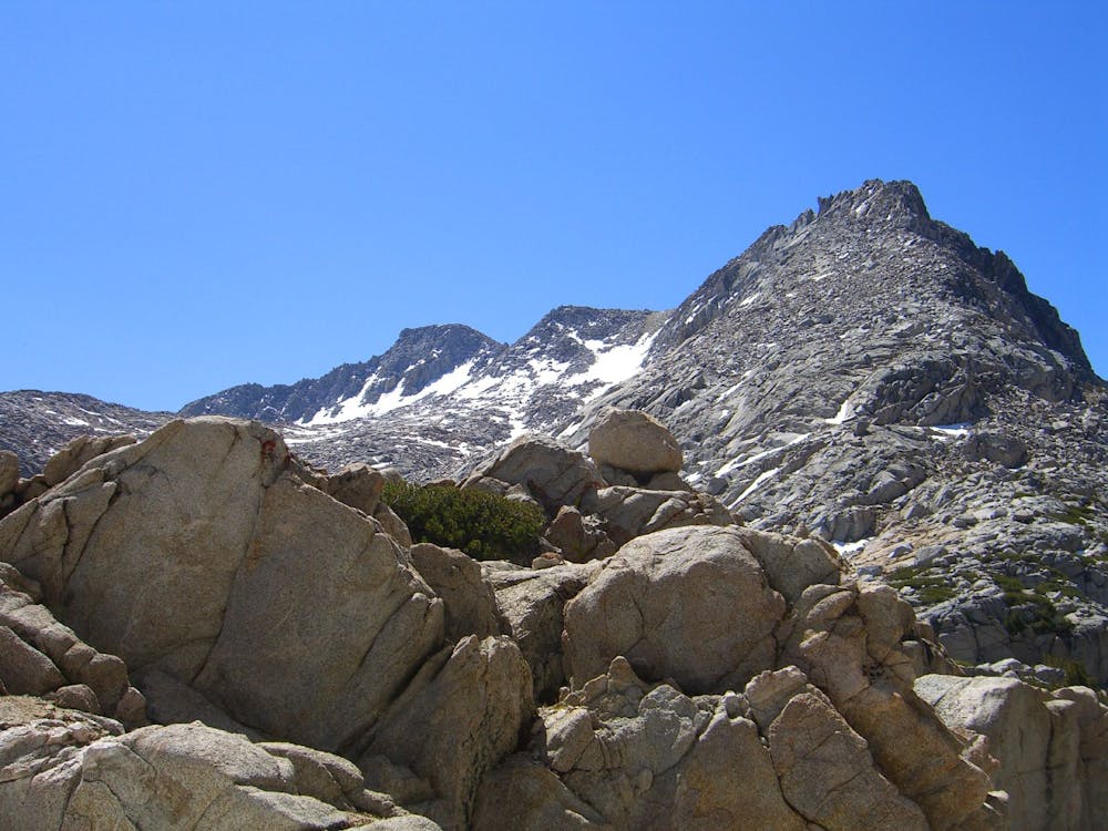

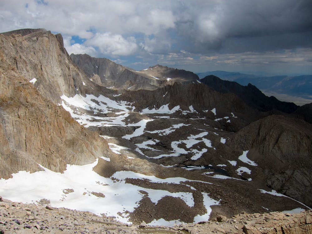
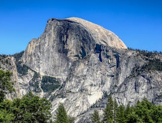
The sights of the John Muir Trail are unparalleled by perhaps any other trail of similar distance. It begins with views of thundering Yosemite waterfalls and the gigantic face of Half Dome, with the option to climb the cables to its summit (additional permit required). It then climbs into the Tuolumne Meadows high country before departing the national park for an extended journey through true backcountry of alpine lakes, glacial cirques, and mountain passes. Culminating in a hard-earned climb to the summit of Mt. Whitney, the highest point in the contiguous United States at 14,505 feet elevation, the JMT really is a trek like no other.
As one of the most coveted thru hikes in the country, and one that partially shares a route with the Pacific Crest Trail, you will certainly encounter other hikers on the JMT. The number is limited by a permit system, however, so you are guaranteed an uncrowded wilderness experience. You must get a permit in advance or as a walk-in from the agency office where you begin the hike. Note that if you plan to start from the south at Whitney Portal, you will also need the Mount Whitney Trail lottery permit.
Most thru-hikers begin in the north at Yosemite. This not only simplifies the permit system but provides other advantages as well. With most of the John Muir Trail above 8,000 feet, altitude is a real concern. From the north, the ascent is more gradual, so you’ll have time to acclimate. Also, there are more supply stops along the northern half of the trail, so you can carry fewer supplies during the early miles and allow your body to adjust.
Camping is at large almost everywhere along the John Muir Trail, with no amenities available, so you must be completely self-sufficient and Leave No Trace. Hikers usually have packages mailed to supply stops for holding. In the southern half, where there are no supply stops along the trail, you can depart at strategic places, which may require hiking an extra day and night on a side trip to resupply and return.
Sources: https://en.wikipedia.org/wiki/JohnMuirTrail https://www.pcta.org/discover-the-trail/john-muir-trail/
Difficult
Hiking trails where obstacles such as rocks or roots are prevalent. Some obstacles can require care to step over or around. At times, the trail can be worn and eroded. The grade of the trail is generally quite steep, and can often lead to strenuous hiking.

The trail contains some obstacles such as outcroppings and rock which could cause injury.

Little chance of being seen or helped in case of an accident.
2 m away
Connect two of Yosemite's great waterfalls in a concise but strenuous loop
Difficult Hiking
2 m away
An exciting hike to the summit of one of North America's most iconic peaks.
Extreme Hiking
26 m away
A stunning hike up steep climbs, passing close to Vernal and Nevada Falls.
Difficult Hiking
1.1 km away
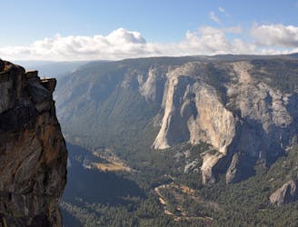
Hike at the brink of a huge waterfall and along the precipitous rim of Yosemite Valley.
Difficult Hiking
3.1 km away
A hike through the forest to a panoramic viewpoint over Yosemite Valley.
Easy Hiking
3.1 km away
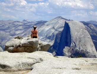
Birds-eye view of the Valley atop one of Yosemite's higher granite domes.
Moderate Hiking
3.2 km away
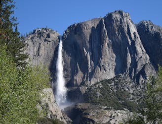
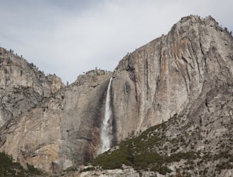
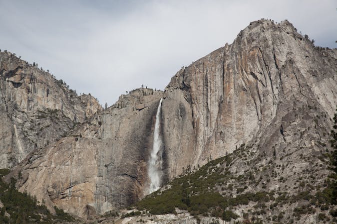
Steep hike to the top of North America's tallest waterfall.
Difficult Hiking
3.2 km away
Make the arduous climb to Upper Yosemite Falls, then go even farther to find the highest point on this side of Yosemite Valley.
Difficult Hiking
7.7 km away
Paved trail to the base of a 620-foot waterfall.
Easy Hiking
8.1 km away
Forest hike to the rim of Yosemite Valley at one of its greatest viewpoints
Moderate Hiking
13 routes · Hiking
6 routes · Hiking · Road Biking
7 routes · Hiking
9 routes · Hiking

25 routes · Alpine Climbing · Hiking

5 routes · Alpine Climbing · Hiking
7 routes · Hiking

63 routes · Alpine Climbing · Hiking