56 m away
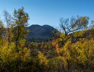
Oak Canyon Trail
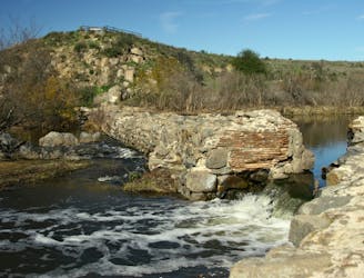
Streamside hike with seasonal waterfalls and wildflowers—best in spring but good year round.
Moderate Hiking
- Distance
- 5.2 km
- Ascent
- 78 m
- Descent
- 77 m
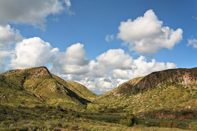
A steep hike to the summit of Kwaay Paay Peak yields a rewarding view.
Hiking Difficult

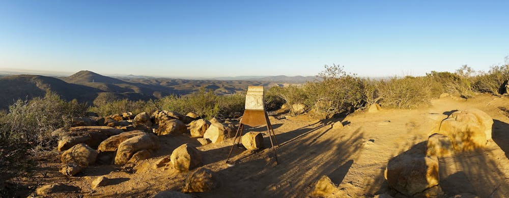
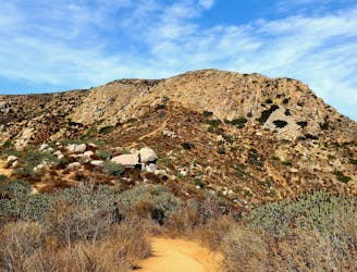
Are you ready for a short but steep hike that will challenge your legs and reward your eyes? If so, you might want to try the Kwaay Paay Peak Trail in Mission Trails Regional Park. This 2.1-mile out-and-back trail will take you to the top of Kwaay Paay Peak, one of the five prominent peaks in the park. You will gain ~870 feet of elevation as you climb up a rocky and rutted trail that offers panoramic views of San Diego and its surroundings.
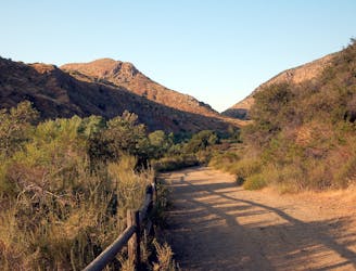
You can start the hike from two different trailheads along Father Juniper Serra Trail, a paved road that runs through the park. One is near Kumeyaay Lake Campground and the other is at Old Mission Dam Historic Site. Both trails will merge at a saddle before reaching the summit. You can also use an alternate route along the west side of the ridge for more variety.
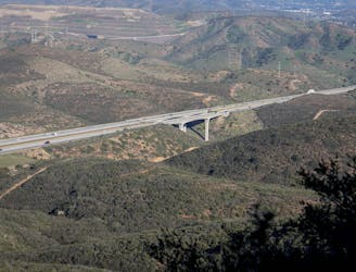
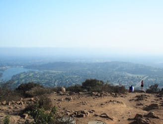
The summit of Kwaay Paay Peak is marked by a wooden post with a sign and a register where you can write your name and comments. From there, you can enjoy a 360-degree view of the park and beyond. You can see Cowles Mountain, Pyles Peak, South Fortuna Mountain, and North Fortuna Mountain, as well as the San Diego River valley, Kumeyaay Lake, and Oak Canyon. On a clear day, you can also see the downtown skyline, the Coronado Bridge, and the Pacific Ocean in the west, and the Miramar air base, the Penasquitos Canyon Preserve, and the Black Mountain in the north.
The trail is open year-round and is popular for hiking and running. Dogs are welcome but must be kept on leash. The trail can be hot and exposed, so avoid hiking during midday or on very warm days.
Source: Kwaay Paay Peak | San Diego | Hikespeak.com. https://www.hikespeak.com/trails/kwaay-paay-peak-hike-san-diego/ Kwaay Paay Peak Trail: A Hike with Panoramic Views - CA Hiking Adventures. https://cahikingadventures.com/kwaay-paay-peak/ Kwaay Paay Peak Hike In Mission Trails | The Simple Hiker. https://thesimplehiker.com/hiking-kwaay-paay-peak-mission-trails/ Conversation with Bing Chat
Difficult
Hiking trails where obstacles such as rocks or roots are prevalent. Some obstacles can require care to step over or around. At times, the trail can be worn and eroded. The grade of the trail is generally quite steep, and can often lead to strenuous hiking.

The trail contains some obstacles such as outcroppings and rock which could cause injury.
Away from help but easily accessed.
56 m away
Streamside hike with seasonal waterfalls and wildflowers—best in spring but good year round.
Moderate Hiking
56 m away
Hike to a stunning 360-degree panorama from the top of North Fortuna Mountain.
Difficult Hiking
2.6 km away
Experience the natural and cultural wonders of Mission Trails Regional Park on the Visitor Center Loop Trail, an easy and scenic hike that starts and ends at the park’s visitor center.
Easy Hiking
3 km away
Gain incredible views from one of Mission Trails Regional Park's beautiful mountains.
Difficult Hiking
3.9 km away
If simply summitting Cowles Mountain isn't enough of a challenge, tack on Pyles Peak for some bonus miles!
Difficult Hiking
3.9 km away
The short and steep approach to the highest point in San Diego.
Difficult Hiking
17 routes · Hiking
8 routes · Mountain Biking · Hiking · Trail Running