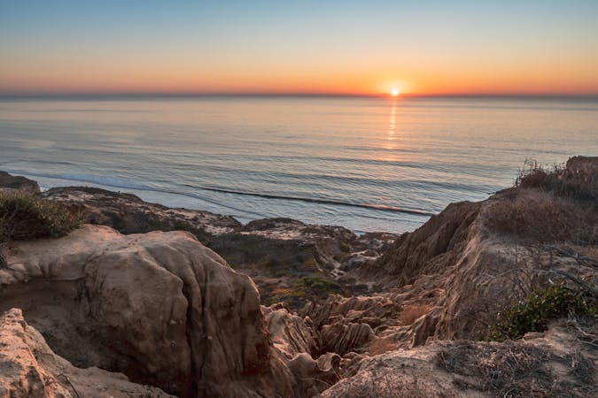
391 m away
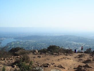
South Fortuna Mountain
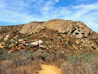
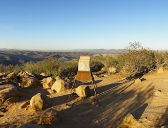
Gain incredible views from one of Mission Trails Regional Park's beautiful mountains.
Difficult Hiking
- Distance
- 8.5 km
- Ascent
- 441 m
- Descent
- 441 m
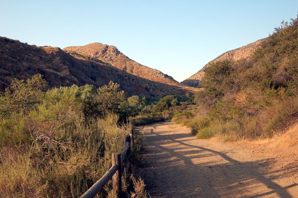
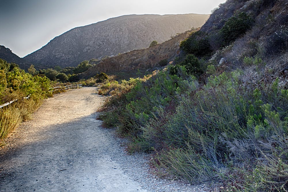
Experience the natural and cultural wonders of Mission Trails Regional Park on the Visitor Center Loop Trail, an easy and scenic hike that starts and ends at the park’s visitor center.
Hiking Easy

The Visitor Center Loop Trail is a great way to enjoy the beauty and diversity of Mission Trails Regional Park while learning about its history and ecology. This 1.5-mile loop trail starts and ends at the park's award-winning visitor center, where you can learn about the park's history, geology, flora, fauna, and activities through interactive exhibits and displays. You can also enjoy regular art exhibits and pick up souvenirs at the gift shop.
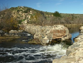
The loop trail follows a well-marked path that crosses different habitats, including chaparral, coastal sage scrub, riparian woodland, and grassland. Along the way, you can see a variety of plants and animals, such as laurel sumac, California buckwheat, western sycamore, arroyo willow, mule deer, coyote, quail, and hawk. You can also see some historical features, such as the Riverside Grinding Site where the Kumeyaay people used to grind seeds and acorns in bedrock mortars.
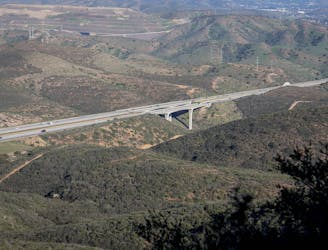
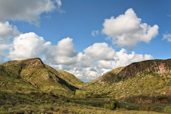
The loop trail offers panoramic views of the park and beyond. You can see several of the park's prominent peaks, such as Cowles Mountain, Pyles Peak, South Fortuna Mountain, and North Fortuna Mountain.
The trail is open year-round and is popular for hiking, running, and dog walking. Dogs are welcome but must be kept on leash.
Source: Mission Trails Regional Park Visitor Center. https://mtrp.org/infocus (Mission Trails Visitor Center – Mission Trails Regional Park - MTRP. https://mtrp.org/visitor-center/ The Nat | Mission Trails Regional Park – Visitor Center Loop. https://www.sdnhm.org/education/canyoneer-hikes/mission-trails-regional-park-visitor-center-loop/ Mission Trails Regional Park, Visitor Center Loop. https://www.outdoorproject.com/united-states/california/mission-trails-regional-park-visitor-center-loop Conversation with Bing Chat
Easy
Walking along a well-kept trail that’s mostly flat. No obstacles are present.

The path is on completely flat land and potential injury is limited to falling over.
Close to help in case of emergency.
391 m away
Gain incredible views from one of Mission Trails Regional Park's beautiful mountains.
Difficult Hiking
2.4 km away
If simply summitting Cowles Mountain isn't enough of a challenge, tack on Pyles Peak for some bonus miles!
Difficult Hiking
2.4 km away
The short and steep approach to the highest point in San Diego.
Difficult Hiking
2.6 km away
Hike to a stunning 360-degree panorama from the top of North Fortuna Mountain.
Difficult Hiking
2.6 km away
Streamside hike with seasonal waterfalls and wildflowers—best in spring but good year round.
Moderate Hiking
2.6 km away
A steep hike to the summit of Kwaay Paay Peak yields a rewarding view.
Difficult Hiking
17 routes · Hiking
8 routes · Mountain Biking · Hiking · Trail Running