1 m away
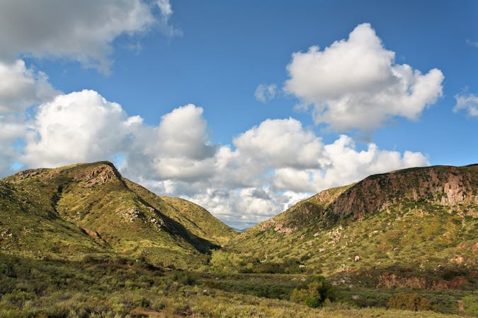
Cowles Mountain Trail
The short and steep approach to the highest point in San Diego.
Difficult Hiking
- Distance
- 4.8 km
- Ascent
- 279 m
- Descent
- 279 m
If simply summitting Cowles Mountain isn't enough of a challenge, tack on Pyles Peak for some bonus miles!
Hiking Difficult

For a challenging and rewarding hike that takes you to two of the highest peaks in Mission Trails Regional Park, try the Pyles Peak hike via the Cowles Mountain trail. This 5.3-mile out-and-back trail will lead you to the summits of Cowles Mountain and Pyles Peak, where you can admire stunning views of San Diego and its surroundings. You will climb 1,778 feet of elevation as you hike up two peaks and along a scenic ridge.
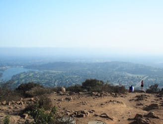
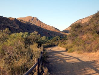
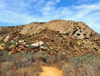
You can start the hike from several trailheads along Golfcrest Drive or Navajo Road, but the most popular one is at the end of Golfcrest Drive. From there, you will follow the well-marked and well-maintained trail up to the summit of Cowles Mountain, the highest point in the city of San Diego at 1,592 feet. This 1.5-mile section is steep and rocky, but offers great views of the city and the ocean. Cowles Mountain is a very popular hike, so expect to share the trail with many other hikers and runners.
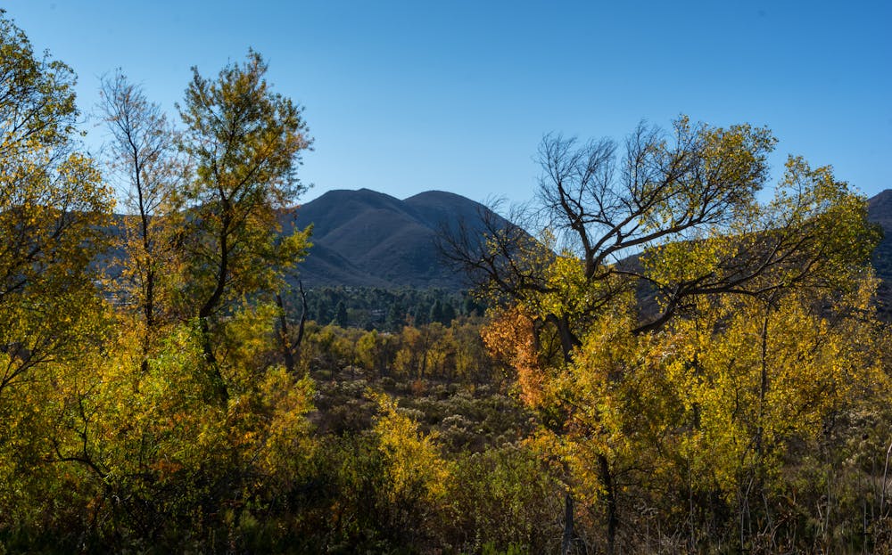
From the summit of Cowles Mountain, you will see a sign for Pyles Peak Trail, which heads northwest along a fire road. Follow this trail as it descends about 300 feet to a saddle, where it meets another trail coming from Barker Dam. Keep left at this junction and continue on Pyles Peak Trail as it climbs up another hill and then drops down to another saddle. The trail is less crowded and more shaded than Cowles Mountain Trail, and passes through chaparral and coastal sage scrub habitats.
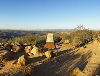
From the second saddle, you will see Pyles Peak ahead of you. The trail ascends about 400 feet to the summit, which is marked by a wooden post with a sign and a register where you can write your name and comments. From there, you can enjoy a 360-degree view of Mission Trails Regional Park and beyond. You can see Cowles Mountain, South Fortuna Mountain, North Fortuna Mountain, Kwaay Paay Peak, and Woodson Mountain in the park. You can also see downtown San Diego, Coronado Island, Point Loma, La Jolla, Mount Laguna, Cuyamaca Peak, and on a clear day, even Mexico.
To return to your starting point, retrace your steps on Pyles Peak Trail and Cowles Mountain Trail. The hike is open year-round and is popular for hiking and running. Dogs are welcome but must be kept on leash. The trail can be hot and exposed during midday or on warm days.
Source: Hiking Cowles Mountain And Pyles Peak - Trail to Peak. https://trailtopeak.com/2017/04/03/hiking-cowles-mountain-and-pyles-peak/ Pyles Peak, San Diego, California - The Outbound. https://www.theoutbound.com/san-diego/hiking/hike-to-pyles-peak Pyles Peak | Cowles Mountain Trail | San Diego Hikes - Getgo Outdoors. https://getgooutdoors.com/pyles-peak-hike/ Conversation with Bing Chat
Difficult
Hiking trails where obstacles such as rocks or roots are prevalent. Some obstacles can require care to step over or around. At times, the trail can be worn and eroded. The grade of the trail is generally quite steep, and can often lead to strenuous hiking.

The trail contains some obstacles such as outcroppings and rock which could cause injury.
Away from help but easily accessed.
1 m away
The short and steep approach to the highest point in San Diego.
Difficult Hiking
2.4 km away
Experience the natural and cultural wonders of Mission Trails Regional Park on the Visitor Center Loop Trail, an easy and scenic hike that starts and ends at the park’s visitor center.
Easy Hiking
2.6 km away
Gain incredible views from one of Mission Trails Regional Park's beautiful mountains.
Difficult Hiking
3.9 km away
A steep hike to the summit of Kwaay Paay Peak yields a rewarding view.
Difficult Hiking
3.9 km away
Hike to a stunning 360-degree panorama from the top of North Fortuna Mountain.
Difficult Hiking
3.9 km away
Streamside hike with seasonal waterfalls and wildflowers—best in spring but good year round.
Moderate Hiking
17 routes · Hiking
8 routes · Mountain Biking · Hiking · Trail Running