123 m away
Lakes Trail
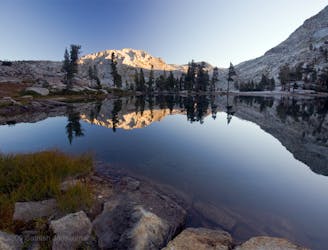
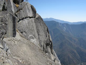
Widely regarded as one of the most incredible day hikes in the USA!
Difficult Hiking
- Distance
- 19 km
- Ascent
- 981 m
- Descent
- 981 m
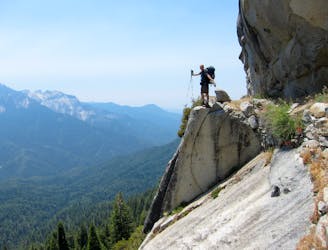
Lakes Trail to Alta Peak
Hiking Difficult

This is a popular hiking route which is generally considered to be difficult. It's very remote, it features high exposure and is typically done between May and September. From a low point of 2.2 km to the maximum altitude of 3.4 km, the route covers 22 km, 1210 vertical metres of ascent and 1213 vertical metres of descent.
13.5 mile out and back trail starting from Wolverton Rd. Parking Lot > Lakes Trail > Panther Gap Trail > Alta Trail/Alta Peak
Difficult
Hiking trails where obstacles such as rocks or roots are prevalent. Some obstacles can require care to step over or around. At times, the trail can be worn and eroded. The grade of the trail is generally quite steep, and can often lead to strenuous hiking.

Some trail sections have exposed ledges or steep ascents/descents where falling could cause serious injury.
Little chance of being seen or helped in case of an accident.
123 m away
Widely regarded as one of the most incredible day hikes in the USA!
Difficult Hiking
1.4 km away
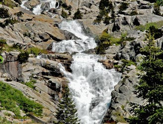
At 1,200 feet tall, Tokopah Falls is the tallest waterfall in Sequoia National Park.
Moderate Hiking
1.9 km away

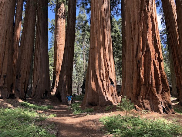
This 7-mile hike rolls through groves of the largest trees on planet earth.
Moderate Hiking
1.9 km away
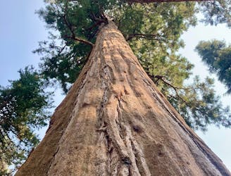
Hike past the largest tree in the world!
Easy Hiking
4.8 km away
A committing crossing of California's Sierra Nevada with the option to summit Mt. Whitney.
Difficult Hiking
5 km away
One of the most popular hikes in Sequoia National Park leads to stunning 360-degree views of the region.
Moderate Hiking

25 routes · Alpine Climbing · Hiking

5 routes · Alpine Climbing · Hiking
7 routes · Alpine Climbing · Hiking

14 routes · Hiking