4 km away
Sidewinder -> Corral
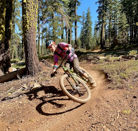
One of the best flow trails in the Lake Tahoe region.
Difficult Mountain Biking
- Distance
- 14 km
- Ascent
- 451 m
- Descent
- 450 m
A classic backcountry-style IMBA Epic ride.
Mountain Biking Severe

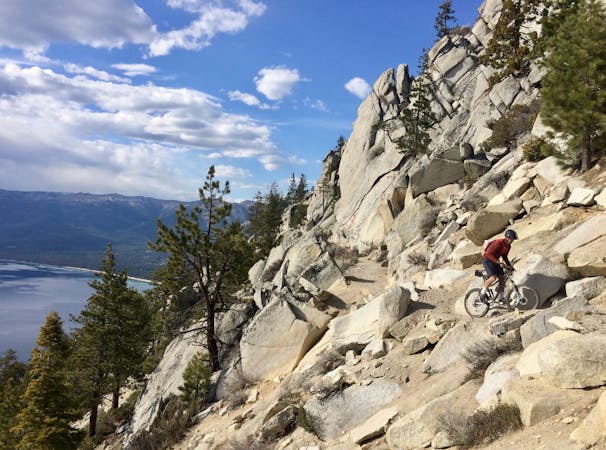
This 36-mile point-to-point route has been designated as one of IMBA’s renowned Epic rides. "This 90 percent singletrack route ranges from fast and flowing to technical and chunky,” writes Adventure Journal. "There are dramatic views of Strawberry Valley from the top of Lover’s Leap, 1,100 feet above the deck, before the final rip-roaring descent."
Beginning with a climb up Armstrong, the route then joins the Tahoe Rim Trail, dropping to Big Meadow.
From here, this route mostly follows a different set of trails than the singletrack segments used to create the Tahoe Rim Trail, although it runs in a similar direction.
From Big Meadow, the route circles around the back of Waterhouse Peak, and then traverses all the way over to and through the Sierra at Tahoe resort. From the ski resort, it’s a fast descent down to the small town Strawberry!
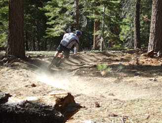
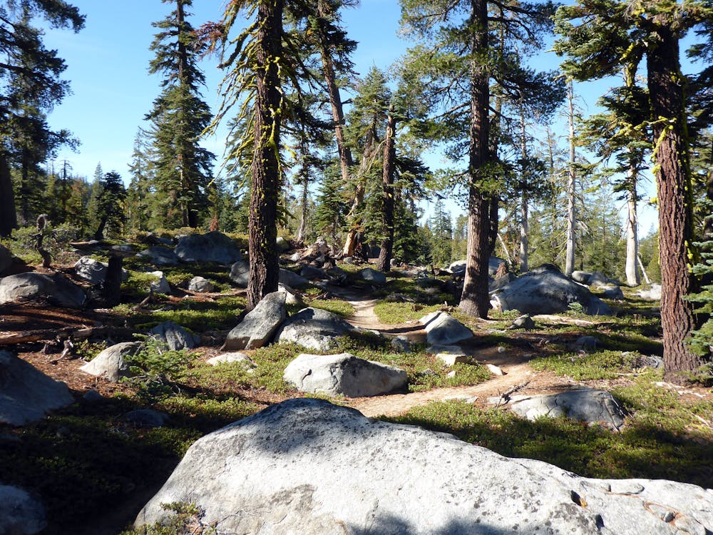
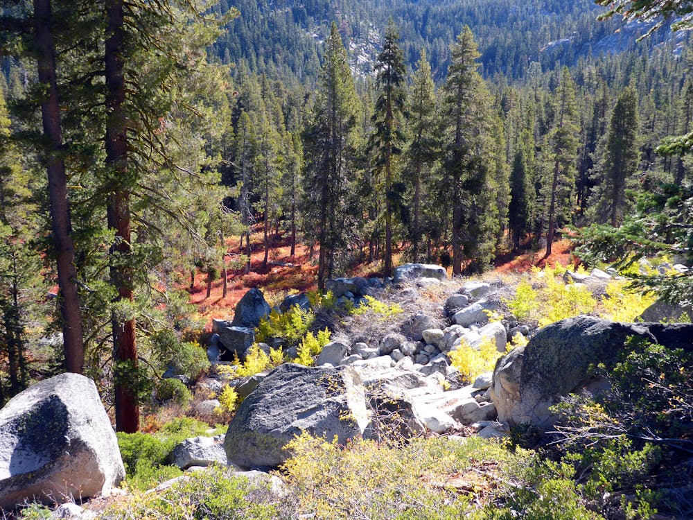
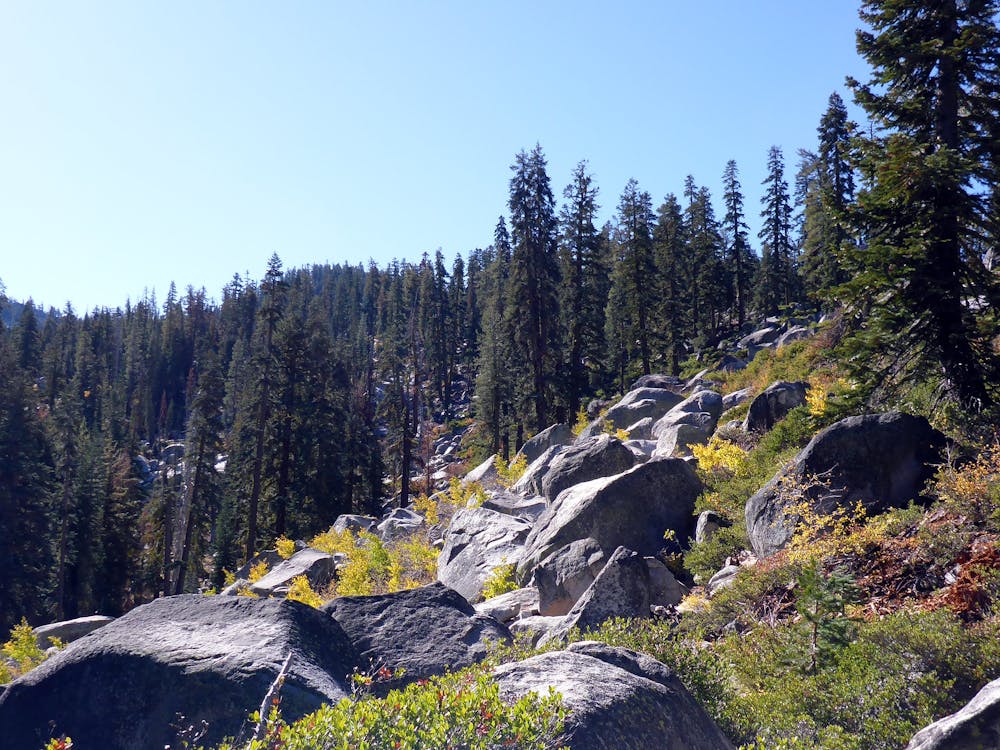
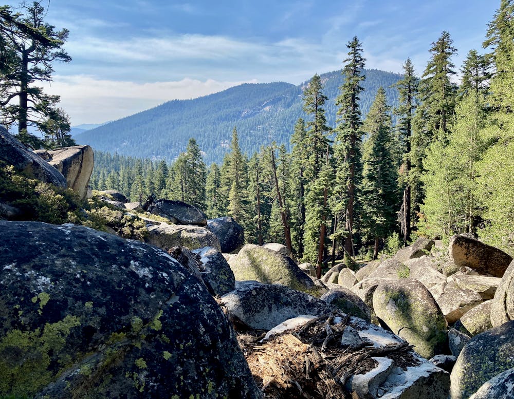
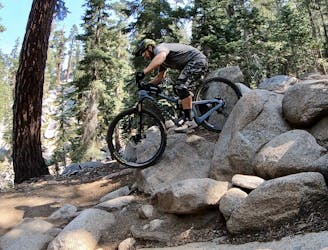
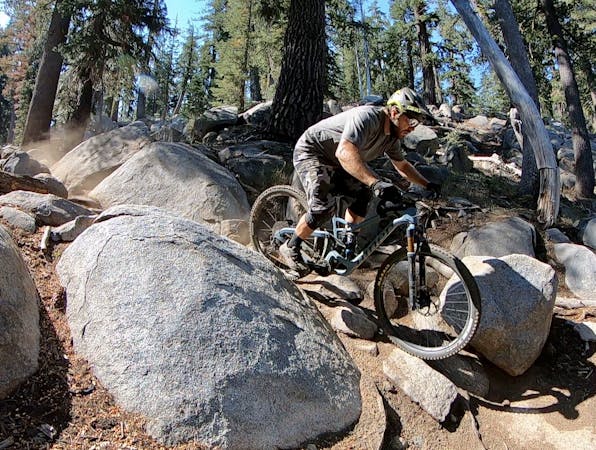
Most of the singletrack along this route is classic backcountry-style riding. In keeping with the Tahoe style, you can expect sections of smooth, flowing dirt… but don’t expect them to hang around for too long! The trail can get rocky in a hurry, but most of the rocky sections feature big, embedded boulders that make for entertaining tech riding. Contrast this with loose, rolling babyheads that can be a pain to ride through.
The boulders in the trail offer entertaining up-and-over tech features, with the opportunity to catch air off of some drops. The final descent on the Pony Express trail also offers plenty of small kickers and air opportunities as side hits along the trail if you know where to look for them.
Sources: https://www.youtube.com/watch?v=Phx9kRgHmlg https://www.adventure-journal.com/2015/09/legitimately-epic-mountain-bike-trails/
Severe
Widely variable, narrow trail tread with steeper grades and unavoidable obstacles of 15in/38cm tall or less. Obstacles may include unavoidable bridges 24in/61cm wide or less, large rocks, gravel, difficult root sections, and more. Ideal for advanced-level riders.

The trail contains some obstacles such as outcroppings and rock which could cause injury.

Little chance of being seen or helped in case of an accident.
4 km away
One of the best flow trails in the Lake Tahoe region.
Difficult Mountain Biking
7.3 km away
South Lake Tahoe's classic, technical MTB descent.
Severe Mountain Biking
10 routes · Mountain Biking
4 routes · Mountain Biking
5 routes · Mountain Biking

24 routes · Mountain Biking

20 routes · Mountain Biking