.jpg?sfvrsn=124bfa04<em>0)
2 m away
Brake Through

A two-way trail that helps tie the mountain together.
Difficult Mountain Biking
- Distance
- 5.3 km
- Ascent
- 9 m
- Descent
- 305 m
A lengthy two-way singletrack trail that helps tie the mountain together.
Mountain Biking Difficult

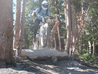
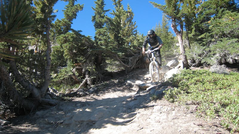
Bearing Straits is yet another a two-way singletrack trail that allows trail riders to pedal up the mountain if they’d like, or downhillers to connect across the mountain to access other runs. For pedal-driven rides, Bearing Straits can be connected with Beach Cruiser and Gravy Train for a respectable vertical gain. Bearing Straits climbs up the sides of the volcano past 9,800 feet, stopping less than 1,200 feet from the summit.
The soil is classic Mammoth Mountain, consisting of dry, loose, dirt and sand between rough volcanic rocks. Despite the intermediate rating, rocks still appear in the trail tread and remind you that yes, you’re still riding a mountain bike! Compared to most of the other two-way trails, Bearing Straits has a few more difficult rock sections that could challenge intermediate riders. However, those sections are never very long.
Sources: https://d1pdyfnmzhu191.cloudfront.net/images/default-source/master/maps/2019bikeparktrailmapfront2000x1171-(2).jpg?sfvrsn=124bfa040 https://www.youtube.com/watch?v=AVrNi-7jjuc
Difficult
Mostly stable trail tread with some variability featuring larger and more unavoidable obstacles that may include, but not be limited to: bigger stones, roots, steps, and narrow curves. Compared to lower intermediate, technical difficulty is more advanced and grades of slopes are steeper. Ideal for upper intermediate riders.

The trail contains some obstacles such as outcroppings and rock which could cause injury.

Close to help in case of emergency.
2 m away
A two-way trail that helps tie the mountain together.
Difficult Mountain Biking
394 m away

A fast DH rip.
Extreme Mountain Biking
400 m away

A burly rock-filled pro line.
Extreme Mountain Biking
440 m away

Home to one of the biggest rock features on the mountain.
Extreme Mountain Biking
611 m away

Possibly the most brutally-technical run on Mammoth Mountain.
Extreme Mountain Biking
707 m away

A surprisingly flowy double black diamond descent.
Extreme Mountain Biking
777 m away
An extremely varied double black diamond pro-line.
Extreme Mountain Biking
910 m away
A high-speed trail filled with pavers and wooden features!
Extreme Mountain Biking
990 m away

An ultra-mellow beginner trail.
Easy Mountain Biking
991 m away

A slight progression up in the Discovery Zone with small tabletop jumps.
Moderate Mountain Biking
34 routes · Mountain Biking
8 routes · Mountain Biking
5 routes · Mountain Biking