138 m away
DC-10
An extremely varied double black diamond pro-line.
Extreme Mountain Biking
- Distance
- 1.4 km
- Ascent
- 0 m
- Descent
- 228 m
A surprisingly flowy double black diamond descent.
Mountain Biking Extreme

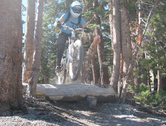
Follow Me is a lengthy double black diamond descent in the classic Mammoth Mountain style. Featuring boulders, loose, sliding dirt, chunks of pumice, and all manner of blown-out gnar, this 2.3-mile descent is guaranteed to get your arms pumped!
While Follow Me is undoubtedly gnarly, the addition of well-built berms—some of which are reinforced with pavers—has prompted some people, such as Jonathan Fennell, to ask, “is this the Flowiest Tech Trail? Is that even possible?"
Since Follow Me starts so high up the mountain, if you can look up from the techy gnar gnar under your tires you’ll enjoy stunning panoramic vistas of the valley below and the mountains all around. Best to pull over and stop while you take in the views, though—a fall on this pumice is guaranteed to shred your flesh!
Extreme
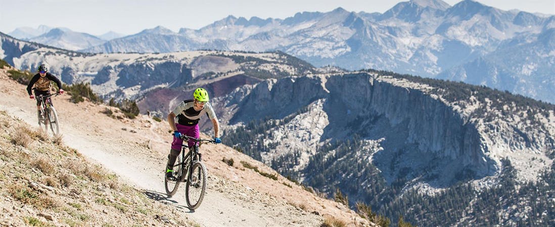
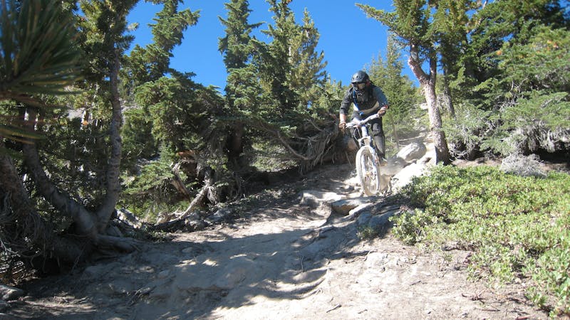
Very steep, difficult, narrow singletrack with widely variable and unpredictable trail conditions. Unavoidable obstacles could be 15in/38cm tall or greater, and unavoidable obstacles with serious consequences are likely to be present. Obstacles could include big rocks, difficult root sections, drops, jumps, sharp switchbacks, and more. Ideal for expert-level riders.

The trail contains some obstacles such as outcroppings and rock which could cause injury.

Close to help in case of emergency.
138 m away
An extremely varied double black diamond pro-line.
Extreme Mountain Biking
555 m away

Home to one of the biggest rock features on the mountain.
Extreme Mountain Biking
576 m away

One of the gnarliest pro lines on Mammoth Mountain.
Extreme Mountain Biking
670 m away

A fast DH rip.
Extreme Mountain Biking
680 m away

Possibly the most brutally-technical run on Mammoth Mountain.
Extreme Mountain Biking
695 m away

A burly rock-filled pro line.
Extreme Mountain Biking
705 m away

A two-way trail that helps tie the mountain together.
Difficult Mountain Biking
707 m away

A lengthy two-way singletrack trail that helps tie the mountain together.
Difficult Mountain Biking
799 m away

Chunky black diamond tech trail.
Severe Mountain Biking
897 m away

Flow trail to the max!
Difficult Mountain Biking
34 routes · Mountain Biking
5 routes · Mountain Biking