8.4 km away
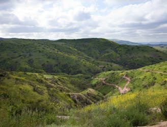
The Luge

An iconic flow trail that predates the advent of the modern flow trail.
Moderate Mountain Biking
- Distance
- 12 km
- Ascent
- 435 m
- Descent
- 435 m
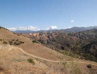
MTB Loop 42km / 26miles with 1340m / 4400ft climb
Mountain Biking Severe

This is a popular mountain biking route which is generally considered to be severe. It's remote, it features medium exposure and is typically done all year round. From a low point of 263 m to the maximum altitude of 1.2 km, the route covers 42 km, 1404 vertical metres of ascent and 1403 vertical metres of descent.
Beautiful views from the Main divide road
Severe
Widely variable, narrow trail tread with steeper grades and unavoidable obstacles of 15in/38cm tall or less. Obstacles may include unavoidable bridges 24in/61cm wide or less, large rocks, gravel, difficult root sections, and more. Ideal for advanced-level riders.

The trail contains some obstacles such as outcroppings and rock which could cause injury.
Away from help but easily accessed.
8.4 km away
An iconic flow trail that predates the advent of the modern flow trail.
Moderate Mountain Biking
8.9 km away
One of the most popular mountain bike trail systems in Orange County.
Difficult Mountain Biking
9.2 km away
An expansive open space offering connections to other nearby trails.
Moderate Mountain Biking
13 routes · Mountain Biking