3.4 km away
Bee Rock and Mount Hollywood Loop
Running Mount Hollywood from bottom to top.
Difficult Trail Running
- Distance
- 9.8 km
- Ascent
- 430 m
- Descent
- 430 m
A beautiful but non-technical run to the summit of Mount Hollywood.
Trail Running Easy

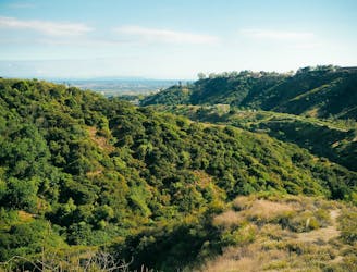
The flanks of Mount Hollywood are riddled with trails and old road grades, providing innumerable options for reaching the summit. The route shown here is one of the easiest and most direct paths to the top of the mountain.
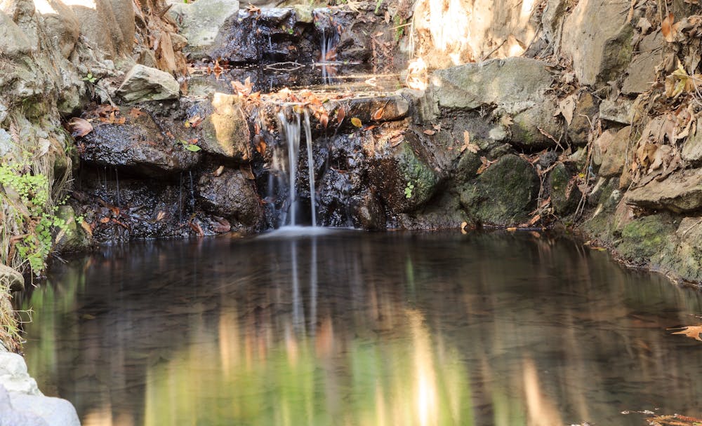
This route begins on the Ferndell Trail, itself an out-of-the-ordinary trail in the Los Angeles area. Ferndell "borders a stream that nourishes tropical plants under the shade of sycamores," according to HikesPeak.com. "Even when other parts of Griffith Park dry out and turn brown, Ferndell stays lush and green, thanks to the recycled water it receives from Griffith Observatory," they continue.
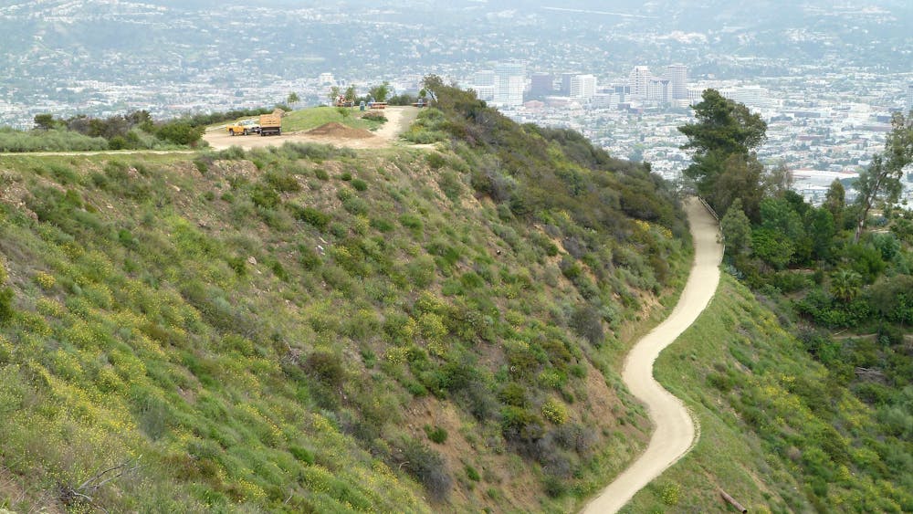
While Ferndell is over quickly, this provides a fantastic start and end to this beautiful run! From the end of Ferndell, you'll begin climbing in earnest on the W Trail—a wide road grade that's smooth and provides easy running, even if it does climb consistently up the mountainside. Singletrack options do exist to bypass the road grade, but this route follows the road to maintain an "Easy" FATMAP difficulty rating.
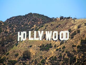
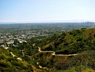
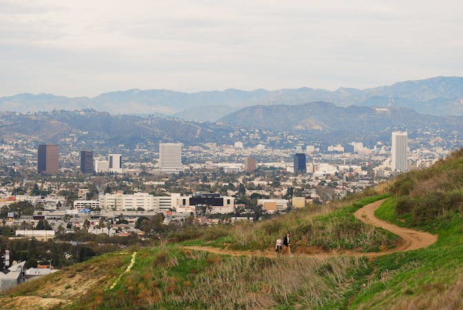
Higher up, you'll reach the named Mount Hollywood trail—again, another old dirt road. At the top, the route shown here includes a small loop for variety, or you can simply run an out-and-back. Once on top of the mountain, you'll enjoy spectacular views of Hollywood directly below you, Los Angeles beyond that, Santa Monica and the Pacific Ocean, and the San Gabriel mountains.
Once finished on the summit, the easiest option is to retrace your steps back to your car. However, as noted above, many other trails run up and down the mountainside, allowing you to create a loop if you so desire.
Sources: https://www.hikespeak.com/trails/ferndell-trail-griffith-park-western-canyon/
Easy

The path is on completely flat land and potential injury is limited to falling over.
Close to help in case of emergency.
3.4 km away
Running Mount Hollywood from bottom to top.
Difficult Trail Running
3.8 km away
Workout with a view on the ridges above West Hollywood.
Moderate Trail Running
8.2 km away

Continuous ups and downs through wooded hills and canyons above Studio City.
Difficult Trail Running
9.9 km away
Hill and ridgeline run with a view over Beverly Hills.
Moderate Trail Running
9 routes · Trail Running