3.8 km away
Ferndell Trail to the Mount Hollywood Summit
A beautiful but non-technical run to the summit of Mount Hollywood.
Easy Trail Running
- Distance
- 8.5 km
- Ascent
- 340 m
- Descent
- 340 m
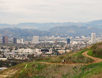
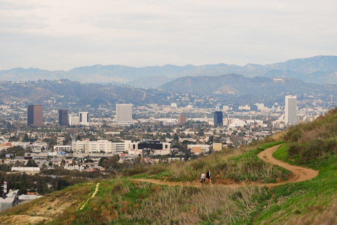
Workout with a view on the ridges above West Hollywood.
Trail Running Moderate

To get the most out of a visit to Hollywood, go for a run in Runyon Canyon. The park’s trails take you high on ridges overlooking the city, and the inclines make a substantial workout. You may even spot a celebrity sharing the trail, as this park is a go-to outdoor escape for Hollywood residents.
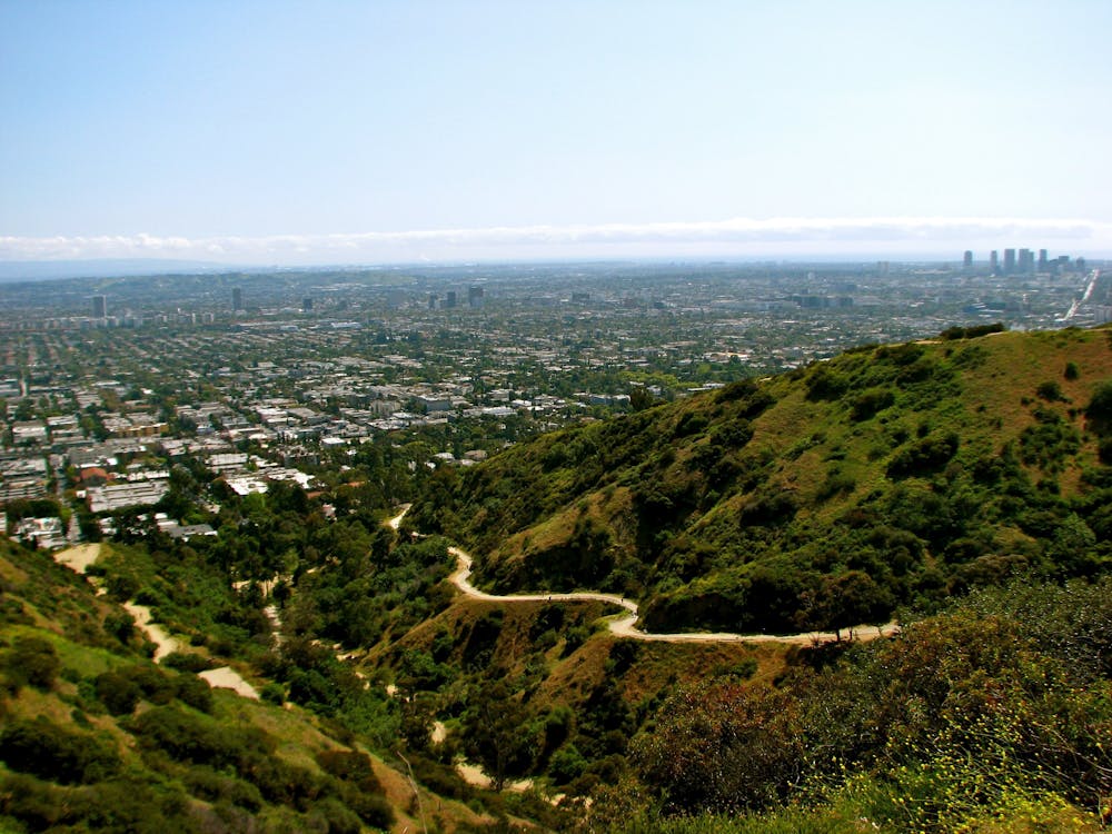
As mapped, the run begins from the park’s main entrance on Fuller Avenue, taking the uphill first. If you’d rather start with the downhill, you can begin from the upper entrance on Mulholland Drive instead. Either entrance is easily connected by roads and other trails, so you can make a longer run in the area. It’s a public park so access is free, but open hours are only dawn until dusk.
From the Fuller Avenue entrance, you’ll first run up the Runyon Canyon Road, which is quite wide and offers the choice of either pavement or dirt surface. It climbs the canyon between the two ridges that define the park, then gains the spine of the east ridge at a spot called Inspiration Point. You may want to pause here, catch your breath, and take in the view. From there, continue uphill on a dirt trail, eventually coming to the Mulholland Drive entrance, at the approximate highpoint of the loop. Then, all that’s left is a glorious downhill on the west ridge, with a panorama of the LA skyline in front of you the whole time.
Because Runyon Canyon Park is so close to the city and so popular, you will never have the trails all to yourself, but you can come at less busy times. The most peaceful time is right at sunrise. Any day that is less ideal for casual hiking and photography, like a cold and cloudy one, will be much less crowded and better for running.
Sources: http://runyoncanyontrails.com/ https://www.nps.gov/samo/planyourvisit/runyoncanyon.htm
Moderate

The path is on completely flat land and potential injury is limited to falling over.
Close to help in case of emergency.
3.8 km away
A beautiful but non-technical run to the summit of Mount Hollywood.
Easy Trail Running
5.1 km away

Continuous ups and downs through wooded hills and canyons above Studio City.
Difficult Trail Running
6.1 km away
Hill and ridgeline run with a view over Beverly Hills.
Moderate Trail Running
6.7 km away
Running Mount Hollywood from bottom to top.
Difficult Trail Running
9.9 km away
Quick cardio on the stairs or the trail to an overlook of the city.
Moderate Trail Running
9 routes · Trail Running