153 m away
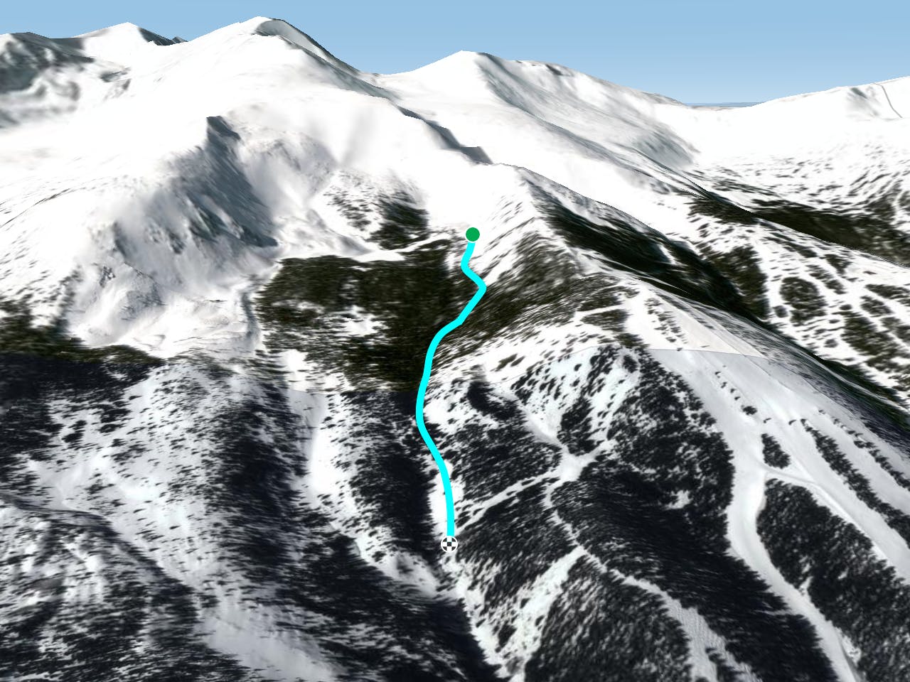
Ballroom 3

Another option off the bootpack of ballroom
Difficult Freeride Skiing
- Distance
- 504 m
- Ascent
- 0 m
- Descent
- 183 m
Bushwacking traverse out
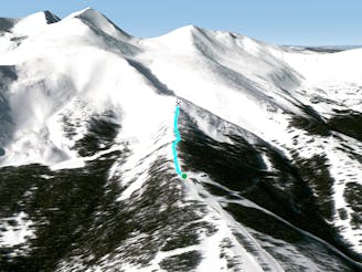
Freeride Skiing Easy
This is a popular freeride skiing route which is generally considered to be easy. It's not remote, it features low exposure (e1) and is typically done in an unknown time of year. From a low point of 3.3 km to the maximum altitude of 3.5 km, the route covers 1.1 km, 0 vertical metres of ascent and 243 vertical metres of descent.
This is your exit out of the Numbers Area. It will eventually put you back on the piste runs. It is flat, and tight with a lot of trees. If you get lost, just simply follow the drainage downhill and out.
Easy
Wide gentle slopes at around 20 degrees or less.

Exposure is limited to that of the slope itself. Getting hurt is still likely if the slope is steep and/or the snow is hard.
Close to help in case of emergency.
153 m away
Another option off the bootpack of ballroom
Difficult Freeride Skiing
154 m away

Another ballroom option off the bootpack hike
Difficult Freeride Skiing
155 m away

Short south facing bowl
Difficult Freeride Skiing
157 m away

Short South Facing Bowl
Difficult Freeride Skiing
217 m away

Another chute off the ballroom hike
Difficult Freeride Skiing
274 m away

A fun and wide open tree run that gets steeper and tighter from top to bottom.
Difficult Freeride Skiing
375 m away
Top of Falcon Chair Hike
Moderate Freeride Skiing
498 m away

A fun short tree run that gets steeper and tighter from top to bottom.
Difficult Freeride Skiing
635 m away

Tight banked tree run off Corsair
Moderate Freeride Skiing
642 m away

The traverse route to take after you enter through the backcountry gate
Moderate Freeride Skiing