7 km away
Capitol Creek Circuit: Snowmass Lake to Capitol Creek Trailhead
A strenuous but exhilarating day to conclude the beautiful Capitol Creek Circuit.
Difficult Hiking
- Distance
- 28 km
- Ascent
- 1.2 km
- Descent
- 1.6 km
A lengthy, spectacular day of hiking through the Rockies.
Hiking Difficult

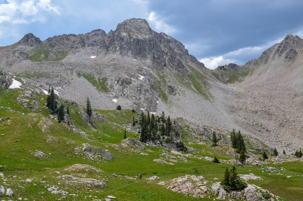
Day two of the Capitol Creek Circuit packs a punch. This section features the most elevation gain and mileage of any day along the circuit so be prepared. That said, the scenery more than makes up for the difficulty of the route.
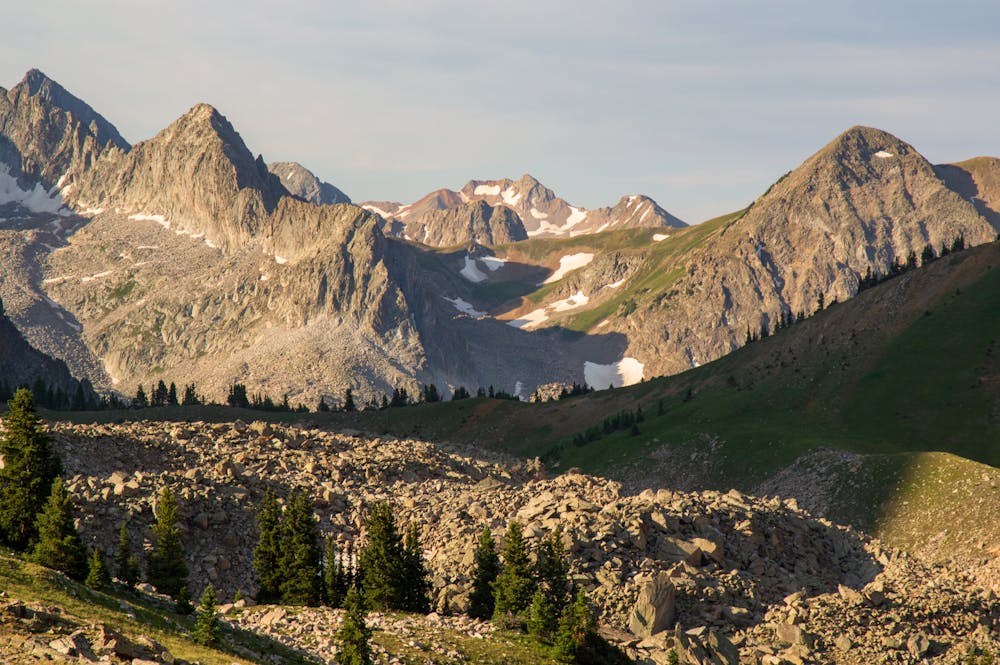
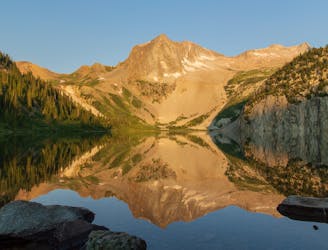
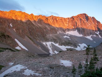
Despite the difficulty, this segment is extremely rewarding because you begin the day at a gorgeous alpine lake (Capitol Lake) and end at another gorgeous alpine lake (Geneva Lake)!
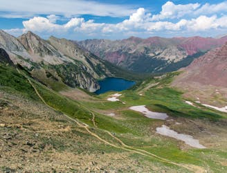
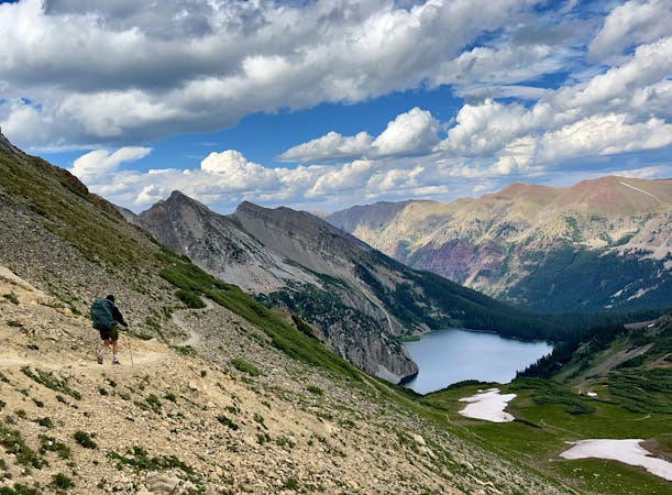
You get some picturesque vistas shortly after leaving Capitol Lake. The outline of the day's trail comes right into view up ahead. You then descend quite a bit down to the Avalanche Lake junction. Adding Avalanche Lake to the route only takes about fifteen minutes, so the detour is easily worth it. Avalanche Lake is a good spot for a snack as it is one of the prettiest lakes in the area. You could also camp here.
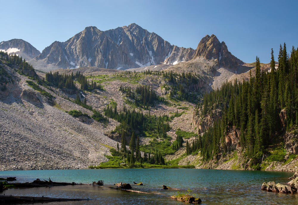
The trail then features a good bit of elevation gain as you make your way over Avalanche Pass. This section of trail is spectacular. You have nearly 360-degree views for a few consecutive miles. Take your time through this magnificent stretch! Pay close attention to the weather, because you are exposed for a decent stretch.
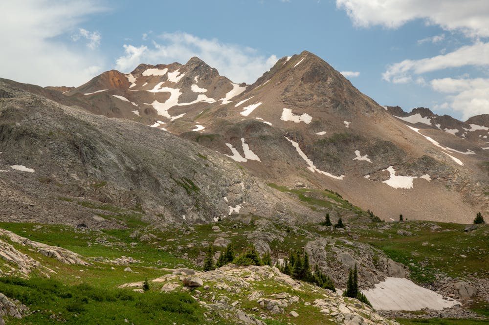
You will eventually reach the junction with the jeep trail. This dirt road has a steep decline in just a few miles. The dirt road features some of the highest concentrations of wildflowers found anywhere (depending on the time of year). The myriad of colors from the flowers is just astounding!
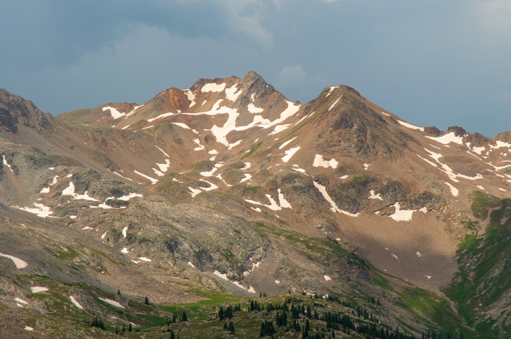
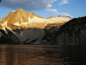
The last section of the route features one more climb up to Geneva Lake. You will eventually catch a glimpse of Maroon Peak in the distance, providing a sign of what's to come. Geneva Lake features numerous campsites, and the lake is located in a spectacular area. Night two of the circuit features another fantastic camping spot!
Difficult
Hiking trails where obstacles such as rocks or roots are prevalent. Some obstacles can require care to step over or around. At times, the trail can be worn and eroded. The grade of the trail is generally quite steep, and can often lead to strenuous hiking.

The trail contains some obstacles such as outcroppings and rock which could cause injury.

Little chance of being seen or helped in case of an accident.
7 km away
A strenuous but exhilarating day to conclude the beautiful Capitol Creek Circuit.
Difficult Hiking
7.1 km away
The final pass of the trip, and a long descent back to the trailhead.
Difficult Hiking
7.6 km away
Capitol Peak is infamously one of Colorado's most difficult yet most rewarding 14ers.
Extreme Hiking
7.6 km away
Day one of an epic circuit through the Maroon Bells
Difficult Hiking
7.8 km away
A shorter day on the circuit featuring a spectacular pass and two alpine lakes.
Difficult Hiking
8.5 km away
A two- or three-day mission to summit one of the most remote 14ers in Colorado, requiring snow travel and Class 3 scrambling with exposure.
Extreme Hiking

6 routes · Alpine Climbing · Hiking
3 routes · Hiking