89 m away
Four Pass Loop Day 3: Snowmass Lake to Maroon Lake
The final pass of the trip, and a long descent back to the trailhead.
Difficult Hiking
- Distance
- 14 km
- Ascent
- 549 m
- Descent
- 995 m
A strenuous but exhilarating day to conclude the beautiful Capitol Creek Circuit.
Hiking Difficult

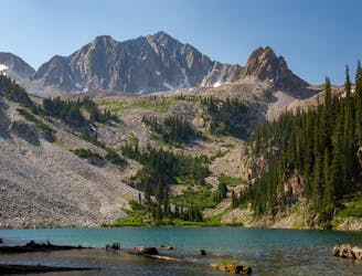
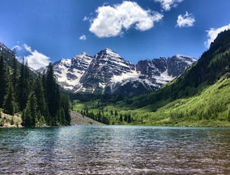
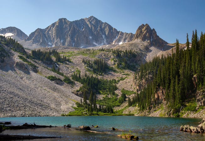
The final day on the Capitol Creek Circuit makes for a great one. It is tempting to just spend the morning relaxing at Snowmass Lake since it such a beautiful spot, but reaching the Capitol Creek trailhead requires over 17 miles of intense hiking.
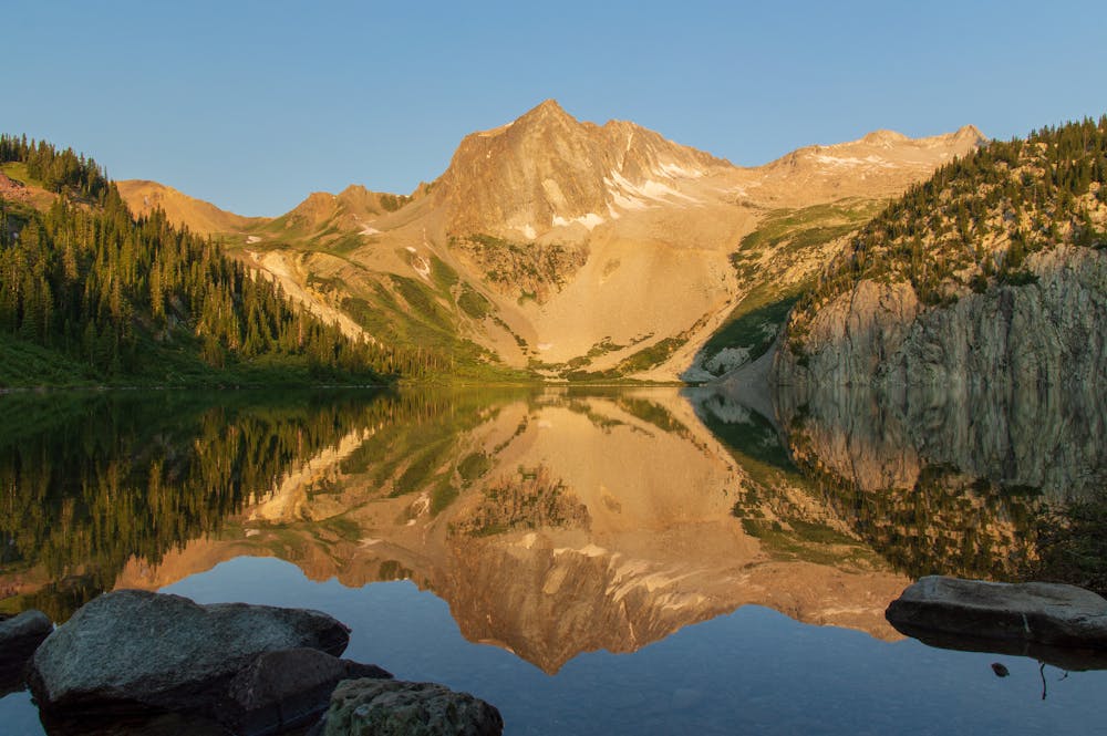
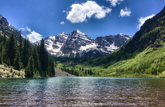
You could always stay at Snowmass Lake for an extra day and either day hike in the area or just relax by the lake. Either would be a good option given that this is one of the prettiest lakes you will ever come across.
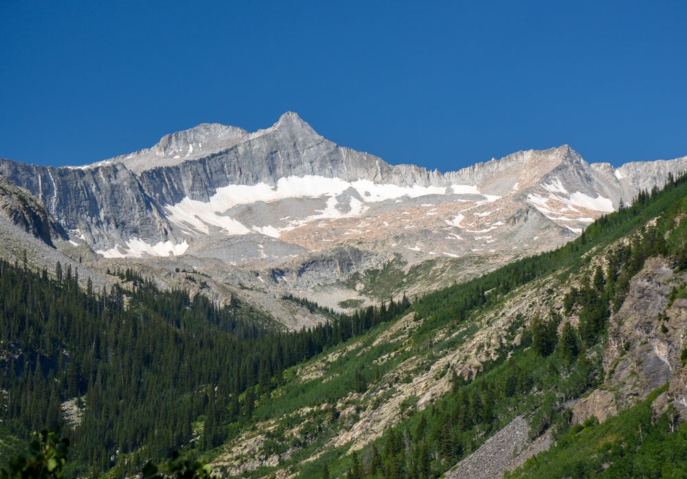
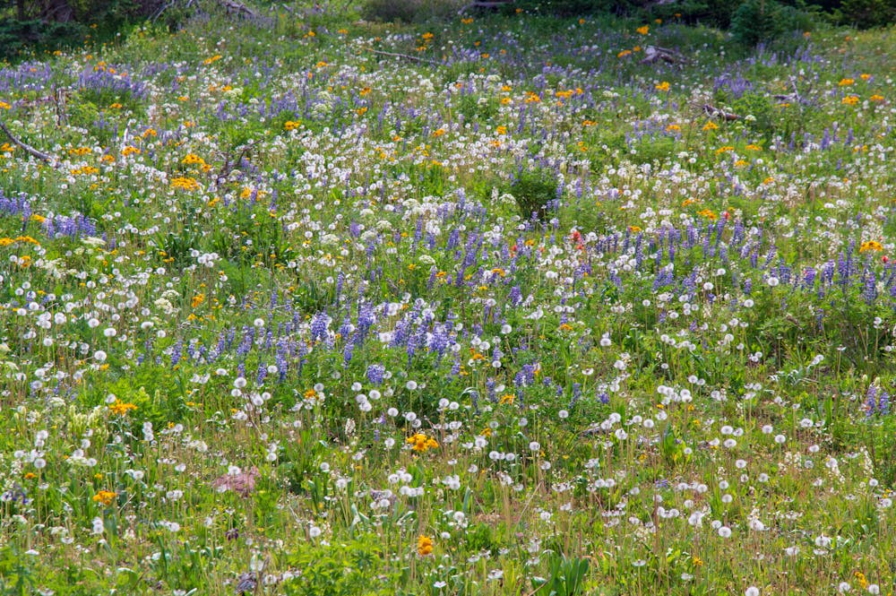
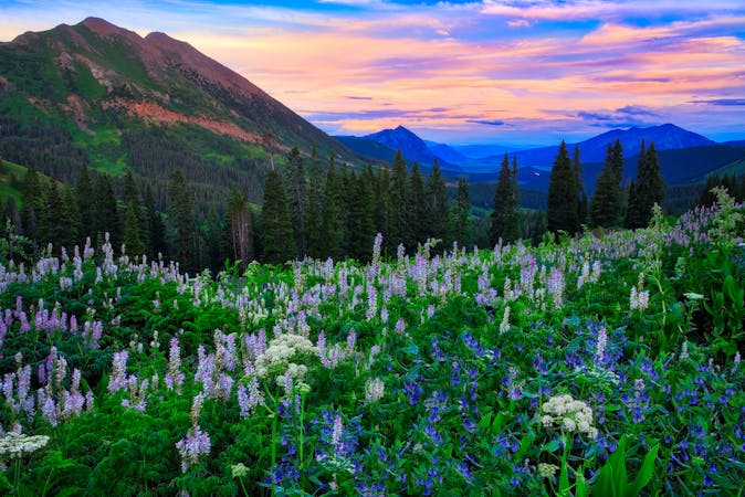
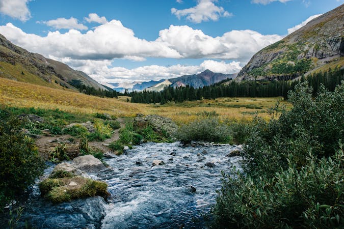
From the lake, the route takes the Maroon-Snowmass trail through the valley. It is pretty forested, but views of the surrounding peaks, such as Snowmass Mountain, still appear. Given that this section of trail is at a lower elevation than most of the circuit, you are treated to a few aspen forests along the way. Seeing aspen leaves flicker in the wind is a special sight. Picnicking by one of the aspen forests is not a bad idea, too.
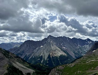
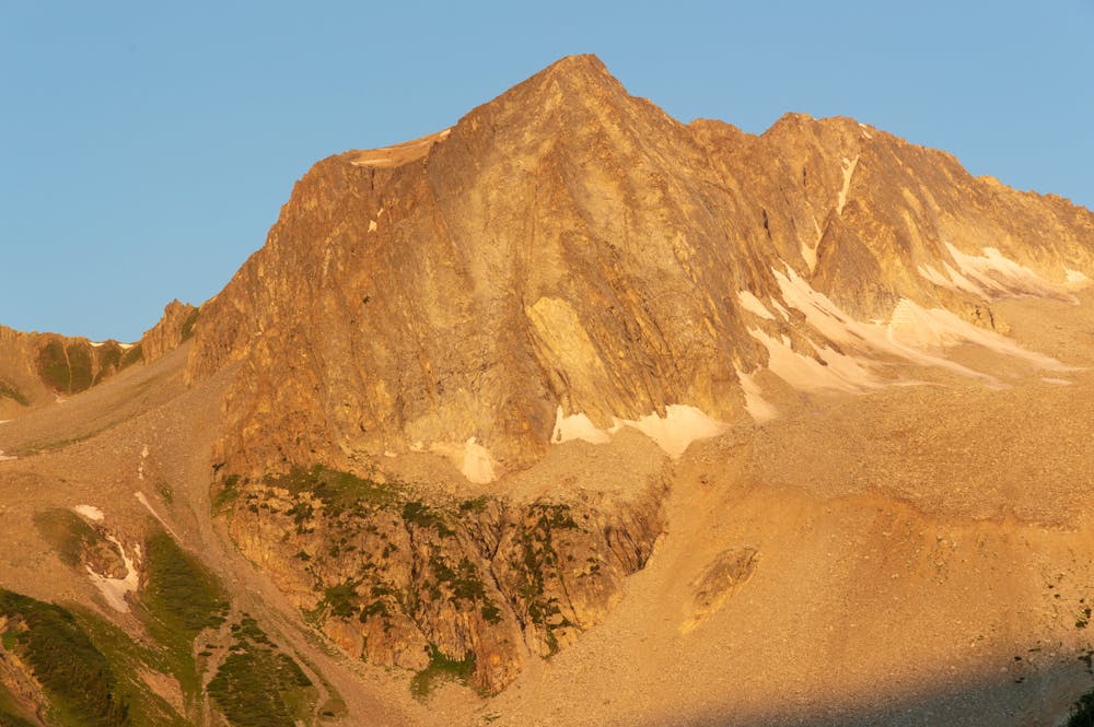
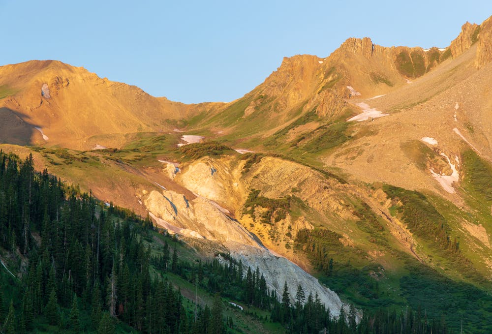
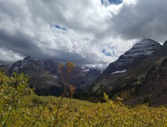
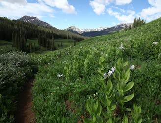
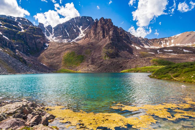
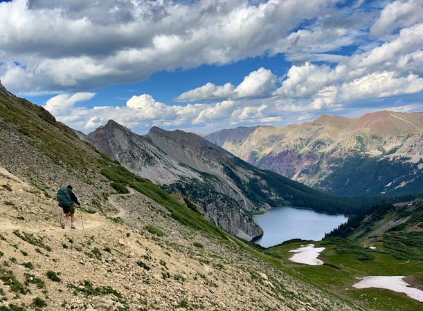
The elevation picks up again once on the West Snowmass trail. It is a long ascent to the final pass on the trail. Similar to the other passes, this one provides magnificent views and is a good spot to rest. It is exposed up there, so be mindful of the weather. Once ready, descend down until you eventually link back up with the Capitol Creek trail.
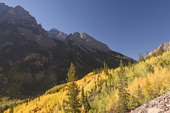
To shorten the route, you could camp somewhere below the pass, as there are a few spots. It is only a few more gentle miles from the pass to the finish, though. Once at the final junction there are two options: to take the Capitol Creek trail, which goes through the forest, or the Upper Ditch trail, which features a more open landscape and better views.
The Capitol Creek trailhead marks the end of this magnificent circuit. This is one of the top backpacking treks anywhere, and anyone who loves the outdoors (especially gnarly peaks and alpine lakes) will especially love this trek!
Difficult
Hiking trails where obstacles such as rocks or roots are prevalent. Some obstacles can require care to step over or around. At times, the trail can be worn and eroded. The grade of the trail is generally quite steep, and can often lead to strenuous hiking.

The trail contains some obstacles such as outcroppings and rock which could cause injury.

Little chance of being seen or helped in case of an accident.
89 m away
The final pass of the trip, and a long descent back to the trailhead.
Difficult Hiking
5 km away
A shorter day on the circuit featuring a spectacular pass and two alpine lakes.
Difficult Hiking
7 km away
A lengthy, spectacular day of hiking through the Rockies.
Difficult Hiking
8 km away
A long day of difficult hiking and rock scrambling to the top of Colorado's most photographed 14er.
Extreme Hiking
8 km away
A long day of steep, sustained hiking and scrambling up one of Colorado's most iconic mountains.
Extreme Hiking
8 km away
14,000-foot summit requiring huge elevation gain and steep scrambling with wild exposure.
Extreme Hiking
8 km away
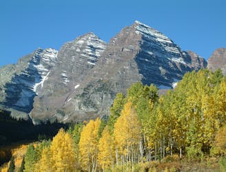
The quintessential Aspen hike, short mileage and big views of the infamous Maroon Bells.
Easy Hiking
8.1 km away
Walk between two of Colorado's favorite ski towns.
Moderate Hiking
8.1 km away
An epic day hike featuring multiple alpine passes and lakes.
Difficult Hiking
8.2 km away
A long grind up West Maroon Valley leads to the tallest pass of this 3-day trip.
Difficult Hiking

16 routes · Hiking
6 routes · Alpine Climbing · Hiking
16 routes · Hiking
3 routes · Hiking
3 routes · Mountain Biking · Hiking · Trail Running
5 routes · Alpine Climbing · Hiking
8 routes · Alpine Climbing · Hiking
3 routes · Hiking