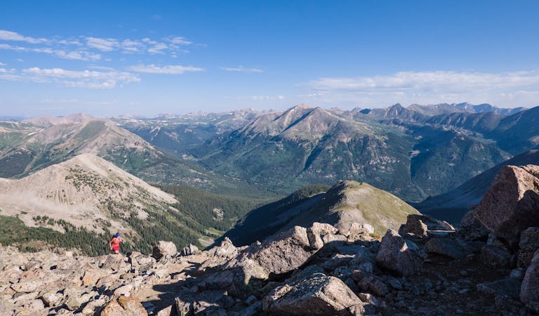
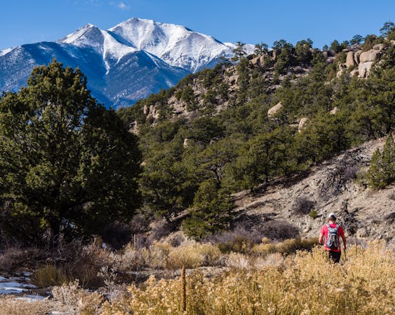
Four Pass Loop Day 1: Maroon Lake to East Fork Zone
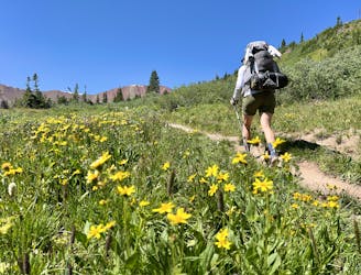
A long grind up West Maroon Valley leads to the tallest pass of this 3-day trip.
Difficult Hiking
- Distance
- 12 km
- Ascent
- 968 m
- Descent
- 292 m
The most famous backpacking loop in Colorado!
Hiking Difficult
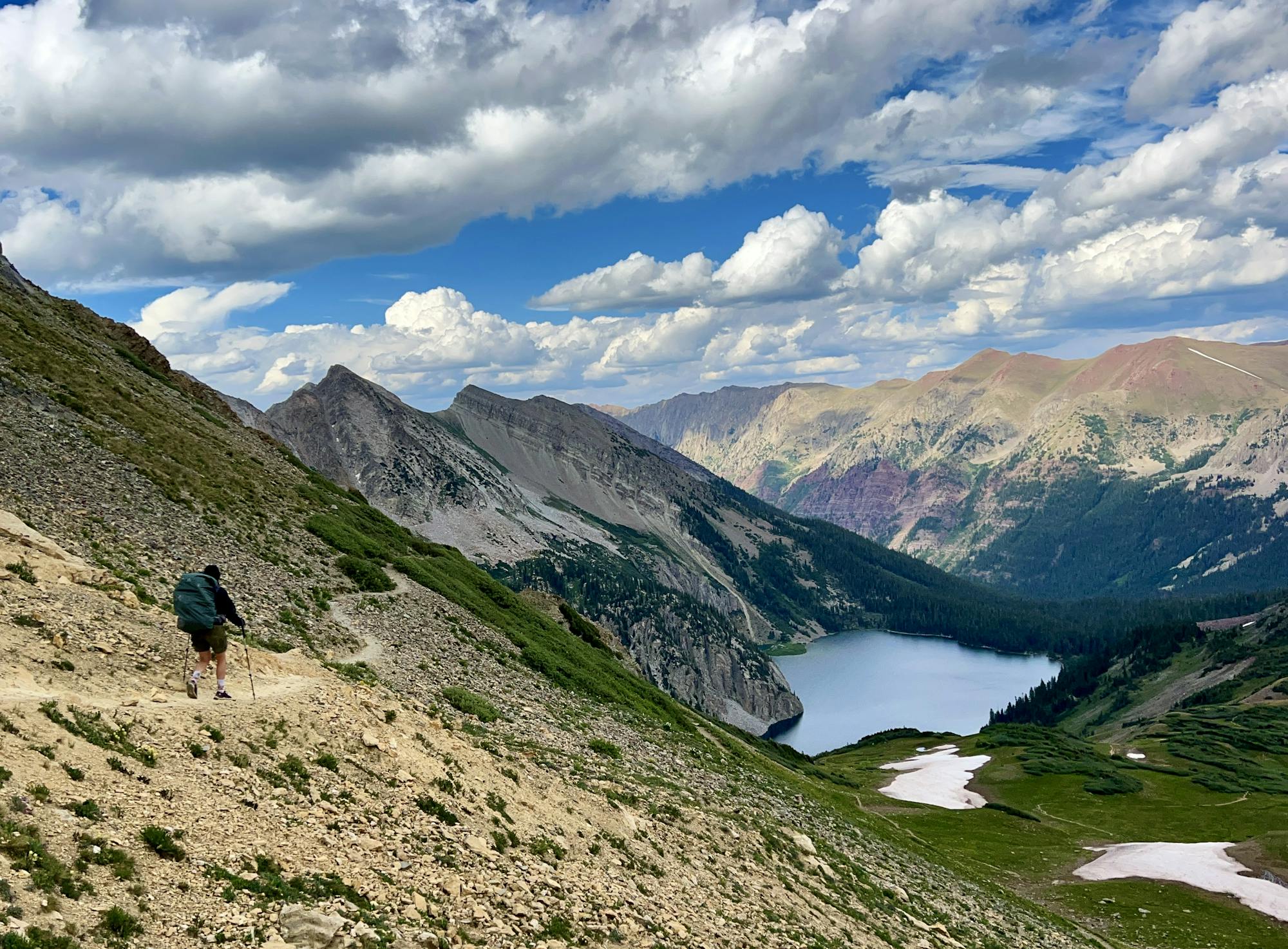
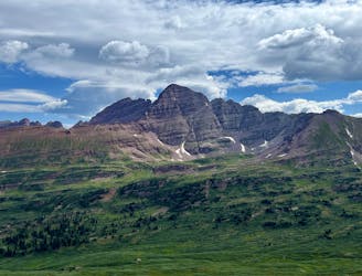
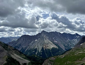
The Four Pass Loop is, far and away, the most famous backpacking loop in Colorado. It crosses four alpine passes (bet you'd never have guessed), all of which soar above 12,400 feet in elevation: West Maroon (~12,500ft), Frigid Air (~12,408ft), Trail Rider (~12,420ft), and Buckskin (~12,462ft). The spectacular ~27-mile loop circumnavigates some of Colorado's most famous mountains: the red-hued Maroon Bells near Aspen. These rugged, rocky 14ers form the center of the loop, with the iconic 14ers of Pyramid Peak and Snowmass Mountain taking up flanking positions on the southeast and northwest sides of the loop.
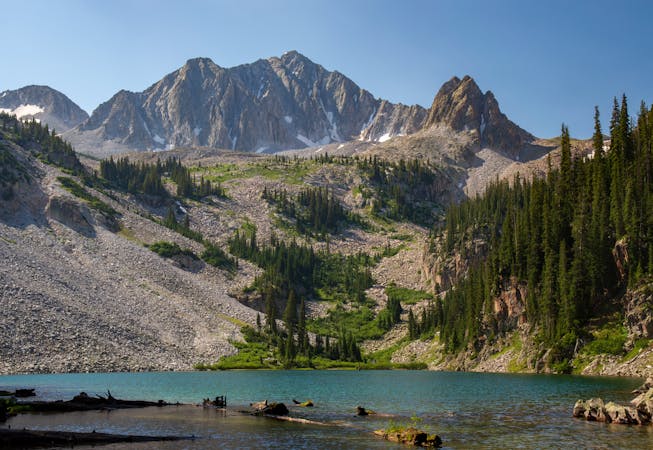
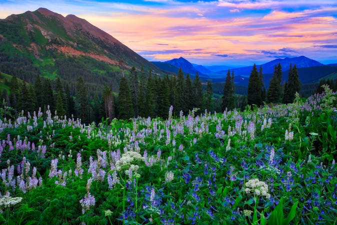
In addition to sky-scraping mountains and jagged ridgelines, crystal-clear alpine lakes such as Maroon, Crater, and Snowmass dot the loop, with a side trip to Geneva available for bonus miles. In between the iconic landmarks, backpackers will travel through gorgeous alpine meadows filled with wildflowers, windswept high alpine tundra, towering pine trees, and even pass one thundering waterfall.
While the hiking on the Four Pass Loop is generally non-technical and follows well-maintained and well-signed trails, this is still a backpacking trip in the high Rockies of Colorado. Travails to expect include, but are not limited to: deep stream crossings (especially early in the season), mud and rocks, steep climbs, slippery descents, snowdrifts early in the season, cold weather and fresh snow late in the season, afternoon thunderstorms in mid-summer, wildlife (such as bears), and more. Even though the Four Pass is ultra-famous, it's still a damn long ways from being easy!
Permit Information
Exactly which direction you choose to hike the loop and exactly how long your days will be depends entirely upon the permits that you pull for your various nights of camping in the wilderness. The new permit system requires visitors to book their backcountry camping sites and zones online, in advance. The wilderness has been subdivided into different camping units, and you can apply for permits for each camping zone. In ultra-popular areas such as Snowmass Lake and Crater Lake, you must camp in the specific numbered site corresponding to your reservation. In other zones, you simply must camp within the designated zone while following Leave No Trace principles.
The permits are released in batches. On February 15 at 8am Mountain Time, overnight permits for April 1-July 31 are released, and on June 15 at 8am, permits for August 1-November 30 are released. On October 15, overnight permits for December 1-March 31 are released... if you fancy some winter backcountry camping by chance.
As you get ready for the permits to drop, be sure to familiarize yourself with the camping zones map to help plan where you'd like to camp. As you get ready to book, be prepared to swap zones if your first choice is taken, or even reverse the direction of your hike if you don't find your choices are working out.
Permits for trips between May 1 and October 31 will cost $10 per person per night, with a $6 processing fee on Recreation.gov. These fees will be fed back into the area as crews work to rehabilitate resource damage in the Wilderness, improve trailhead amenities, and maintain the well-used trails.
Finally, if you plan to hike directly from the Maroon Lake trailhead (instead of taking the shuttle bus), you'll also need to book an additional parking reservation.
Itinerary
As mentioned above, exactly how long each day of your trip will be depends on the permits you can (or cannot) get. The three-day itinerary shown here follows the loop in a clockwise direction, with camping in the East Fork Zone for night one and camping at Snowmass Lake for night two. If you can't get permits for Snowmass Lake, you can most likely get a permit for the Upper Snowmass Zone, but it will make for a longer second day of the trip. You can always choose to reverse the direction of travel of this loop.
The route, as divided up here, logs 7.5 miles and 3,176 feet of climbing on day 1, 10.9 miles and 2,982 feet of climbing on day 2, and 8.4 miles and 1,801 feet of climbing on day 3. So, if you have to add additional mileage onto day 2 (due to Snowmass Lake's popularity), that will make for a very long day.
Bear Canister Required
Bear canisters are required in the Maroon Bells-Snowmass wilderness. Make sure to purchase one and bring it with you—there is no gear available at the trailhead.
A long grind up West Maroon Valley leads to the tallest pass of this 3-day trip.
Difficult Hiking
The toughest day of this 3-day itinerary, crossing two of the four alpine passes.
Difficult Hiking
The final pass of the trip, and a long descent back to the trailhead.
Difficult Hiking
10 routes · Alpine Climbing · Hiking

16 routes · Hiking
6 routes · Alpine Climbing · Hiking
6 routes · Hiking
8 routes · Hiking

7 routes · Alpine Climbing · Hiking
11 routes · Alpine Climbing · Hiking
16 routes · Hiking
6 routes · Hiking
7 routes · Hiking