0 m away
The Four Pass Loop
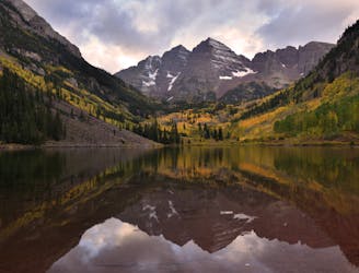
An epic backpacking route through Colorado's Elk Mountains.
Difficult Hiking
- Distance
- 43 km
- Ascent
- 2.4 km
- Descent
- 2.4 km
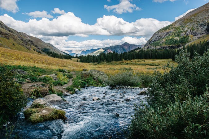
A long grind up West Maroon Valley leads to the tallest pass of this 3-day trip.
Hiking Difficult

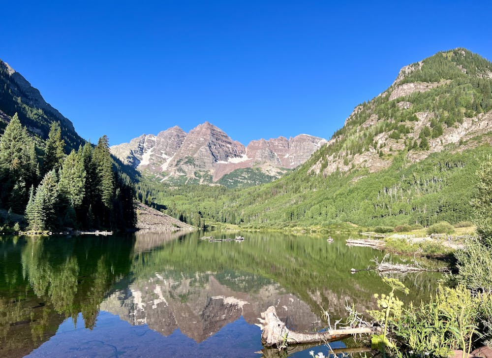
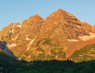
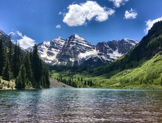
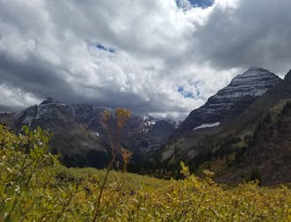
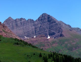
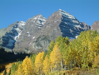
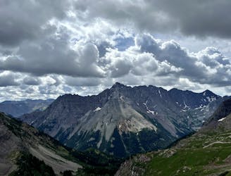
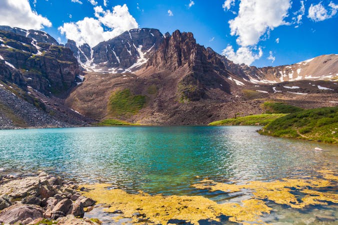
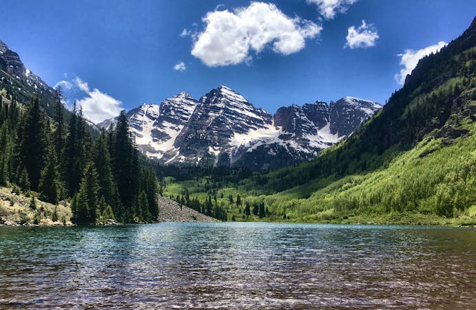
The Four Pass Loop is, far and away, the most famous backpacking loop in Colorado. It crosses four alpine passes (bet you'd never have guessed), all of which soar above 12,400 feet in elevation: West Maroon (~12,500ft), Frigid Air (~12,408ft), Trail Rider (~12,420ft), and Buckskin (~12,462ft). The spectacular ~27-mile loop circumnavigates some of Colorado's most famous mountains: the red-hued Maroon Bells near Aspen. These rugged, rocky 14ers form the center of the loop, with the iconic 14ers of Pyramid Peak and Snowmass Mountain taking up flanking positions on the southeast and northwest sides of the loop.
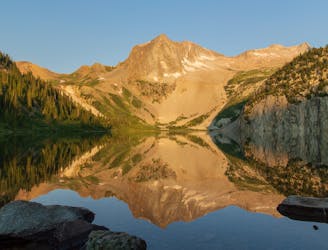
Exactly which direction you choose to hike the loop and exactly how long your days will be depends entirely upon the permits that you pull for the various nights of camping in the wilderness. The three-day itinerary shown here follows the loop in a clockwise direction, with camping in the East Fork Zone for night one and camping at Snowmass Lake for night two.
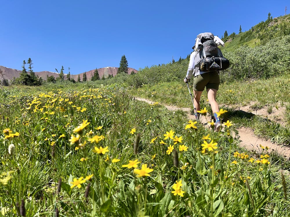
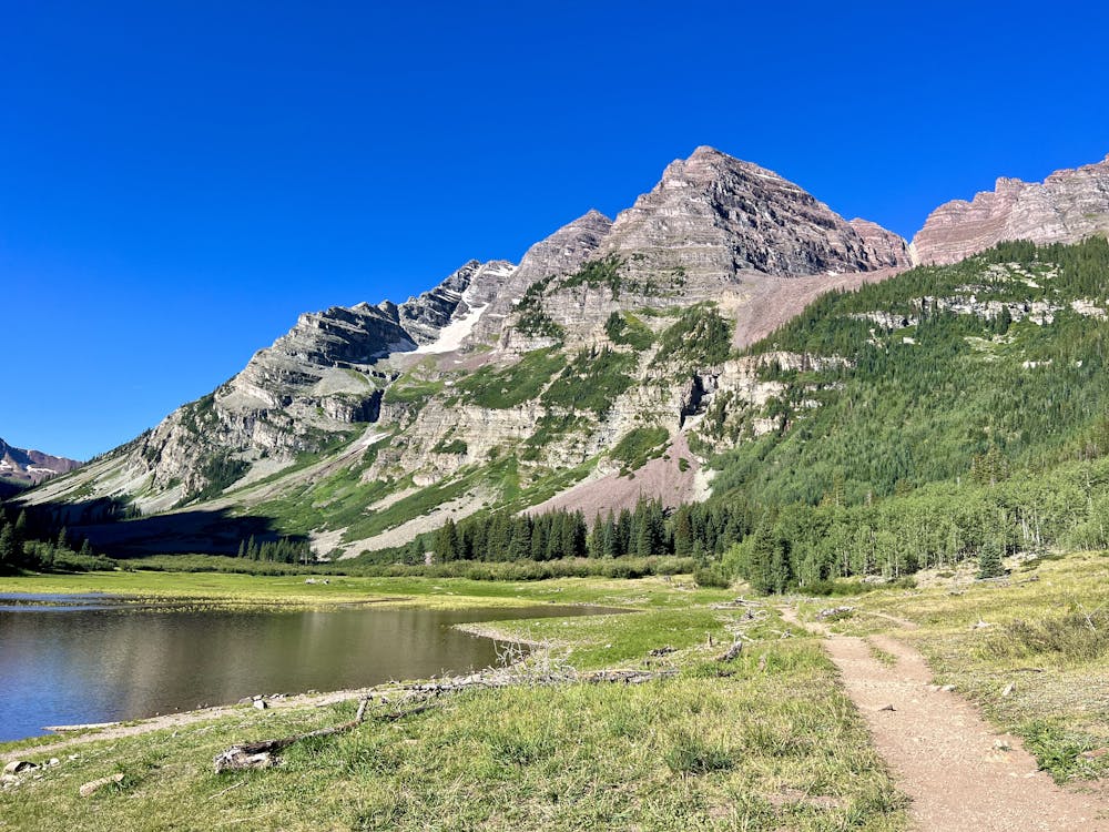
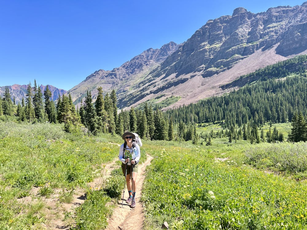
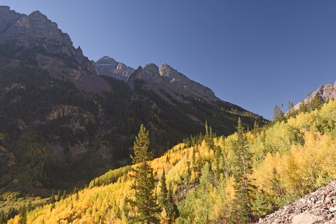
The hike begins from the Maroon Lake trailhead on a very popular section of trail that's well-used by day hikers heading to Crater Lake. If you get an early start, you can beat most of the Crater Lake traffic, quickly heading uphill on the West Maroon Trail. However, you'll still encounter a substantial amount of traffic from day hikers who are completing a point-to-point crossing of the Elks. So, this will be by far the busiest day of your backpacking trip.
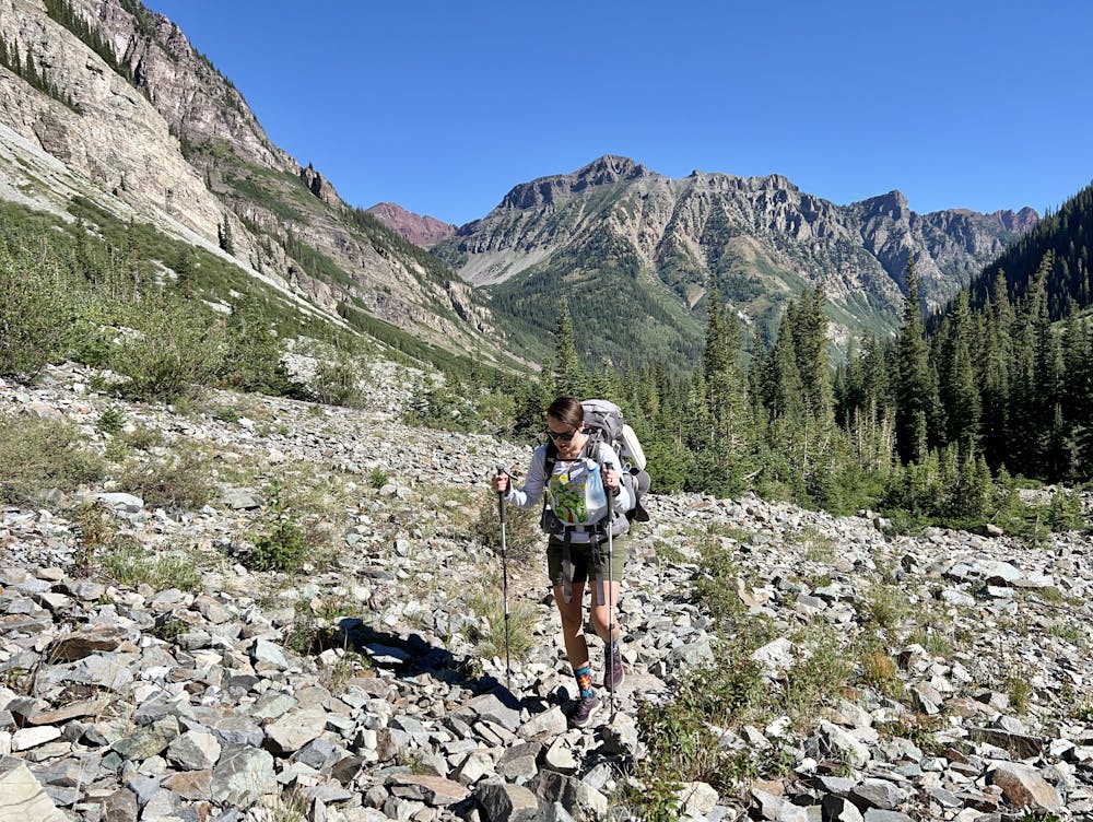
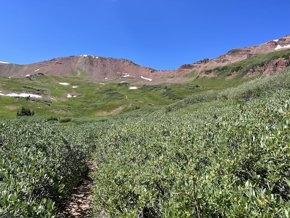
Day 1 also has the most climbing of any day in this itinerary. Since you're climbing from the low point at Maroon Lake (9,575 feet) to the top of the tallest pass at 12,500 feet, you'd better brace yourself for a long slog of a climb. Thankfully, since most of the climb follows the bottom of a winding valley, the grade is fairly reasonable most of the way, with the steepest section found at the very top.
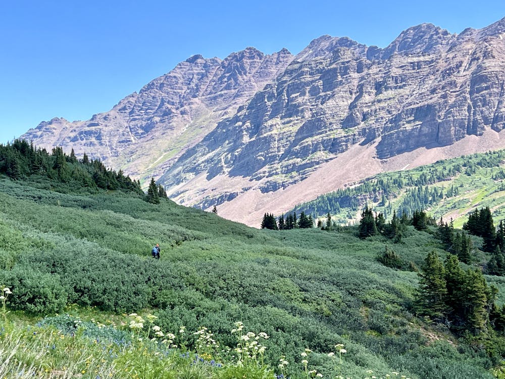
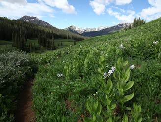
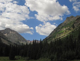
The trail through the West Maroon Valley is choked with willows growing over the trail. You'll find yourself walking through a narrow corridor cut from the willows for long stretches, often having to duck beneath the branches. This reduces the views for much of the hike until you finally break out into the high alpine meadows and can breathe a sigh of relief. Also, several substantial stream crossings in the lower sections can be sketchy early in the season.
Thanks to the moderate grade of this stretch of trail, the trail tread is generally non-technical, aside from the typical rocks, roots, and slippery dirt. The trickiest portions are likely the stream crossings when the water is high.
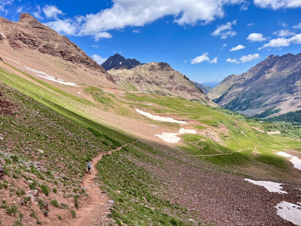
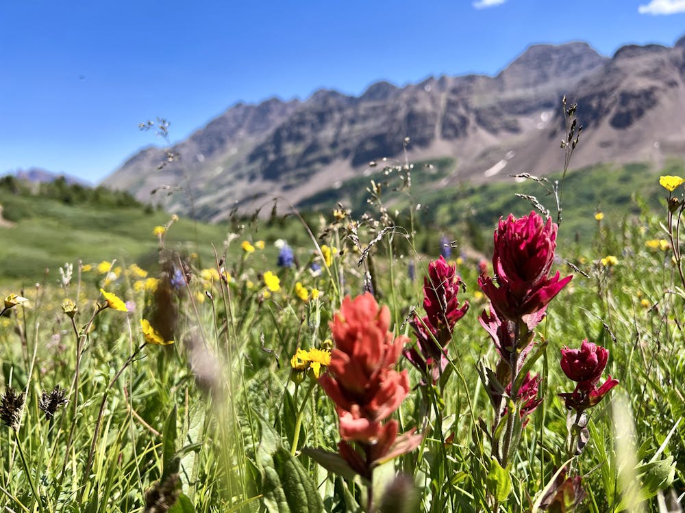
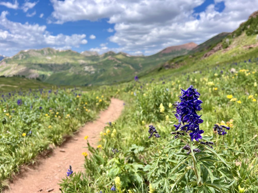
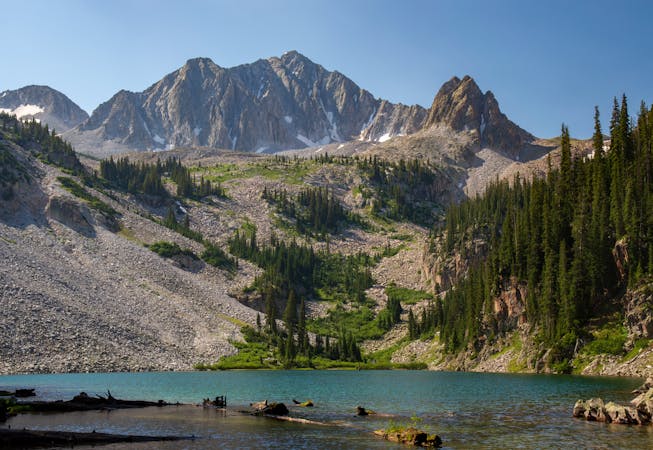
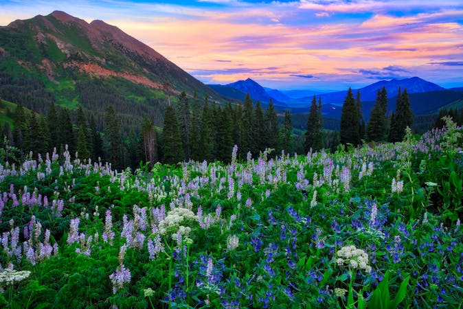
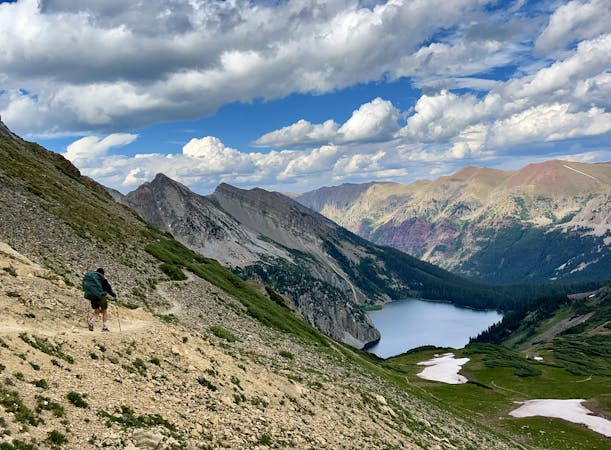
After crossing the majestic top of West Maroon Pass, the descent into the East Fork Zone is substantially steeper than the trail that preceded it, foreshadowing what's to come on Day 2 of the trip. While the East Fork zone might be the shortest of all the zones on the trip, it is home to the most beautiful wildflowers of all! There's just something in the air (and the soil?) around Crested Butte, the wildflower capital of Colorado—this is the section of the hike that's closest to CB.
At the trail junction with the North Fork Crystal River Trail, take a hard left turn, hike down into the meadow, and cross a stream to find the best campsites in the East Fork Zone. And, of course, if you don't have camping permits in this zone, keep on hiking.
Difficult
Hiking trails where obstacles such as rocks or roots are prevalent. Some obstacles can require care to step over or around. At times, the trail can be worn and eroded. The grade of the trail is generally quite steep, and can often lead to strenuous hiking.

The path is on completely flat land and potential injury is limited to falling over.

Little chance of being seen or helped in case of an accident.
0 m away
An epic backpacking route through Colorado's Elk Mountains.
Difficult Hiking
181 m away
An epic day hike featuring multiple alpine passes and lakes.
Difficult Hiking
211 m away
Walk between two of Colorado's favorite ski towns.
Moderate Hiking
215 m away
The quintessential Aspen hike, short mileage and big views of the infamous Maroon Bells.
Easy Hiking
215 m away
14,000-foot summit requiring huge elevation gain and steep scrambling with wild exposure.
Extreme Hiking
215 m away
A long day of steep, sustained hiking and scrambling up one of Colorado's most iconic mountains.
Extreme Hiking
281 m away
A long day of difficult hiking and rock scrambling to the top of Colorado's most photographed 14er.
Extreme Hiking
7.4 km away
Colorado's most popular hot springs hike.
Moderate Hiking
8.2 km away
The final pass of the trip, and a long descent back to the trailhead.
Difficult Hiking
8.2 km away
A strenuous but exhilarating day to conclude the beautiful Capitol Creek Circuit.
Difficult Hiking

16 routes · Hiking
6 routes · Alpine Climbing · Hiking
16 routes · Hiking
3 routes · Hiking
3 routes · Mountain Biking · Hiking · Trail Running
5 routes · Alpine Climbing · Hiking
8 routes · Alpine Climbing · Hiking
3 routes · Hiking