4.9 km away
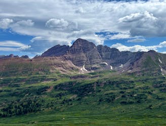
Four Pass Loop Day 3: Snowmass Lake to Maroon Lake
The final pass of the trip, and a long descent back to the trailhead.
Difficult Hiking
- Distance
- 14 km
- Ascent
- 549 m
- Descent
- 995 m
A shorter day on the circuit featuring a spectacular pass and two alpine lakes.
Hiking Difficult

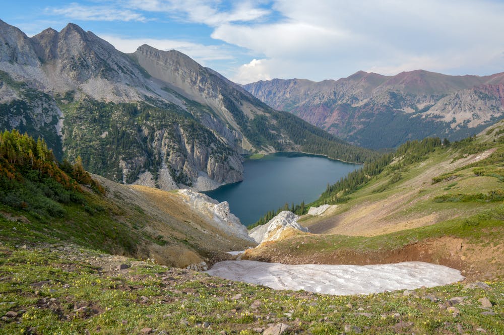
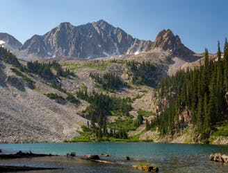
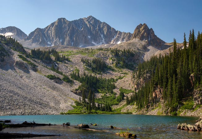
The Capitol Creek Circuit keeps living up to the hype with another spectacular section of trail. This segment of the route features Geneva Lake, Trail Rider Pass, and concludes with Snowmass Lake—one of the prettiest alpine lakes in the country!
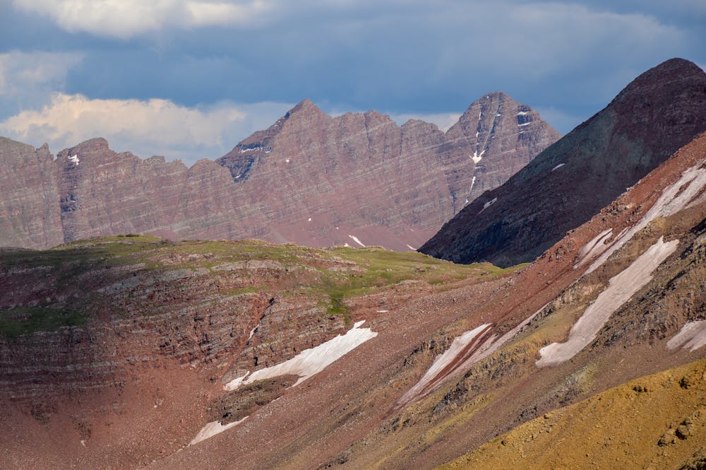
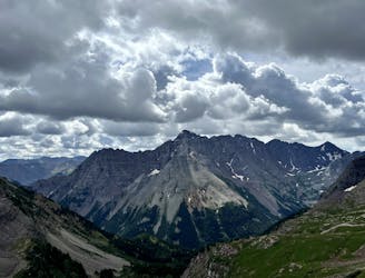
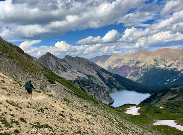
The route is essentially all uphill from Geneva Lake to Trail Rider Pass. You descend into the forest following Geneva Lake, but views can still be found. The ascent to Trail Rider Pass is simply awesome! Once below the pass, you can clearly see it, as well as several switchbacks you will soon face. The wonder of what lies at the pass lures you in.
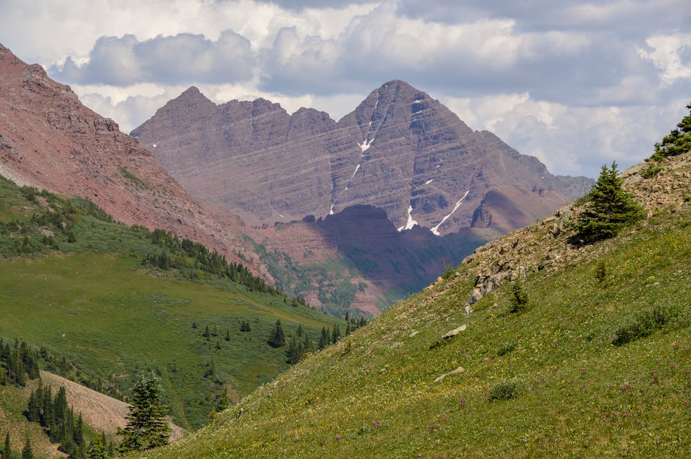
Traverse the switchbacks at your own pace, as it can be easy to tire yourself out. Trail Rider pass is incredible—it provides spectacular views of the surrounding peaks. Maroon Peak and Snowmass Lake loom in the distance. Spend some quality time up here if the weather is good, as there are a few spots to shield yourself from the wind.
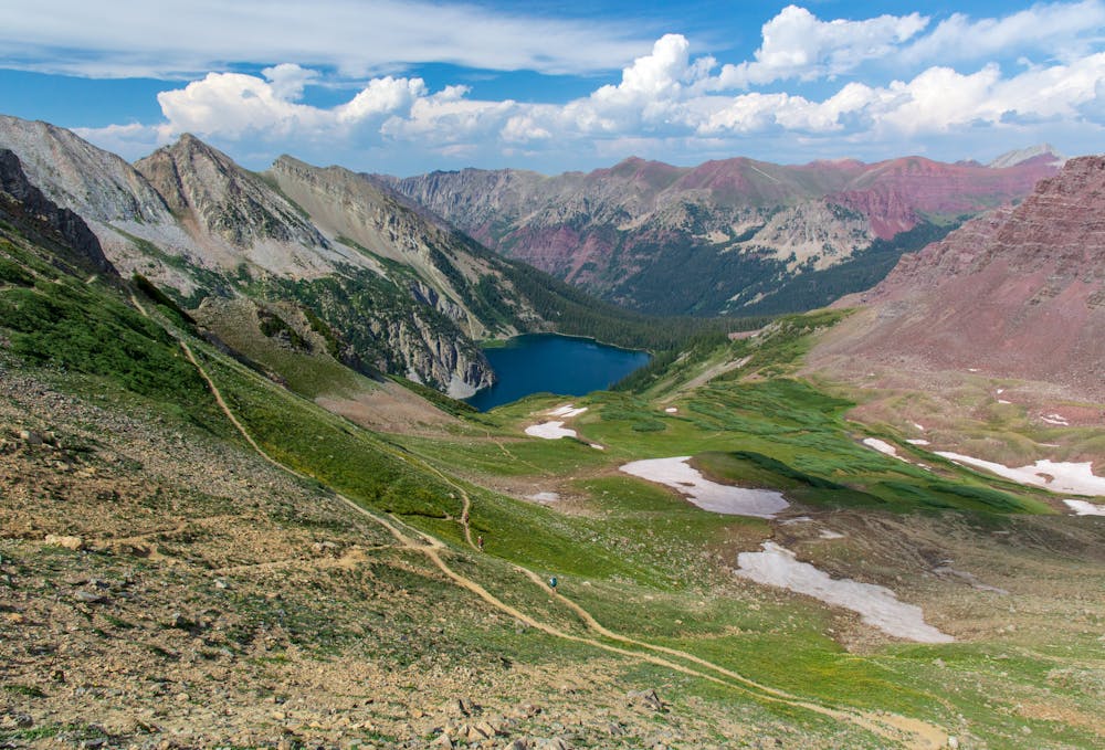
From Trail Rider, it is all downhill to Snowmass Lake. There is still some mileage to cover, but the destination of the lake entices you to push forward. One plus is that the trail is mostly open, so you still are provided with impressive views on the descent.
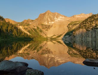
Once at Snowmass Lake, choose your site wisely. There are a few sites at the lake, but this is a popular spot. If you can secure a spot right near the lake, take advantage and lock it in. This lake is spectacular, as Hagerman Peak and Snowmass Mountain loom right behind.
The sunrise at this lake was one of the most epic sunrises I have ever witnessed, so make sure to not depart camp too early! Lastly, if one wants to climb a nearby 14er, Snowmass Mountain is a popular choice. Be careful, though, as this is a difficult peak to climb.
Difficult
Hiking trails where obstacles such as rocks or roots are prevalent. Some obstacles can require care to step over or around. At times, the trail can be worn and eroded. The grade of the trail is generally quite steep, and can often lead to strenuous hiking.

The trail contains some obstacles such as outcroppings and rock which could cause injury.

Little chance of being seen or helped in case of an accident.
4.9 km away
The final pass of the trip, and a long descent back to the trailhead.
Difficult Hiking
5 km away
A strenuous but exhilarating day to conclude the beautiful Capitol Creek Circuit.
Difficult Hiking
7.8 km away
A lengthy, spectacular day of hiking through the Rockies.
Difficult Hiking
8.9 km away
The toughest day of this 3-day itinerary, crossing two of the four alpine passes.
Difficult Hiking
6 routes · Alpine Climbing · Hiking
3 routes · Hiking