7.5 km away
Grays and Torreys Peaks
Summit two 14,000-foot peaks in one big hike.
Severe Hiking
- Distance
- 13 km
- Ascent
- 1.1 km
- Descent
- 1.1 km
A diverse segment of the CDT traversing alpine and sub-alpine singletrack connecting Interstate 70 to Grand Lake, the gateway to the Rocky Mountains NP.
Hiking Difficult

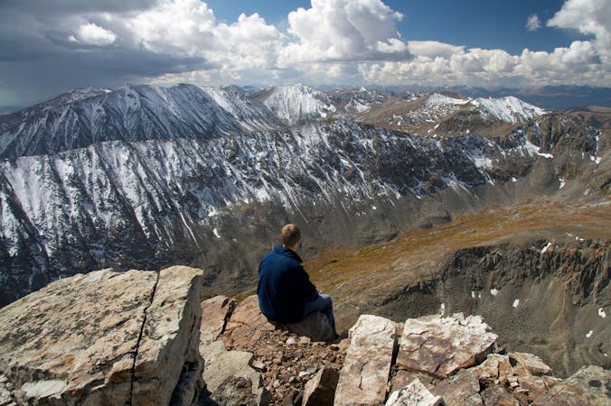
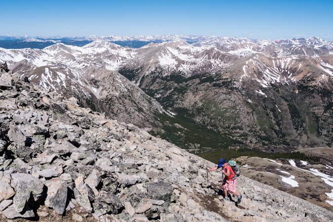
This portion of the CDT begins at the Herman Gulch Trailhead at an exit on Interstate 70. Overnight parking, plus space for larger vehicles and/or trailers is available, and several noteworthy cities, including Breckenridge, Frisco, Silverthorne, and Georgetown, are just a short drive away. If you're visiting the area and hoping to summit some of the nearby 14ers, this guidebook published by Greg Heil rounds up some of the best ones in the area - which also includes some of the more attainable 14,000' peaks in the state.
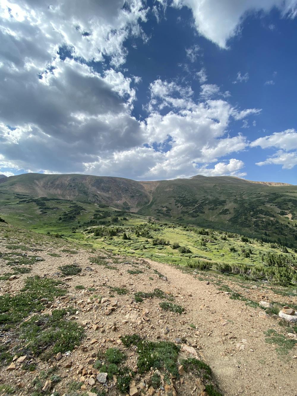
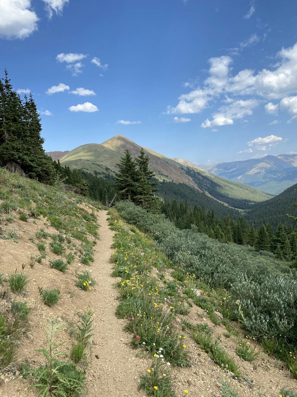
Heading north from the parking area, the trail follows the Herman Gulch Trail through a forested river drainage shrouded with aspen and pine, though spruce and fir also blanket many of the nearby mountain slopes. A quick spur over to Herman Lake comes about 2.5-miles from the trailhead, making an excellent option for a day hike. The CDT Water Report also notes plenty of water alongside the trail, though there may be stretches upwards of 10 to 15 miles at a time where options are limited. Make sure you fill up at Herman Gulch before you continue north.
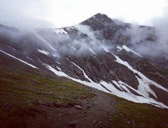
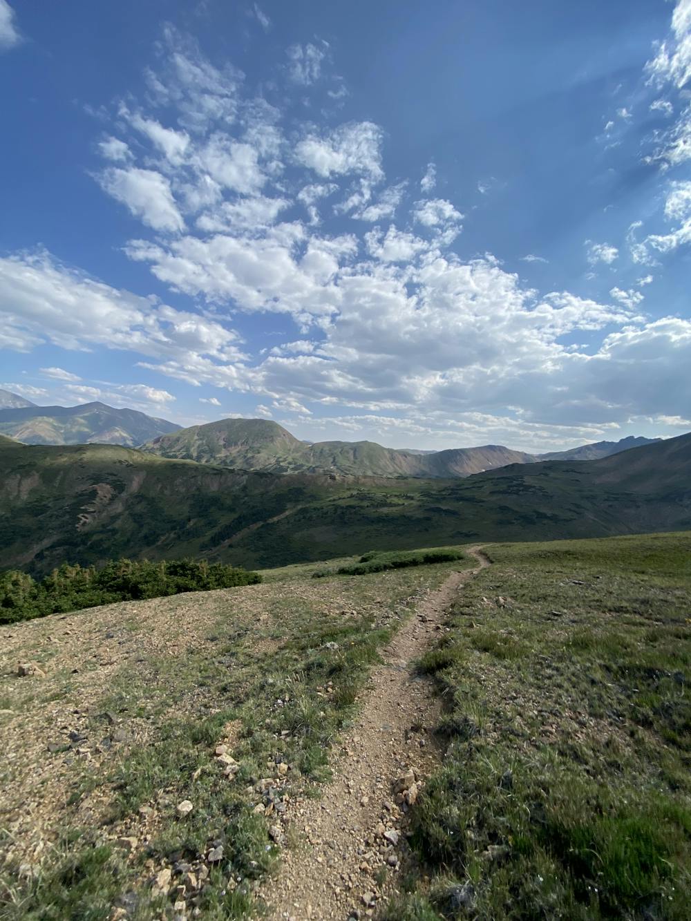
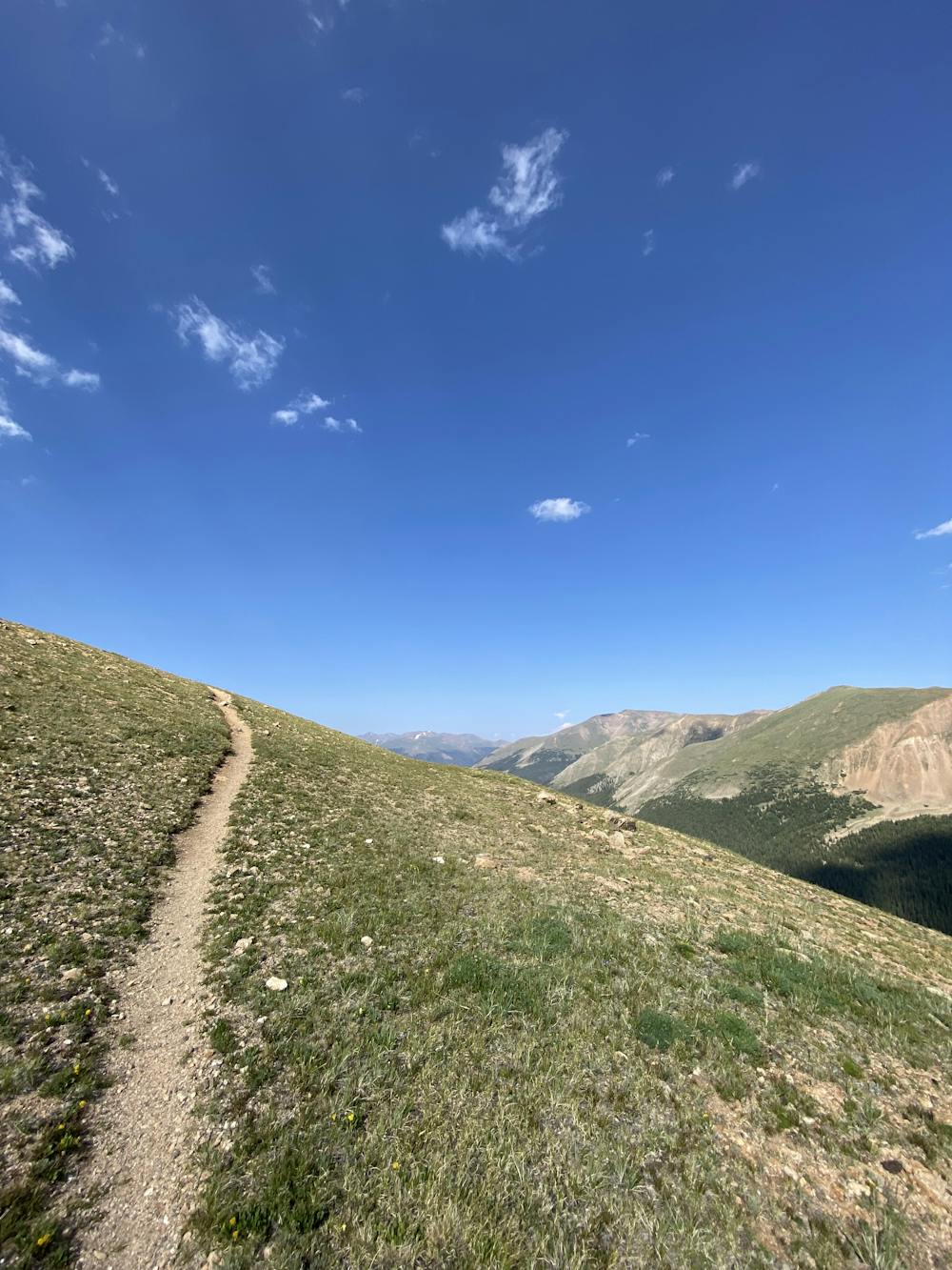
The CDT continues by following a narrow, high mountain ridgeline well-above tree line, then skirts the Vasquez Peak Wilderness Area before arriving at Berthound Pass on US-40. Blanketed with stands of spruce and fir trees, the high mountain peaks are loaded with views and plenty of options for day hiking if the CDT doesn't offer what you're looking for. The trailhead, named after the road's founder and engineer, hosts parking for at least 50 vehicles, including larger vehicles, RV's or campers. No facilities are immediately available, however.
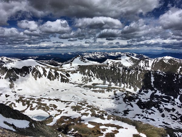
Leaving Berthound Pass, the CDT wanders eastward to Saint Marys, where you could also pick up the trail at Rainbow Road. The next several miles offer high exposure as you traverse through alpine terrain and the James Peak Wilderness Area. Named for the late Edwin James, an American physician and botanist who surveyed the area in the early 1800's, the mountains host numerous lakes, plus alpine, sub-alpine, and upper montane ecosystems. It's both diverse and visually stunning every step of the way.
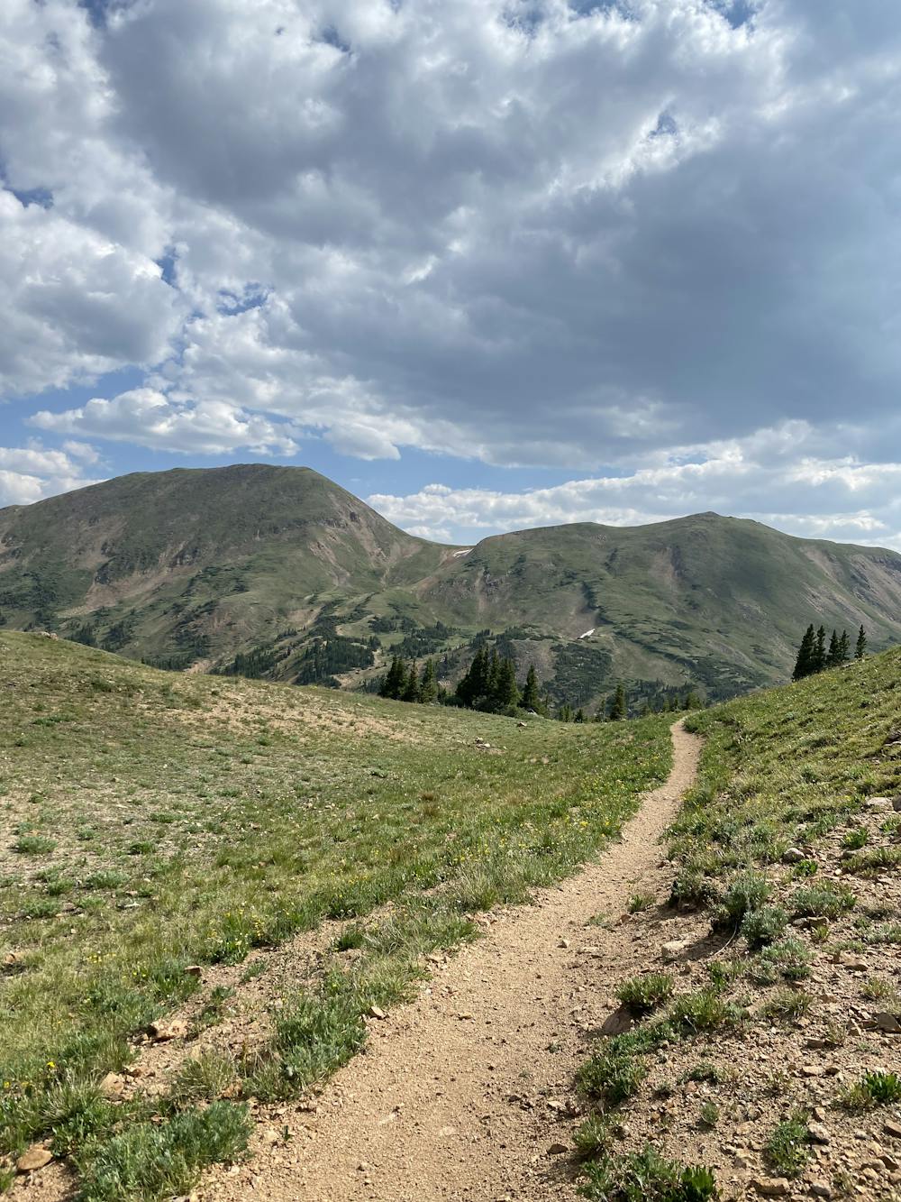
After spurring west and away from the southern approach to Mount Jasper, the trail dips back below the timberline and runs along the western slopes of the Indian Peaks Wilderness Area. Known for its hiking, backpacking, fishing, and wildlife, the Forest Service lists over two-dozen trails exploring various parts of the range, including this route to Jasper and Devils Thumb Lakes. Jesse Weber describes as an excellent day hike or overnight trip in the area, but before you hit the trail, check here to see if your planned adventure requires any permits.
After skirting the eastern shores of Lake Granby, this portion of the CDT ends at the Tonahutu Trailhead just moments outside of Grand Lake. As an official trail town and gateway to the Rocky Mountain NP, "the town boasts amazing access to a variety of year-round outdoor recreation opportunities, and has been dubbed the “Snowmobile Capital of Colorado” due to its access to Colorado’s largest network of groomed snowmobile trails," the CDT Coalition notes. It's also considered an excellent jump-off point for those planning a longer CDT adventure, or a key resupply point for those simply passing through.
Sources: https://continentaldividetrail.org/ https://www.fs.usda.gov/recarea/arp/recarea/?recid=80809 https://www.fs.usda.gov/recarea/arp/recarea/?recid=80804 https://continentaldividetrail.org/cdt-gateway-communities/grand-lake/
Difficult
Hiking trails where obstacles such as rocks or roots are prevalent. Some obstacles can require care to step over or around. At times, the trail can be worn and eroded. The grade of the trail is generally quite steep, and can often lead to strenuous hiking.

The trail contains some obstacles such as outcroppings and rock which could cause injury.

Little chance of being seen or helped in case of an accident.
7.5 km away
Summit two 14,000-foot peaks in one big hike.
Severe Hiking
5 routes · Alpine Climbing · Hiking
5 routes · Alpine Climbing · Hiking
3 routes · Hiking
6 routes · Alpine Climbing · Hiking

46 routes · Alpine Climbing · Hiking

10 routes · Hiking

40 routes · Hiking