3.8 km away
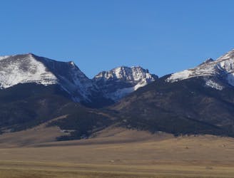
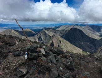
Humboldt Peak
One of the least technical peaks in the Sangres.
Severe Hiking
- Distance
- 20 km
- Ascent
- 1.3 km
- Descent
- 1.3 km
from South Colony Lakes. Class 3. 5,700'/14mi (Upper TH) or 6,850'/20mi (Lower TH)
Hiking Severe

Imported from 14ers.com. Photos and route description available for offline download using the 14ers app.
Trailhead:
Take Colorado 69 south from Westcliffe. Drive 4.5 miles and turn right on Colfax Lane. Drive 5.5 miles to the end of Colfax. Turn right and drive 1 mile on a dirt road to a junction. Continue straight up the 120 Road for 0.3 mile to the Lower 2WD Trailhead at 8,800'. To reach the Upper 4WD Trailhead, continue 2.7 miles to parking/camp spots before the first river crossing, near 9,950'. In 2009, the South Colony Lakes road was permanently closed here (gate) and this is the current trailhead. The trail starts next to the trailhead kiosk, in the parking area.
Route:
From the gate closure at 9,900', cross the foot bridge and walk 2.5 miles up the South Colony Lakes (Approach) road to reach a junction - 1. Turn left, cross the river on a log bridge and reach what used to be the 4WD trailhead, before they closed the upper road. Continue past a gate ( 2) and walk 3/4 mile to 11,400' where the old road ends and smaller trail begins. Hike through the bushes and into the trees - 3. Follow the trail as it turns left above 11,600' and parallels the stream below the lower South Colony Lake. Near 11,650' and before the lake, turn left on the trail towards Broken Hand Pass - 4. Follow the mostly-defined trail as it climbs south up the slope before turning west into rugged terrain, below Broken Hand Pass - 5. Ascend steep terrain to reach a narrow section (Class 3) with few options - 6. Scramble up through the rocks and hike another 200' to reach the pass , near 12,900'.
On the west side of the pass ( 7), follow a trail down the steep slope and west to Cottonwood Lake - 8, 9 and 10. Pass the lake and continue west below Crestone Needle's southwest ridge. After you pass the end/base of this ridge, the view opens up and you can see Crestone Peak up to the right (north). Follow the small trail as it curves right and heads toward Crestone Peak's south face. 11 shows the prominent red gully in the middle of the south face and 12 is a broader view which shows the general route into the gully.
Follow the trail northeast as it climbs into the basin to the right of the base of the gully. You do not have to enter the base of the gully. As seen in 12 and 13, bypass steep rock at the base of the gully by following a small trail to about 12,700'. Turn left and follow cairns up onto the easy rock just east of the gully. 14 looks back toward Crestone Needle and 15 is the view back over the approach. After a short climb west across the rocks, reach the Red Gully - 16. Without snow, the rock is stained red from top to bottom. In summer, the lower half will likely have some water running down the center.
Climb directly up the gully by following the red rock - 17. The Class 3 climbing is not too difficult but there are a few steep pitches, especially if you have to climb around snow in the center. Some of the gully is steep "hiking" on smooth rock. Follow the best rock by occasionally switching from one side of the gully to the other. There are steep sections between 13,000' and 13,500' and then again between 13,750' and the notch at the top of the gully. 18 was taken near 13,600', 19 and 20 show the upper portions of the gully and the steep section below the notch. Above 14,100', reach the (notch ) at the top of the gully - 21 and 22. Turn left and scramble up on conglomerate-rock ledges - 23, 24 and 25. The summit is a short distance away but it's good to take your time and find the best route up through this semi-exposed area. Depending on your climbing skills, you may find this final pitch to be more difficult than the gully. After the short scramble from the notch, reach The Peak's rugged summit - 26 and 27.
Notes:
The route finding is relatively easy and the Class 3 scrambling is on mostly stable rock. Overall, this route is longer than the standard Crestone Needle route but the climbing is easier and there is less exposure. IMPORTANT: This route enters the Sangre De Cristo Wilderness area. Wilderness areas have special regulations and restrictions for party size, dispersed camping, campfires, etc. Also, dog owners should read the wilderness information carefully because some wilderness areas prohibit dogs to be off-leash and/or limit how close dogs can be to lakes and streams. If you have questions about the wilderness area, please contact a U.S. Forest Service office for the National Forest(s) listed above.
Severe
Hiking challenging trails where simple scrambling, with the occasional use of the hands, is a distinct possibility. The trails are often filled with all manner of obstacles both small and large, and the hills are very steep. Obstacles and challenges are often unexpected and can be unpredictable.

Some trail sections have exposed ledges or steep ascents/descents where falling could cause serious injury.

Away from help but easily accessed.
3.8 km away
One of the least technical peaks in the Sangres.
Severe Hiking
6.8 km away
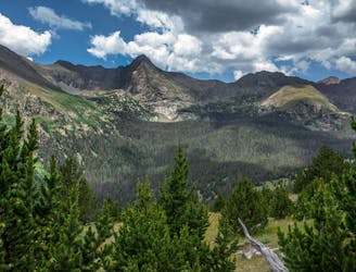
Two seldom-seen alpine lakes, high in the Sangre de Cristo Wilderness.
Difficult Hiking
6.8 km away
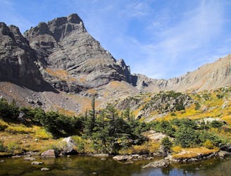
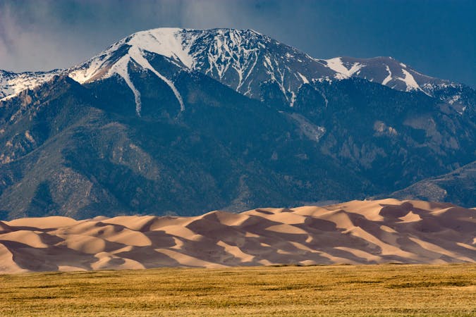
Alpine hike to a Sangre de Cristo 13er, within Great Sand Dunes National Park and Preserve.
Extreme Hiking
9.2 km away
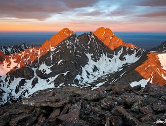
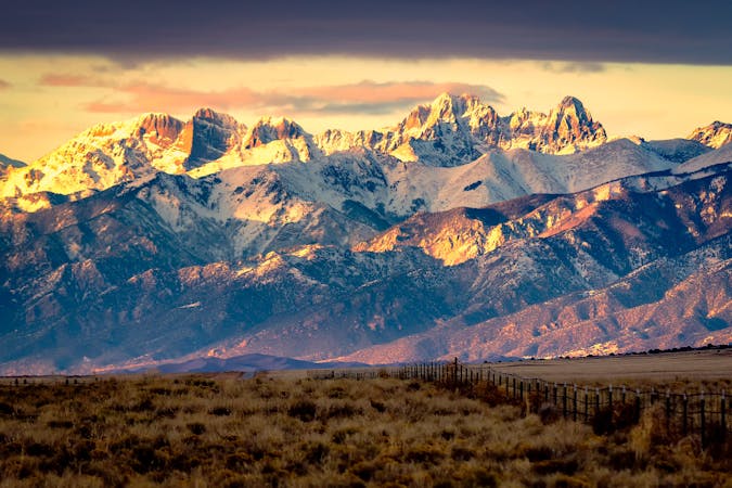
One of the most aesthetic and challenging Colorado 14ers.
Extreme Hiking
9.2 km away
Climb one of the most beautiful and most challenging of Colorado's 14ers
Extreme Hiking
10 routes · Alpine Climbing · Hiking

46 routes · Alpine Climbing · Hiking
7 routes · Alpine Climbing · Hiking