1 m away
Lake Ann
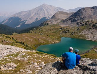
A gorgeous hike to a breathtaking alpine lake and pass.
Moderate Hiking
- Distance
- 11 km
- Ascent
- 458 m
- Descent
- 458 m
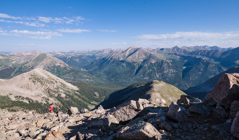
Second lowest in stature, 14,003' Huron Peak is second-to-none in sheer beauty.
Hiking Severe

Huron Peak's Northwest Slopes route is considered the standard choice to summit this lovely 14er tucked back into the Sawatch Range. Starting at the South Winfield 4x4 trailhead, the hike is about 6.5 miles, roundtrip. Sans a capable high-clearance vehicle, add 2 miles to each end for a 10.75 mile roundtrip excursion.
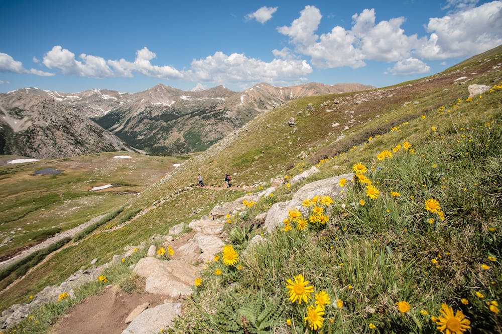

The majority of this superb 14er hike travels an easy-to-follow Colorado Fourteeners Initiative (CFI) built trail. CFI trails are designed and built to be solid and erosion resistant in order to withstand the many footsteps of eager 14er hikers. Think rock-steps on steep segments, rather than rutted, loose scree.
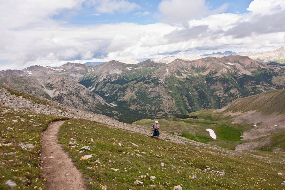
As the route switchbacks up a half-mile through the woods, stop to enjoy views as they appear. Once the trail breaks out of the trees, it will emerge in a gorgeous alpine basin. This is a great place to rest for a few minutes, enjoy a snack, and soak in the scenery before the ascent up Huron's northwest slope. Listen for the whistling call of pika and marmots; there are many in the basin.
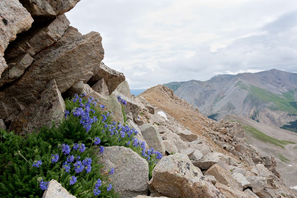
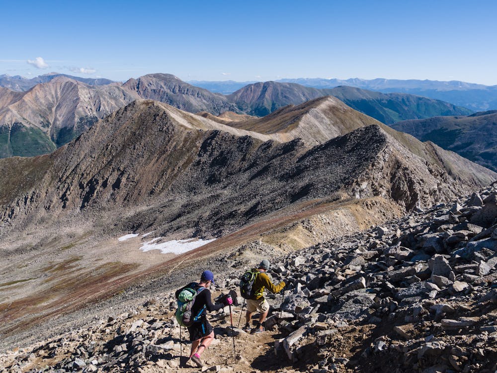
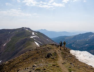
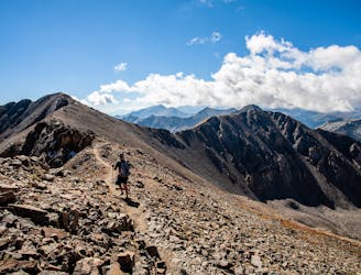
After climbing the slope, at the obvious high point, the well-built and obvious trail peters out and some rocky pitches appear. Take care to locate the best way around the rocky area. At about 13,700' the remainder of the route is fairly steep and is comprised of loose scree, but the trail isn't too difficult to find. Trekking poles are super-helpful on this stretch, particularly on the descent.
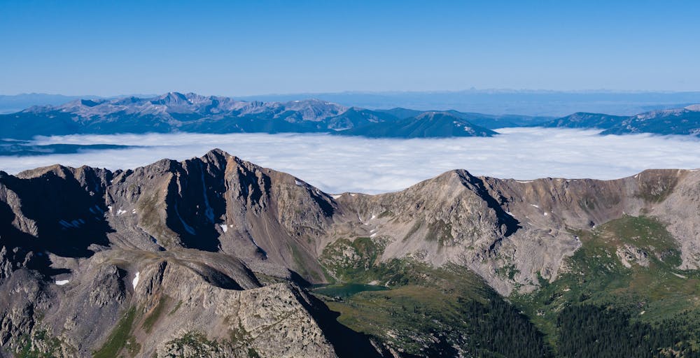
Upon gaining Huron Peak's 14,003' summit, views of Taylor Reservoir, Lake Ann and the always-stunning Three Apostles burst into view. If the weather is good, be sure to take plenty of time to appreciate the 360 degrees of sheer beauty before beginning the 3,500' descent.
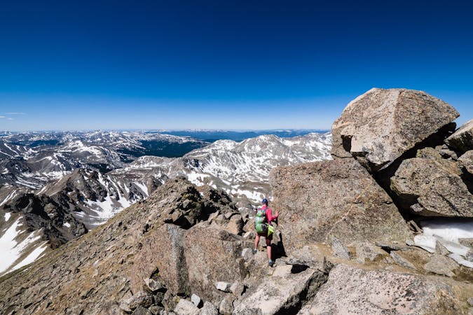
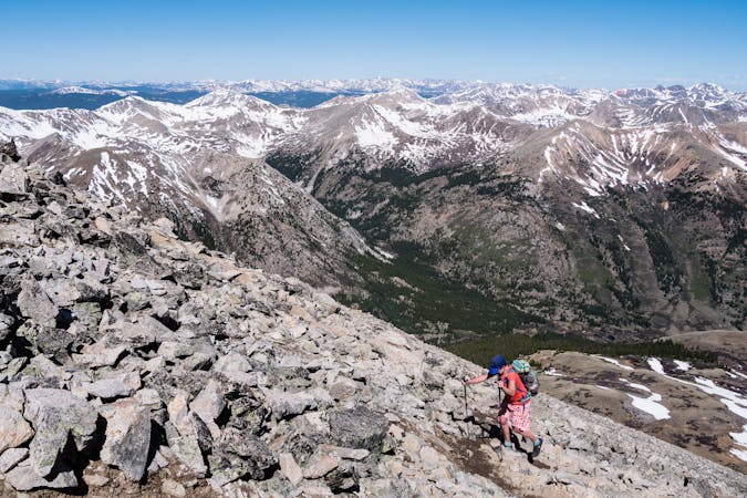
Severe
Hiking challenging trails where simple scrambling, with the occasional use of the hands, is a distinct possibility. The trails are often filled with all manner of obstacles both small and large, and the hills are very steep. Obstacles and challenges are often unexpected and can be unpredictable.

Some trail sections are extremely exposed where falling will almost certainly result in serious injury or death.

Close to help in case of emergency.
1 m away
A gorgeous hike to a breathtaking alpine lake and pass.
Moderate Hiking
8.6 km away
Two 14er summits, a beautiful pass, and 6,146' elevation gain over 12.2 miles is a wonderful way to spend a day in the Sawatch Range.
Severe Hiking
8.6 km away
An autumn backpacking excursion in Missouri Gulch is the best way to experience the splendor of 14,067' Missouri Mountain.
Extreme Hiking
10 routes · Alpine Climbing · Hiking

16 routes · Hiking
13 routes · Alpine Climbing · Hiking
6 routes · Alpine Climbing · Hiking

46 routes · Alpine Climbing · Hiking