12 m away
CDT: Monarch Pass (US-50) to Twin Lakes (CO-82)
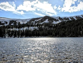
A stunning section of the CDT known for its views of Monumental Peak and passage through the Collegiate Peaks Wilderness.
Difficult Hiking
- Distance
- 131 km
- Ascent
- 4.9 km
- Descent
- 5.5 km
One of the most scenic traverse trails in the state!
Hiking Difficult

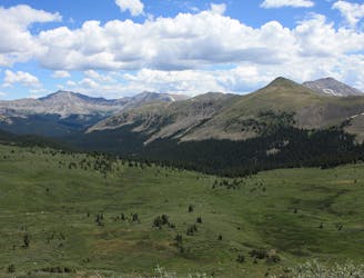
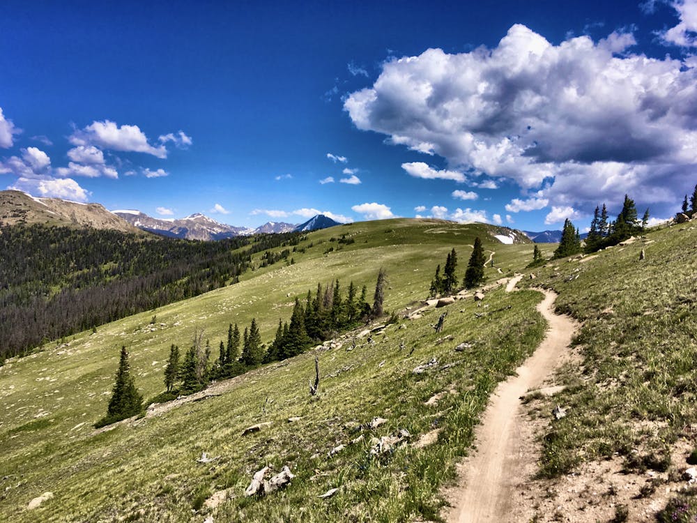
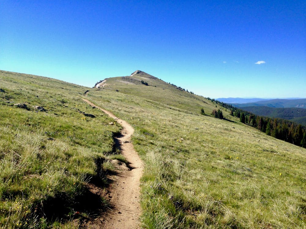
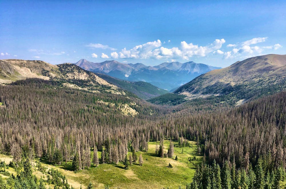
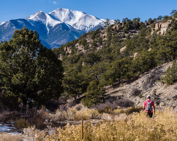
The section of the Continental Divide Trail running between the paved Monarch Pass and the gravel Marshall Pass is commonly referred to as the “Monarch Crest.” This singletrack trail traverses the crest of the Continental Divide, running at or near treeline almost the entire way. The expansive views of gorgeous mountains in all directions make this trail one of the most scenic, idyllic hikes in the state!
How you choose to tackle this stretch of the CDT is entirely up to you. You can hike from either end as far as you’d like, then turn around for an out-and-back route. You could easily set up a shuttle with some friends and hike this section point-to-point. Or, if you’re backpacking through, you can easily add this section of trail into a section hike, a thru-hike, or a loop route with other trails in the region. The options are really endless, but the line in the map shown here depicts a point-to-point hike from Monarch Pass to Marshall Pass.
Hiking this route may be much more approachable than climbing any of the major peaks in the region, but at 10.6 miles long and 1,165 feet of climbing (1,627 feet if you go the other direction), a point-to-point hike on the Monarch Crest will still require a solid effort to complete. Since you’re at treeline for most of the hike, be sure to get started early so that you can complete the route and get back below treeline before the afternoon thunderstorms roll in. One benefit of hiking in the direction mapped here is that after passing the Agate Creek trail, the Monarch Crest soon descends into the trees, staying below tree cover until it reaches Marshall Pass.
Do note that the Monarch Crest is one of the most popular mountain bike trails in Colorado, and it’s also open to motorcycles. Expect to encounter other trail users on this hike, but prepared to have an amazing time regardless!
Difficult
Hiking trails where obstacles such as rocks or roots are prevalent. Some obstacles can require care to step over or around. At times, the trail can be worn and eroded. The grade of the trail is generally quite steep, and can often lead to strenuous hiking.

The trail contains some obstacles such as outcroppings and rock which could cause injury.

Little chance of being seen or helped in case of an accident.
12 m away
A stunning section of the CDT known for its views of Monumental Peak and passage through the Collegiate Peaks Wilderness.
Difficult Hiking
3.9 km away
Climb to a set of beautiful alpine lakes nestled right below the Continental Divide.
Difficult Hiking

16 routes · Hiking
11 routes · Alpine Climbing · Hiking

10 routes · Hiking

40 routes · Hiking