3.9 km away
Monarch Crest: Monarch Pass to Marshall Pass
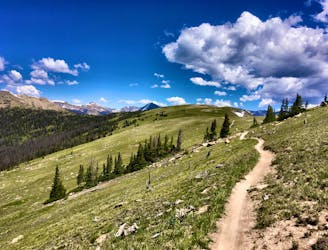
One of the most scenic traverse trails in the state!
Difficult Hiking
- Distance
- 17 km
- Ascent
- 354 m
- Descent
- 500 m
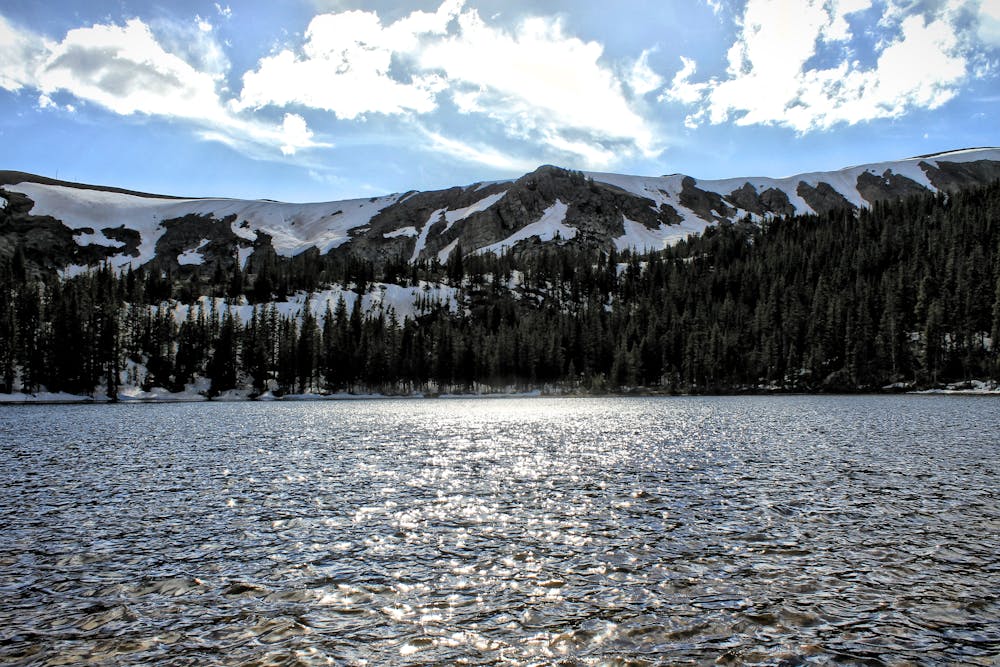
Climb to a set of beautiful alpine lakes nestled right below the Continental Divide.
Hiking Difficult

The Waterdog Lakes lie in an absolutely gorgeous location: almost exactly at treeline, and below a rocky mountain ridge that rings the valley. The ridge itself is actually the Continental Divide, with water falling on the mountaintop running to the Atlantic Ocean on the Waterdog Lakes side, and the Pacific Ocean on the opposite side.
Many of the best hikes in the greater Salida area require a drive down a rough dirt road to access... and some of them even require high clearance 4x4 vehicles to get all the way to the trailhead. Not so with Waterdog Lakes—the trailhead is located right on Highway 50 / Monarch Pass, making this one of the most easily-accessible alpine hikes in the region.
The length of this hike is also quite accessible. While the climb is steep, it's relatively easy to complete this hike in a short half-day (or less, depending on how fast you're moving).
The climb takes place mostly in the trees, with the singletrack switchbacking back and forth as it climbs over loose rocks and boulders.
Up high, the trail begins to break out into alpine meadows, with a short, steep climbing delivering you to a stunning vista at the first lake. A brief walk around the lake and a climb uphill will bring you to the second major lake, with a third, smaller lake nearby. If you still have more energy to burn, an unmarked trail climbs steeply up the mountainside all the way to the top of the ridge, where it runs into the Continental Divide Trail.
Difficult
Hiking trails where obstacles such as rocks or roots are prevalent. Some obstacles can require care to step over or around. At times, the trail can be worn and eroded. The grade of the trail is generally quite steep, and can often lead to strenuous hiking.

The trail contains some obstacles such as outcroppings and rock which could cause injury.
Away from help but easily accessed.
3.9 km away
One of the most scenic traverse trails in the state!
Difficult Hiking
3.9 km away
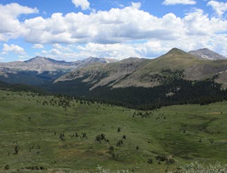
A stunning section of the CDT known for its views of Monumental Peak and passage through the Collegiate Peaks Wilderness.
Difficult Hiking

16 routes · Hiking
11 routes · Alpine Climbing · Hiking

10 routes · Hiking

40 routes · Hiking