6.9 km away
Little Bear Peak
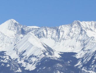
One of the most technical and coveted 14er summits.
Extreme Hiking
- Distance
- 4.6 km
- Ascent
- 715 m
- Descent
- 715 m
A secluded alpine lake trek.
Hiking Moderate

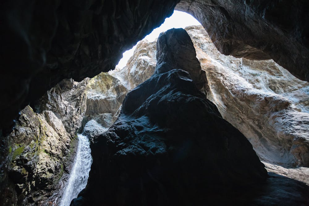
The first half-mile of the trail is shared with the Zapata Falls route. Zapata Falls is an extremely popular destination, so this part of the trek will likely be shared with many other hikers. The falls is worth making a short side trip to, but it's best done on the return from the lake.
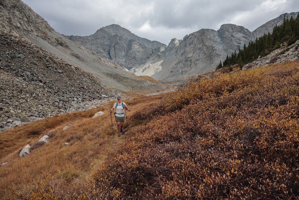
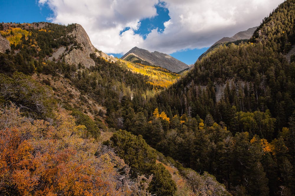
Leaving the crowds behind at the falls, continue steadily upwards toward South Zapata Lake. The route is at its most stunning in late September when the aspens are glowing gold and the trail sees very few hikers. On a weekday in the fall, it is quite possible that no one will share the trail to the lake with you.
Though the hike is not particularly difficult, it does climb! Starting at 9,089 feet, the route ascends more than 2,600 feet over 4.6 miles to the lake, which sits at about 11,800 feet. Taking time to stop and gaze around helps to keep the heart rate manageable. Look back periodically for views of the San Luis Valley spread out below.
At 2.25 miles there will be a signed intersection with the North Fork South Zapata Creek Trail. Continue on the South Zapata Lake Trail as it makes its way up the drainage, passing by some old cabins before it gains treeline.
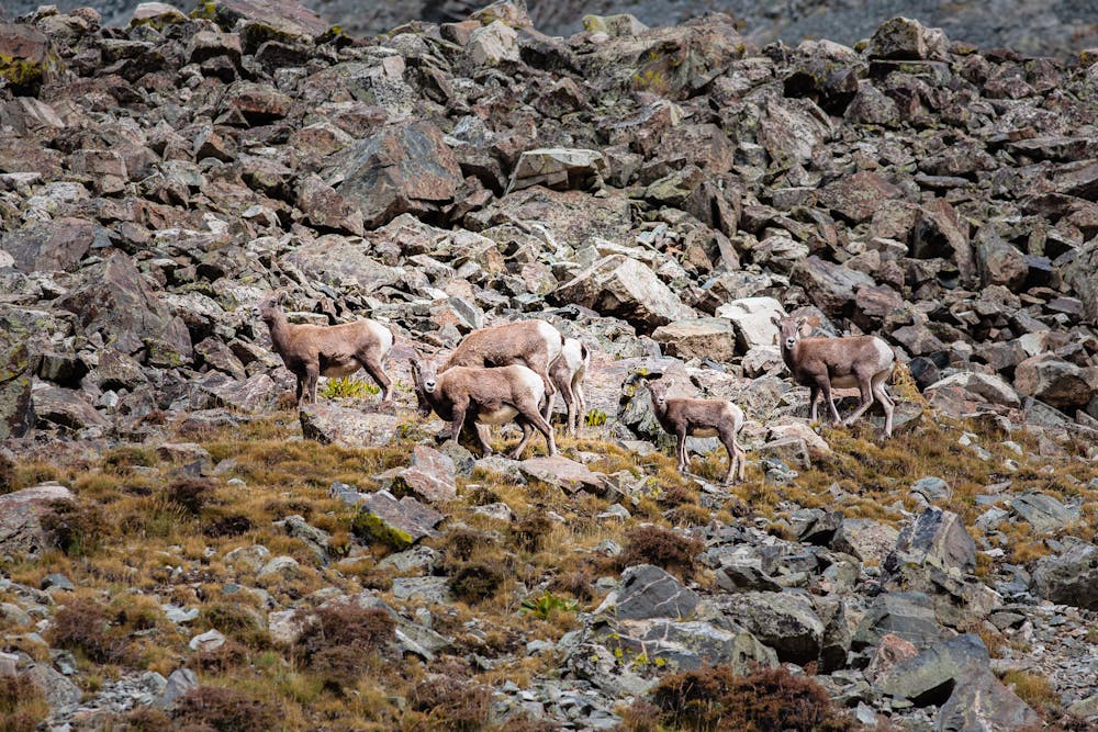
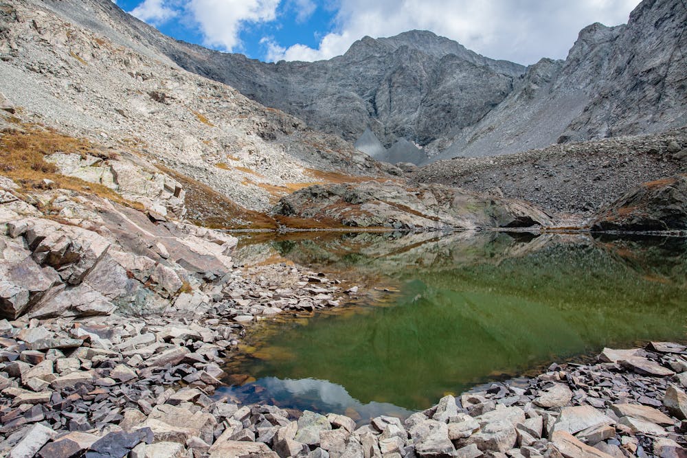
Once at South Zapata Lake, there is plenty to explore before heading back down. Sit down to enjoy a picnic lunch in the shadow of rugged 14,042-foot Ellingwood Point. Listen carefully for the sound of rocks falling and perhaps you'll see bighorn sheep navigating the sketchy talus slopes. They blend so well with the rocks that it is hard to locate them without the tell-tale sound of the small rocks they dislodge.
It is possible to backpack up to South Zapata Lake, which allows much more time to bask in the solitude. If done as a day hike, be sure to start down before too late in the afternoon. The descent is always best done in daylight!
If time and energy allow, divert to Zapata Falls 1/2 mile before the trailhead. Even if there are lots of people, the falls provide a dramatic finish to the day.
Moderate
Hiking along trails with some uneven terrain and small hills. Small rocks and roots may be present.

The path is on completely flat land and potential injury is limited to falling over.

Little chance of being seen or helped in case of an accident.
6.9 km away
One of the most technical and coveted 14er summits.
Extreme Hiking
6.9 km away
Tag two lofty summits on the Blanca Massif.
Extreme Hiking
7.7 km away
One of the four 14er summits in the Sierra Blanca Massif.
Extreme Hiking