4.5 km away
Top of the World Loop
A fantastically-beautiful loop on the elevated trails along the steep cliff bands of Hartman's.
Difficult Mountain Biking
- Distance
- 13 km
- Ascent
- 383 m
- Descent
- 383 m
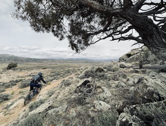
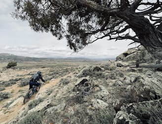
Pedal the most remote trails in the Hartman Rocks trail system.
Mountain Biking Difficult

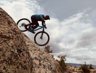
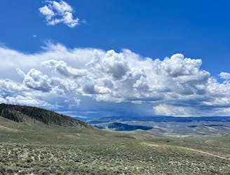
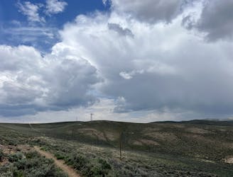
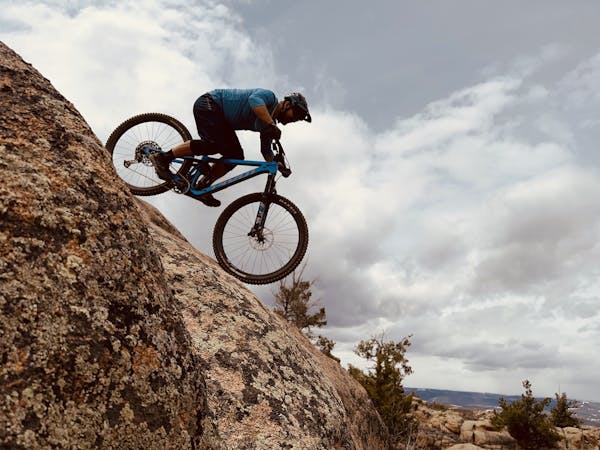
The Aberdeen Loop is the most remote trail in the Hartman Rocks Trail System, providing an almost backcountry-style ride quality. It's also incredibly scenic, providing stunning views and diverse terrain in Hartman's iconic high desert landscape.
Since the trail is so remote, getting there can be a chore. For a truly epic ride, you can complete a 40-mile loop from the main trailhead, known as the Original Growler: Big Bad 40. Or, for a more approachable route option, try out this lollipop loop beginning from the Bambi's trailhead.
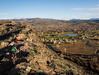
This route cuts the total mileage down to 16, but still demands over 2,000 feet of climbing. The climbing begins directly from the trailhead on Bambi's, but you can be assured of a riotous final descent back down at the end of your ride!
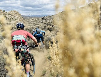
The route shown here follows the Outback Trail on the way out to Aberdeen but bypasses Skull Pass to keep the difficulty to an upper-intermediate level. If you're looking for a dose of technical difficulty, you can add in the black diamond Skull Pass trail as a bonus.
The Aberdeen Loop itself can be ridden in either direction, but it's featured in the Original Growler in the clockwise direction (as shown here). Aberdeen provides a fantastic mixed bag of backcountry singletrack, including some flowy sections and some rock-filled tech features. This area of Hartman's also features longer climbs and longer descents than the rest of the trail system, making for a nice, rewarding rip back down after all the work you've put in!
On the way back to the trailhead, you can follow the dirt road as mapped for the most direct route back to Bambi's, or you can always tack on bonus miles by doing Skull Pass or Outback again. The choice is yours!
Note: All trails south of the Powerline Road—which includes this entire ride—are closed seasonally from March 15th - May 15th for sage grouse habitat. Please respect this seasonal closure—there is plenty of time to ride Aberdeen after May 15th.
Source: https://originalgrowler.com/
Difficult
Mostly stable trail tread with some variability featuring larger and more unavoidable obstacles that may include, but not be limited to: bigger stones, roots, steps, and narrow curves. Compared to lower intermediate, technical difficulty is more advanced and grades of slopes are steeper. Ideal for upper intermediate riders.

The trail contains some obstacles such as outcroppings and rock which could cause injury.

Little chance of being seen or helped in case of an accident.
4.5 km away
A fantastically-beautiful loop on the elevated trails along the steep cliff bands of Hartman's.
Difficult Mountain Biking
4.6 km away
The classic Growler course. One loop only gets you a Half Growler: you'll have to do two for a Full Growler!
Difficult Mountain Biking
4.6 km away
The longest version of the Original Growler course.
Difficult Mountain Biking
4.6 km away
An expansive high-desert trail system offering incredible variety.
Severe Mountain Biking
4.6 km away
Two tech lines filled with massive slickrock slabs to roll!
Severe Mountain Biking
9.9 km away
A fantastic pedal-friendly loop through the Signal Peak trails.
Moderate Mountain Biking
9.9 km away
A fantastic beginner ride accessible directly from the outskirts of Gunnison.
Easy Mountain Biking

25 routes · Mountain Biking
8 routes · Mountain Biking