Hartman Rocks Sampler
An expansive high-desert trail system offering incredible variety.
Severe Mountain Biking
- Distance
- 32 km
- Ascent
- 790 m
- Descent
- 790 m
Two tech lines filled with massive slickrock slabs to roll!
Mountain Biking Severe

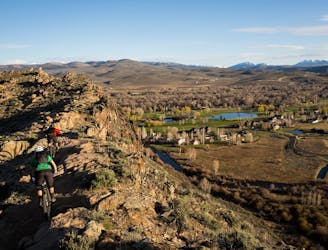
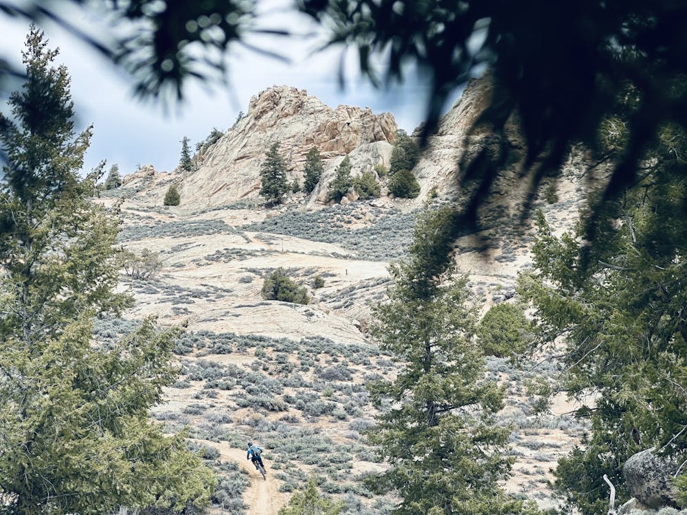
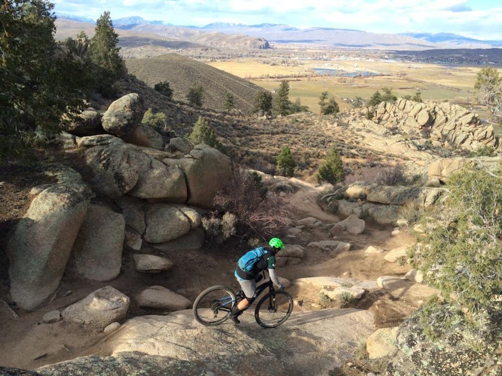
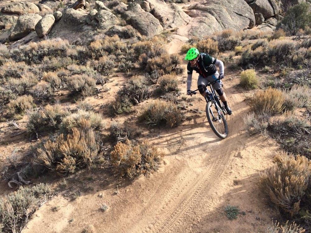
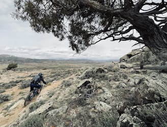
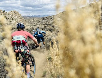
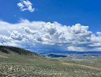
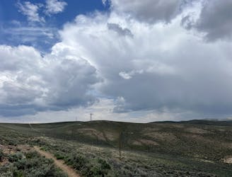
The vast majority of the trails in the Hartman Rocks Trail System consist of long, flowing cross country singletrack punctuated by techy rock moves. These long trails run for miles to the south and west of the trailhead, traversing the wide-open prairie occupying a high mesa in the Gunnison Valley. However, near the main trailhead, you can find a few trails that are radically more technical and utterly different from the rest of the trail system!
The technical trails shown here are combined into two runs dropping back to the trailhead: Rattlesnake -> Beck’s -> The Notch and Ring Dike -> V-Drop.
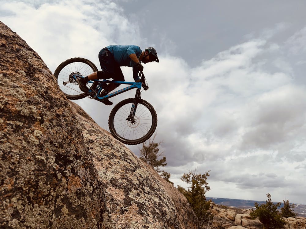
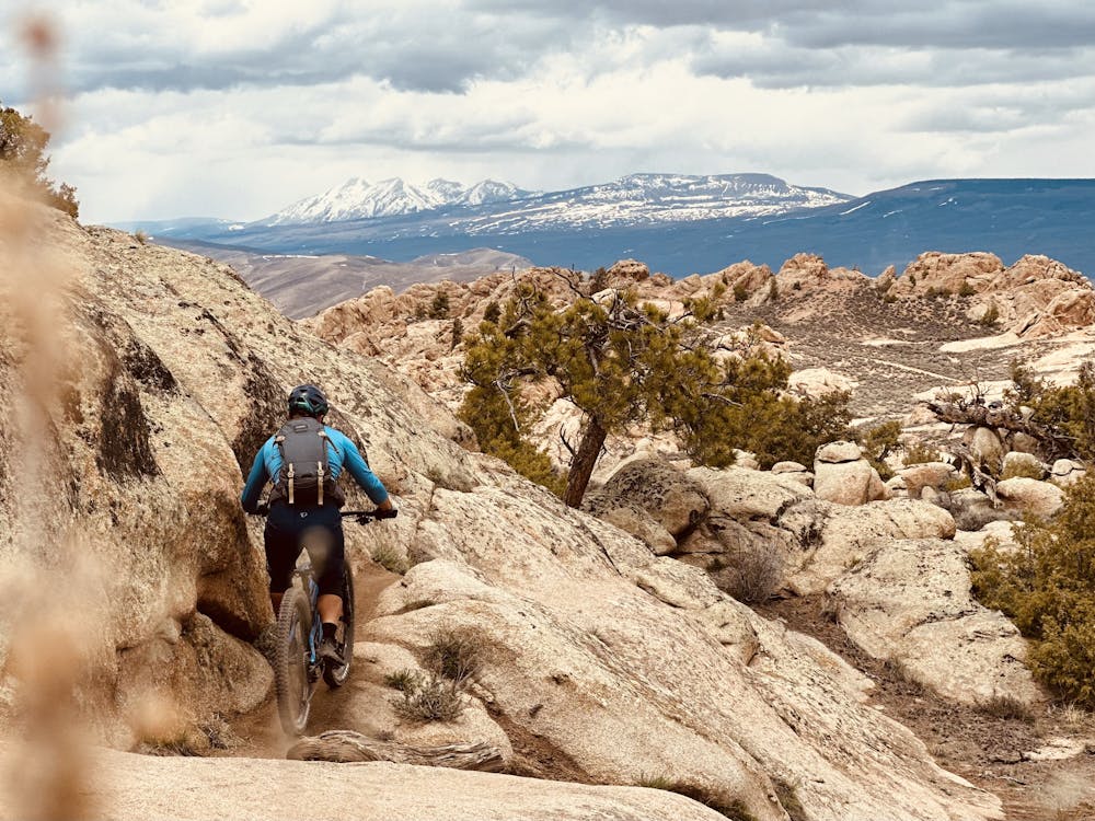
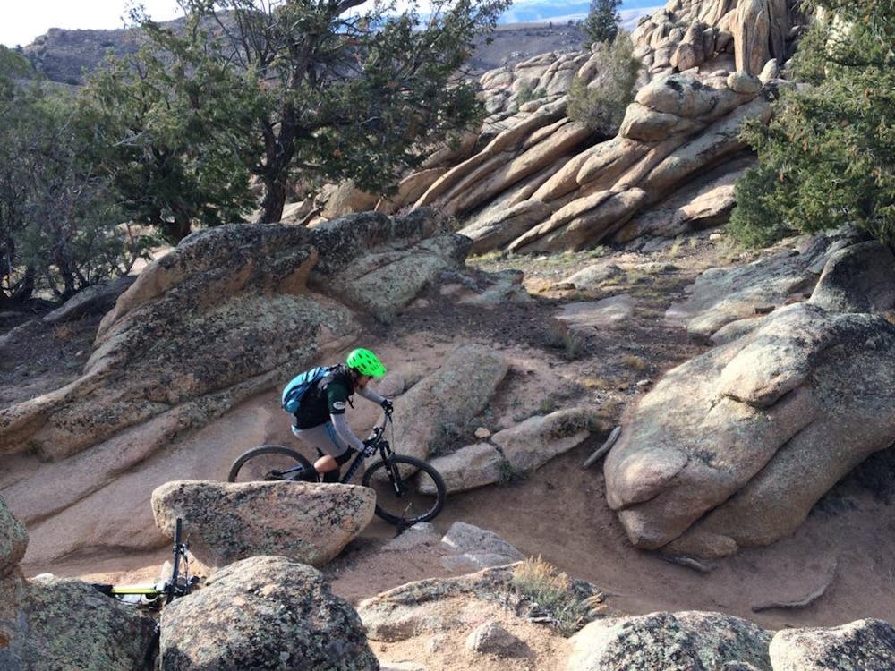
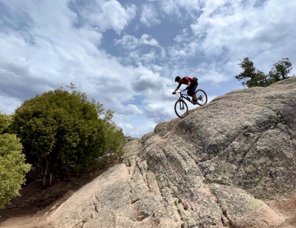
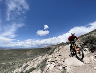
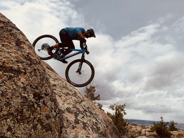
These tech lines boast some of the best slickrock slab riding in the state of Colorado! Massive, committing lines roll down extended slabs of sandstone as you blast down the abrupt edge of the mesa. Near-vertical rock rolls require total commitment, and many options to huck instead of roll are available if you look for them. While most of the slabs are wide-open and offer good visibility, some of the rock moves require threading through tight notches in the sandstone and negotiating buck-puckering rock gardens. But even on the wide-open slabs, it can often take a bit of time to examine the plethora of lines and determine which one will suit you best.
If, after two runs up and down the rocky edge of the mesa, you haven’t had your fill of tech just yet, be sure to check out Rocky Ridge, Free Fall, and The Ridge, which aren’t included in the recommended route mapped here.
Severe
Widely variable, narrow trail tread with steeper grades and unavoidable obstacles of 15in/38cm tall or less. Obstacles may include unavoidable bridges 24in/61cm wide or less, large rocks, gravel, difficult root sections, and more. Ideal for advanced-level riders.

Some trail sections have exposed ledges or steep ascents/descents where falling could cause serious injury.

Away from help but easily accessed.
An expansive high-desert trail system offering incredible variety.
Severe Mountain Biking
10 m away
The classic Growler course. One loop only gets you a Half Growler: you'll have to do two for a Full Growler!
Difficult Mountain Biking
10 m away
The longest version of the Original Growler course.
Difficult Mountain Biking
808 m away
A fantastically-beautiful loop on the elevated trails along the steep cliff bands of Hartman's.
Difficult Mountain Biking
4.6 km away

Pedal the most remote trails in the Hartman Rocks trail system.
Difficult Mountain Biking
5.5 km away
A fantastic pedal-friendly loop through the Signal Peak trails.
Moderate Mountain Biking
5.5 km away
A fantastic beginner ride accessible directly from the outskirts of Gunnison.
Easy Mountain Biking
8 km away
A fantastic quick rip in the heart of the Signal Peak Trail System
Moderate Mountain Biking

25 routes · Mountain Biking
8 routes · Mountain Biking