3.1 km away
Contour Trail: Out-and-Back
A fantastic beginner ride accessible directly from the outskirts of Gunnison.
Easy Mountain Biking
- Distance
- 22 km
- Ascent
- 129 m
- Descent
- 129 m
A fantastic quick rip in the heart of the Signal Peak Trail System
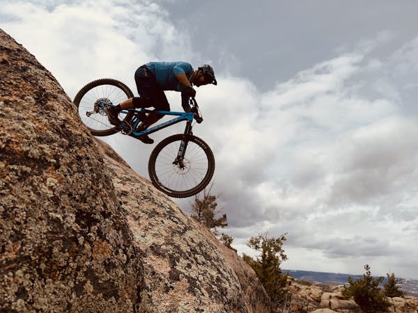
Mountain Biking Moderate
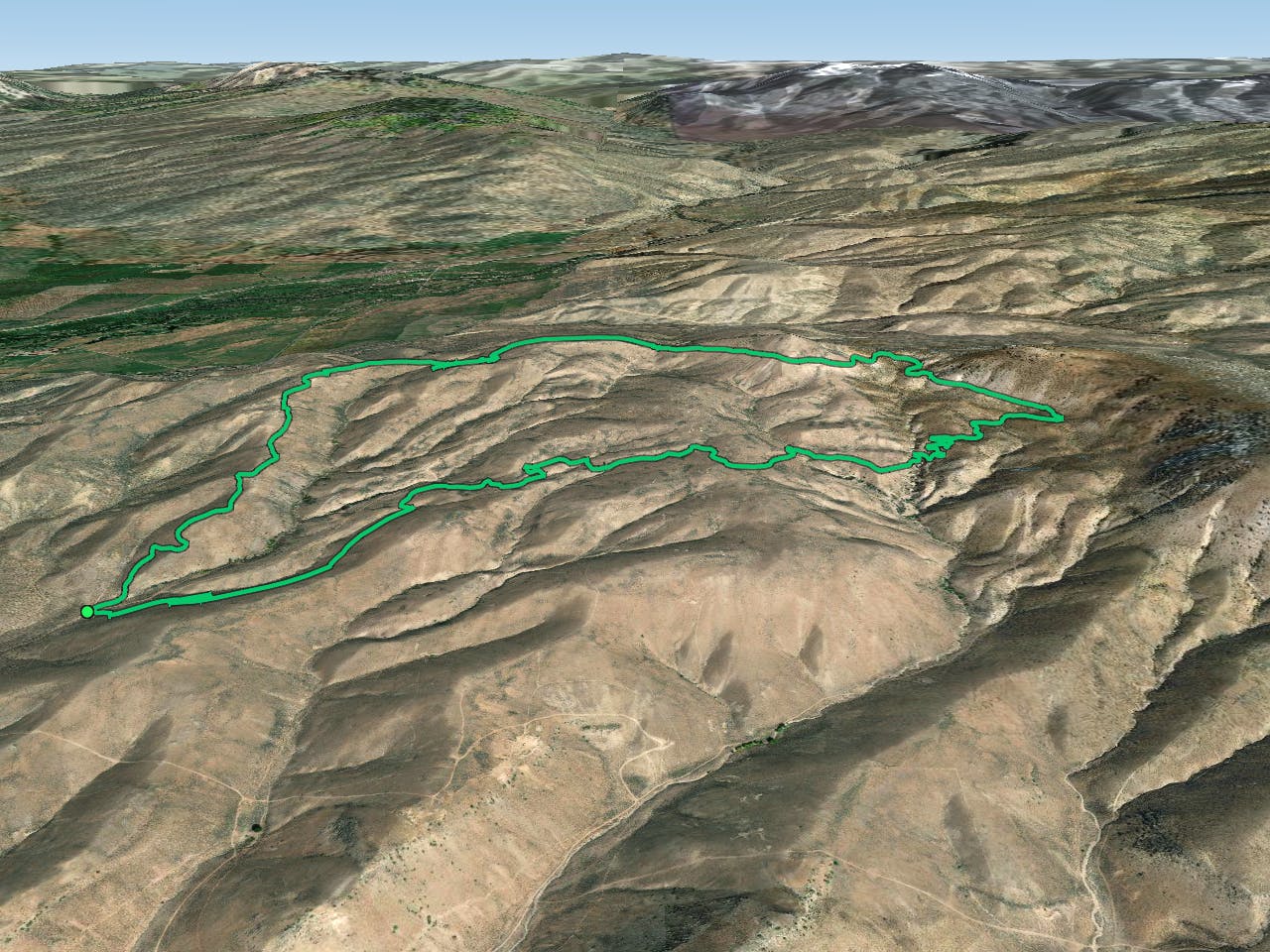
The Signal Peak Trail System offers miles upon miles of flowing, non-technical mountain bike trails that are perfect for beginner and intermediate mountain bikers. Two of the trails buried in the trail system, Duane's World and Chicken Wing, form an attractive loop when linked by the scenic South Rim trail.
This loop ride features a trailhead parking area at the marked beginning, so you can drive deep into the heart of Signal Peak and ride from here for a short rip. For a longer ride, you can pedal from downtown and access this trailhead via the Contour Trail.
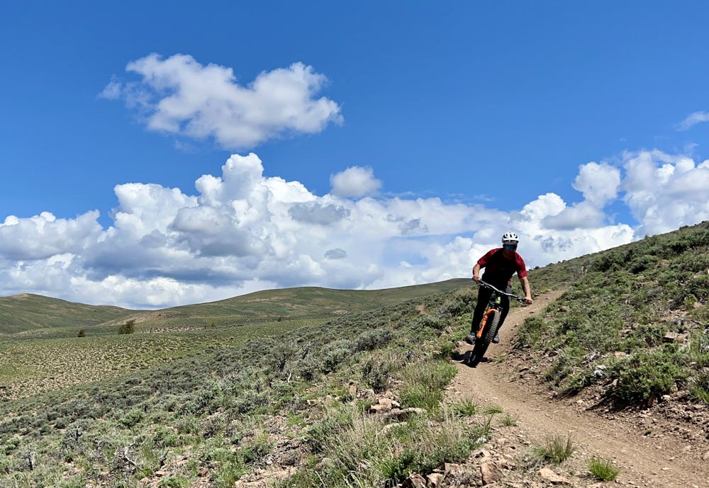
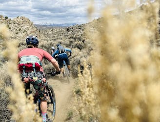
The loop begins by climbing Duane's World, a fantastic machine-built singletrack that climbs gradually for about three miles to access the top of the ridge. The trail tread is smooth and flowy, with plenty of grade reversals, making for an easy ascent to the ridge.
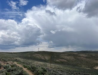
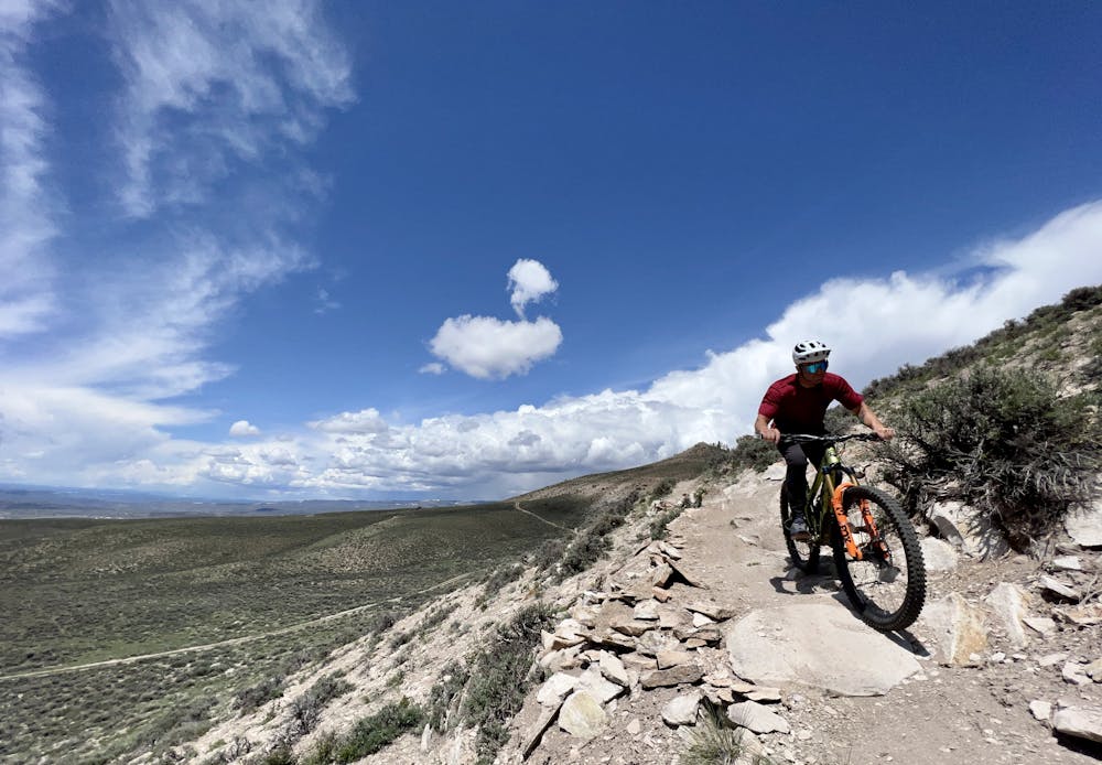
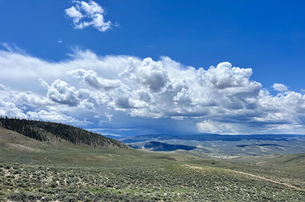
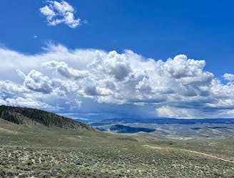
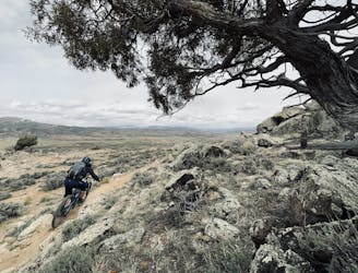
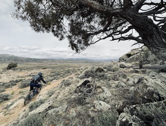
The climb continues on the South Rim Trail. From the side of Signal Peak, the views of the surrounding region are absolutely phenomenal! Thanks to the sagebrush-covered slopes, the million-dollar views are wide-open and unobstructed. On a clear day, you can easily spot the jagged San Juan mountains to the south poking up over the lower ranges in the foreground.
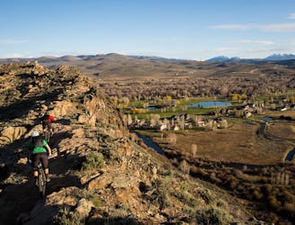
As you round Signal Peak and reach the saddle, prepare to have your breath taken away by the stunning views of the Elk Range that open up to the north and west! This ride is truly a stunner, with a high effort-to-view ratio.
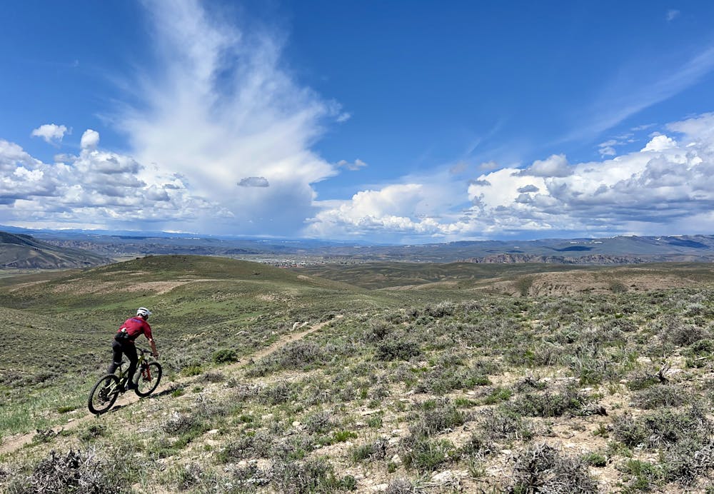
From the saddle, the descent kicks up on the Shoelace trail before dropping quickly down the Chicken Wing descent. Chicken Wing is an older trail than Duane's World, dropping faster and straighter over some small rolling rocks toward the trailhead where you began. Aside from a few corners and switchbacks, most of the trail is wide-open and fast, providing a viciously-fun finish to a beautiful intermediate loop ride!
Moderate
Mostly stable trail tread with some variability, with unavoidable obstacles 8in/20cm tall or less. Other obstacles such as rock gullies and steep sections may exist. Ideal for lower intermediate riders.

The trail contains some obstacles such as outcroppings and rock which could cause injury.
Away from help but easily accessed.
3.1 km away
A fantastic beginner ride accessible directly from the outskirts of Gunnison.
Easy Mountain Biking
3.1 km away
A fantastic pedal-friendly loop through the Signal Peak trails.
Moderate Mountain Biking
8 km away
The longest version of the Original Growler course.
Difficult Mountain Biking
8 km away
The classic Growler course. One loop only gets you a Half Growler: you'll have to do two for a Full Growler!
Difficult Mountain Biking
8 km away
An expansive high-desert trail system offering incredible variety.
Severe Mountain Biking
8 km away
Two tech lines filled with massive slickrock slabs to roll!
Severe Mountain Biking
8.6 km away
A fantastically-beautiful loop on the elevated trails along the steep cliff bands of Hartman's.
Difficult Mountain Biking

25 routes · Mountain Biking
8 routes · Mountain Biking