8.1 km away
Arkansas Hills Tech Ride: Unkle Nazty and Sand Dunes
A rowdy collection of the original tech trails in the Arkansas Hills.
Extreme Mountain Biking
- Distance
- 13 km
- Ascent
- 432 m
- Descent
- 432 m
Some people say that "Trump Shuttles Cottonwood," but if Trump can do it, then why not you too?
Mountain Biking Severe

While the Cottonwood Trail is typically pedaled as a loop by the locals, with easy access to the top of the trail via the 2WD Ute Trail Road, it's not surprising that it has become a popular shuttle ride. In fact, local bike shop Absolute Bikes also offers commercial shuttles to the upper parking lot.
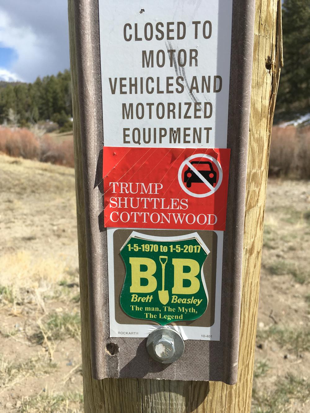
Even though the angsty locals might say that "Trump Shuttles Cottonwood," if Trump can do it, then why can't you do it, too? The route shown here depicts the quickest rip down the Cottonwood Shuttle Run.
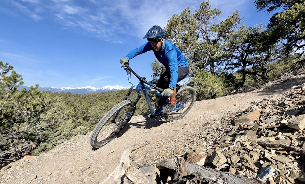
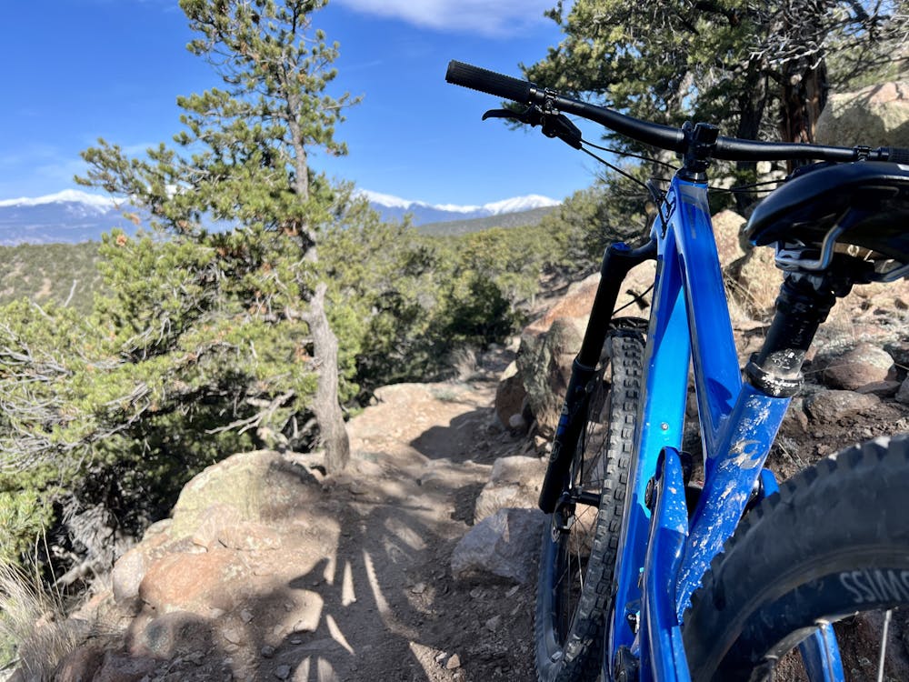
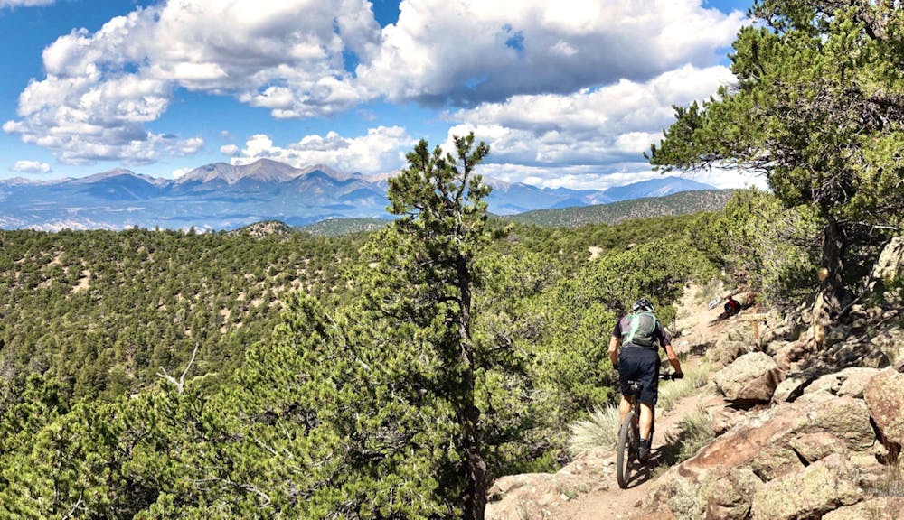
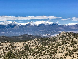
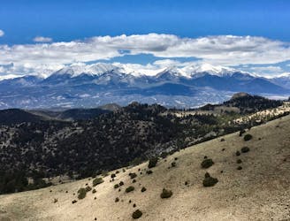
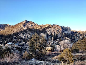
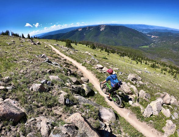
Even though Cottonwood is known as a shuttle run, you'll still have to do a little bit of up-and-down climbing along the Beasway Trail before you get to the bulk of the descent. Despite a bit of pedaling that's required, Beasway is a true bench cut masterpiece that holds some rocks and flow in alternating doses. This meandering trail runs along close to 9,000 feet, providing spectacular views of the valley below and the Sawatch Range beyond.
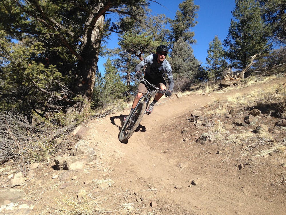
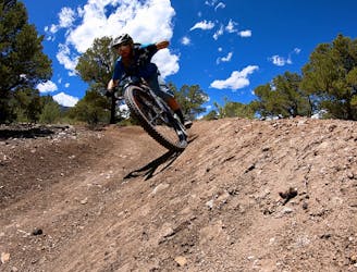
Once you hit the top of Rhumba Ridge, get ready to descend! The downhill begins with a high-speed bench cut singletrack transitioning into a flowy, swoopy drop down the valley.
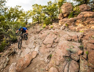
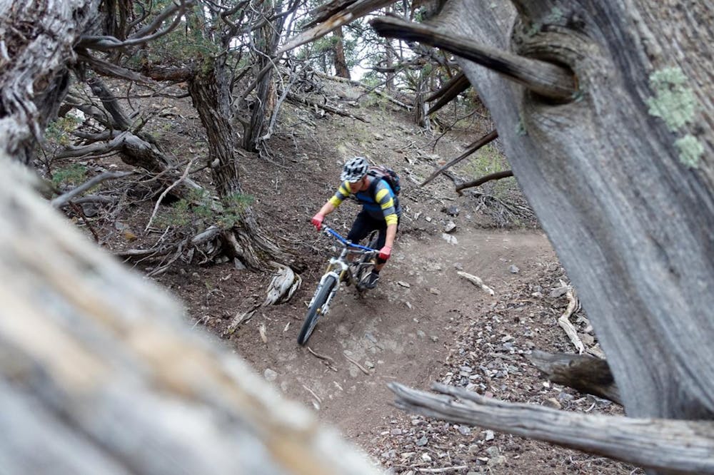
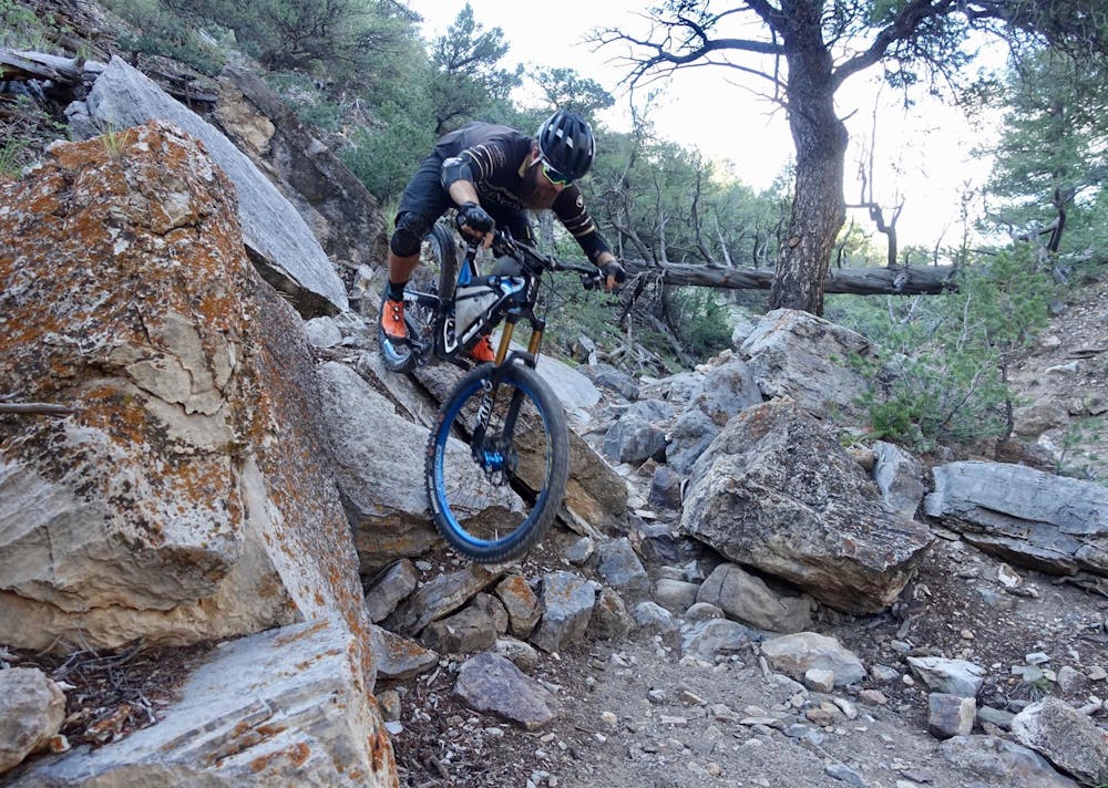
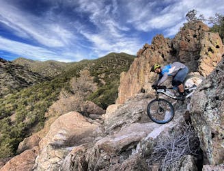
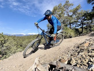
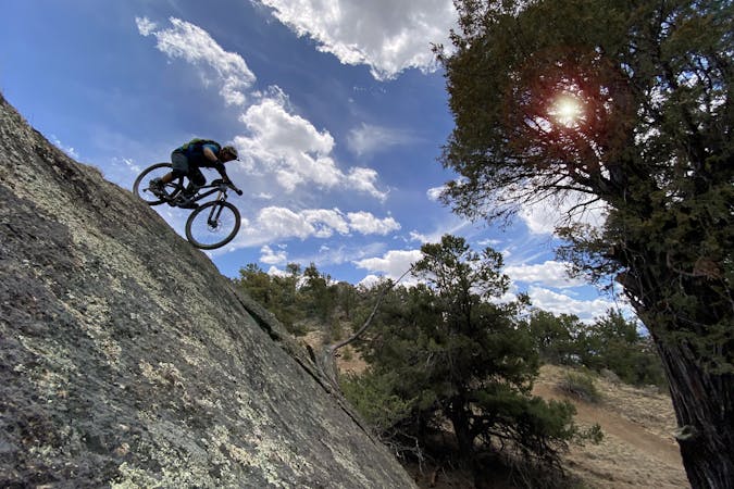
Then, the singletrack gets radically more technical, with the Waterfall section offering wall rides, steep rock rolls, chunder, ledge drops, and more—the advanced mountain biker's dream!
Following the Waterfall, the singletrack drops into the Cottonwood drainage from whence the trail gets its name, speeding down to the tightly-wound Arkansas Hills trail network. While the singletrack here isn't as technical as the Waterfall, it feels like the rocks never end, and optional jumps and drops abound.
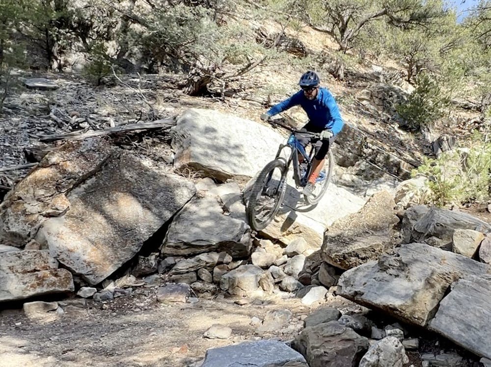
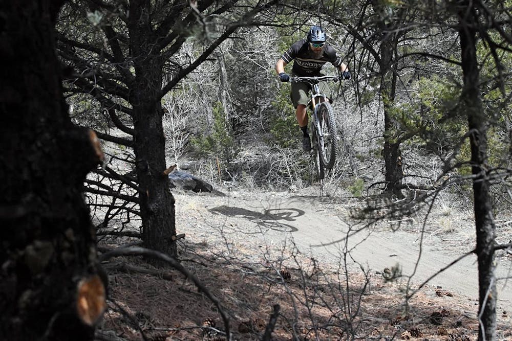
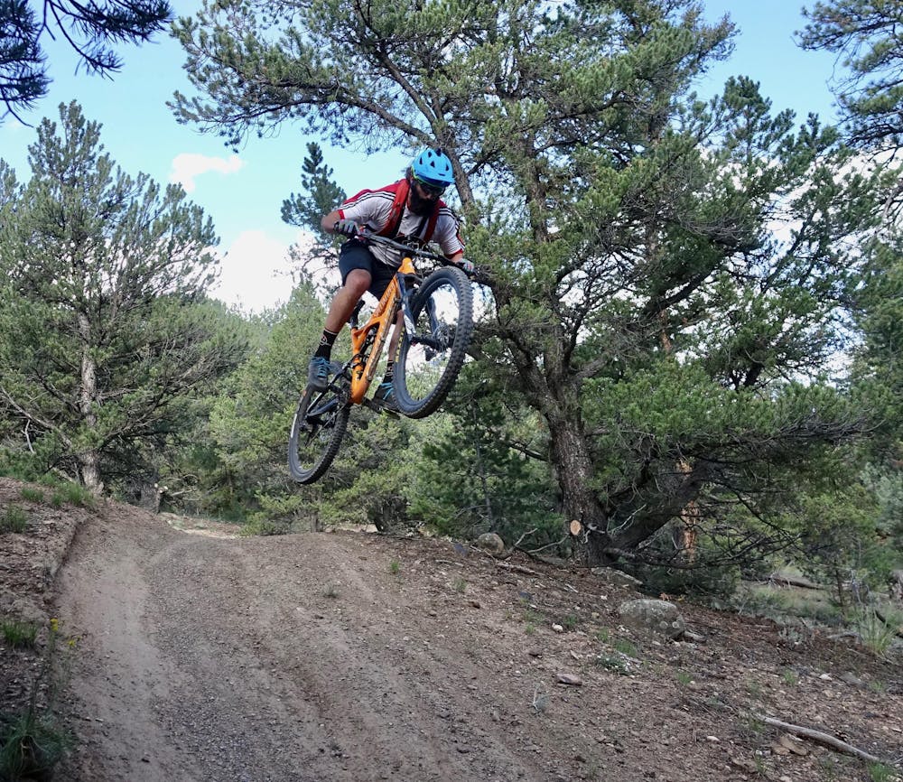
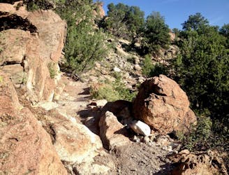
Once you get into the Arkansas Hills, there's no end of options for finishing the descent. The route shown here keeps it steep and rowdy, but you'll have to pedal a bit across the Backbone Trail to reach the finale on Lower Sand Dunes. Lower Sand Dunes is a true gem, with rock gardens, drops, and a rowdy rock wall ride mixed in!
Severe
Widely variable, narrow trail tread with steeper grades and unavoidable obstacles of 15in/38cm tall or less. Obstacles may include unavoidable bridges 24in/61cm wide or less, large rocks, gravel, difficult root sections, and more. Ideal for advanced-level riders.

The trail contains some obstacles such as outcroppings and rock which could cause injury.
Away from help but easily accessed.
8.1 km away
A rowdy collection of the original tech trails in the Arkansas Hills.
Extreme Mountain Biking
8.1 km away
Get into a flow state on the newest singletrack trails in the Arkansas Hills Trail System!
Moderate Mountain Biking
8.1 km away
New school tech-gnar to challenge even the best of mountain bikers.
Extreme Mountain Biking
8.1 km away
A challenging 200km double loop through the Arkansas Hills region.
Easy Mountain Biking
8.1 km away
A gorgeous, challenging gravel loop from downtown Salida.
Easy Mountain Biking
8.1 km away
The Trans-Backbone route is an efficient, easy-to-navigate route through the Arkansas Hills trail system, with singletrack ranging from technical and challenging to flowy and fast.
Difficult Mountain Biking
8.1 km away
Pedal from downtown Salida high into the Arkansas Hills to access a ripping descent with fast, flowy sections and uber-gnarly rock gardens.
Severe Mountain Biking
8.1 km away
A flow ride with perfect berms and jumps up high, and tougher natural features down low.
Difficult Mountain Biking
8.1 km away
One of the least technical rides in Salida, the singletrack is still flowy and fun.
Easy Mountain Biking
8.1 km away
A scenic out-and-back ride to a little-visited ghost town.
Easy Mountain Biking
14 routes · Mountain Biking
11 routes · Mountain Biking
4 routes · Mountain Biking
5 routes · Mountain Biking