1.7 km away
Troy Built -> Mack Ridge -> Hawkeye Loop
A lesser-ridden area in the Kokopelli Loops Trail System, with one of the best-quality singletrack trails!
Difficult Mountain Biking
- Distance
- 16 km
- Ascent
- 388 m
- Descent
- 388 m
A challenging add-on to the more popular rides in the Kokopelli Loops.
Mountain Biking Severe

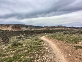
The route mapped here combines the singletrack portion of the Lion's Loop trail and Mack Ridge into a long, narrow loop ride located far from the main trailhead in the Kokopelli Trails network. This zone sees a fraction of the traffic that the trails closer to the trailhead experience, providing a more isolated and remote-feeling ride option!
While it's possible to park and ride from the dirt road as mapped, this loop is most often tacked on as an addition to other rides in the network, such as Mary's -> Steve's -> Wrangler's or a Moore Fun Loop. Adding on Lion's and Mack Ridge will add more mileage, vert, and challenge!
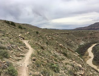
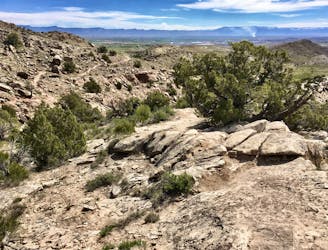
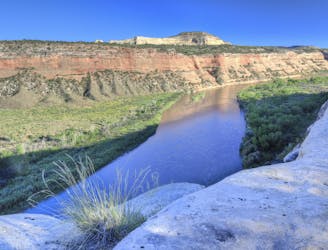
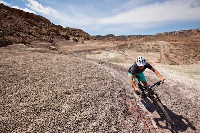
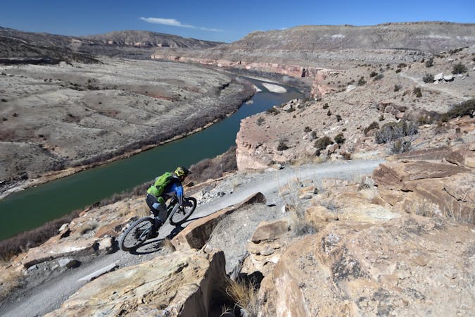
The first section of this loop follows the Lion's Loop trail on a technical and exposed traverse high above the Colorado River. While the views of the Colorado River and McInnis Canyons National Conservation Area are stunning, you'll have to keep your eyes down and focused on the trail. This section is narrow, exposed, and quite technical, with plenty of slow-speed moves between boulders.
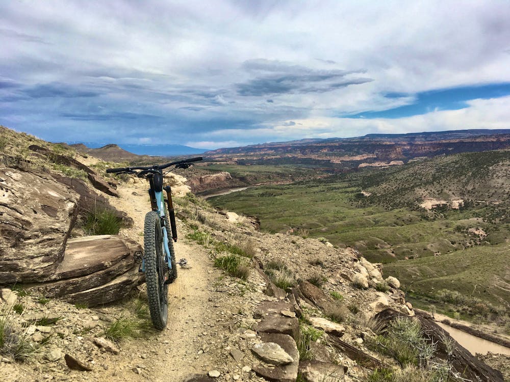
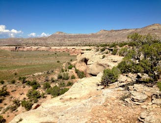
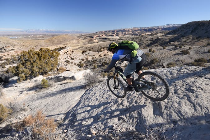
At the end of Lion's, a steep climb (which may be a hike-a-bike for some) brings you to the top of Mack Ridge. Here, the views get cranked up to 11, with stunning vistas in all directions! Be sure to whip out the phone for a few snapshots.
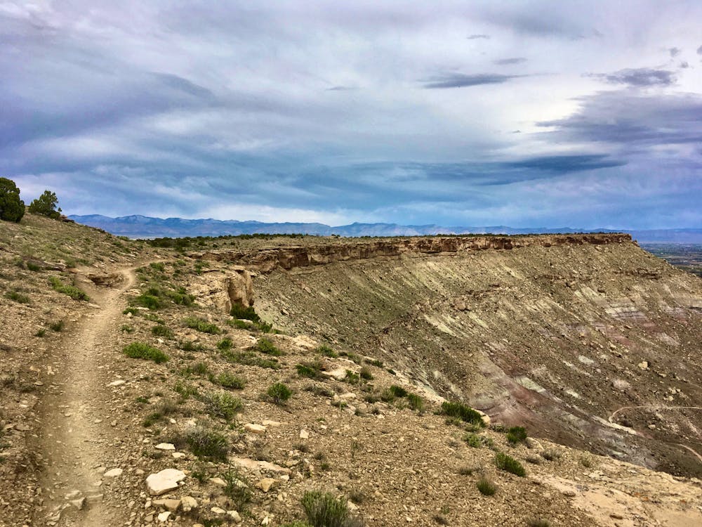
Overall, the trail along the upper section of Mack Ridge is smoother and more attainable than Lion's, but there's plenty of exposure and fall danger, so remain diligent.
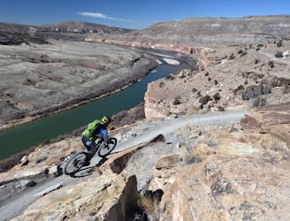
The route mapped here twists and turns down a technical descent on the end of Mack Ridge to return to the dirt road. For a flowier and more bike-optimized descent, you could choose to descend Hawkeye and pedal the dirt road back to your original starting spot.
Severe
Widely variable, narrow trail tread with steeper grades and unavoidable obstacles of 15in/38cm tall or less. Obstacles may include unavoidable bridges 24in/61cm wide or less, large rocks, gravel, difficult root sections, and more. Ideal for advanced-level riders.

Some trail sections have exposed ledges or steep ascents/descents where falling could cause serious injury.
Little chance of being seen or helped in case of an accident.
1.7 km away
A lesser-ridden area in the Kokopelli Loops Trail System, with one of the best-quality singletrack trails!
Difficult Mountain Biking
3.5 km away
The original Moore Fun loop route.
Severe Mountain Biking
3.5 km away
Enjoy a well-built cross country trail on your way to access the technical centerpiece of the Kokopelli Loops: Moore Fun.
Severe Mountain Biking
3.5 km away

A massive loop ride with essentially no doubling back through the Kokopelli Loops network.
Severe Mountain Biking
3.5 km away
Horsethief Bench is the most famous trail in the Kokopelli Trail System, primarily because of its uber-gnarly drop down to the main trail. The views are spectacular as well!
Extreme Mountain Biking
3.5 km away
An epic 142-mile point-to-point route between Fruita, Colorado and Moab, Utah.
Difficult Mountain Biking
3.7 km away
An incredibly-scenic intermediate-friendly ride through the Kokopelli Loops.
Difficult Mountain Biking
3.8 km away
Rustler's Loop is probably the best beginner mountain bike trail in the state of Colorado.
Easy Mountain Biking
5 routes · Mountain Biking
20 routes · Mountain Biking
12 routes · Mountain Biking

37 routes · Mountain Biking
11 routes · Mountain Biking
4 routes · Mountain Biking
7 routes · Mountain Biking
8 routes · Mountain Biking