3.8 km away
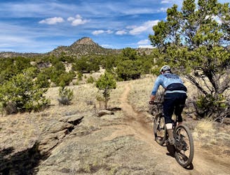
Midland Trails: OG Version
The best high-desert singletrack trails in Buena Vista (as of 2018) combined into one ride.
Difficult Mountain Biking
- Distance
- 37 km
- Ascent
- 703 m
- Descent
- 704 m
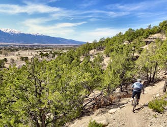
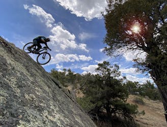
One of the most brutally-technical and high-consequence mountain bike trails in Central Colorado.
Mountain Biking Extreme

For years, finding the best access points to the Vitamin B trail required knowing the right person... and usually a six pack of beer. Granted, the secret was poorly kept, but nevertheless Vitamin B has technically an unauthorized, illegal route.
Not anymore! Both the Forest Service and the BLM have legalized the Vitamin B trail on their respective lands, meaning that this route is now official and totally legal.
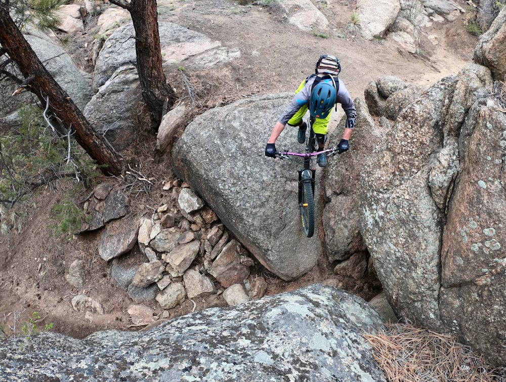
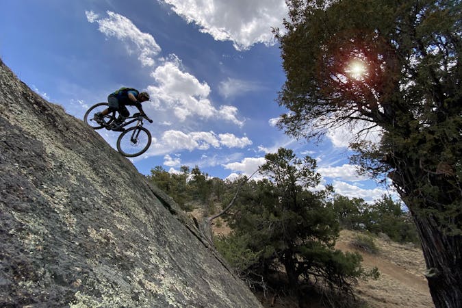
So far, nothing has changed in the trail’s alignment and character. Simply put, this is one of the biggest, burliest, most technical mountain bike trails in Central Colorado.
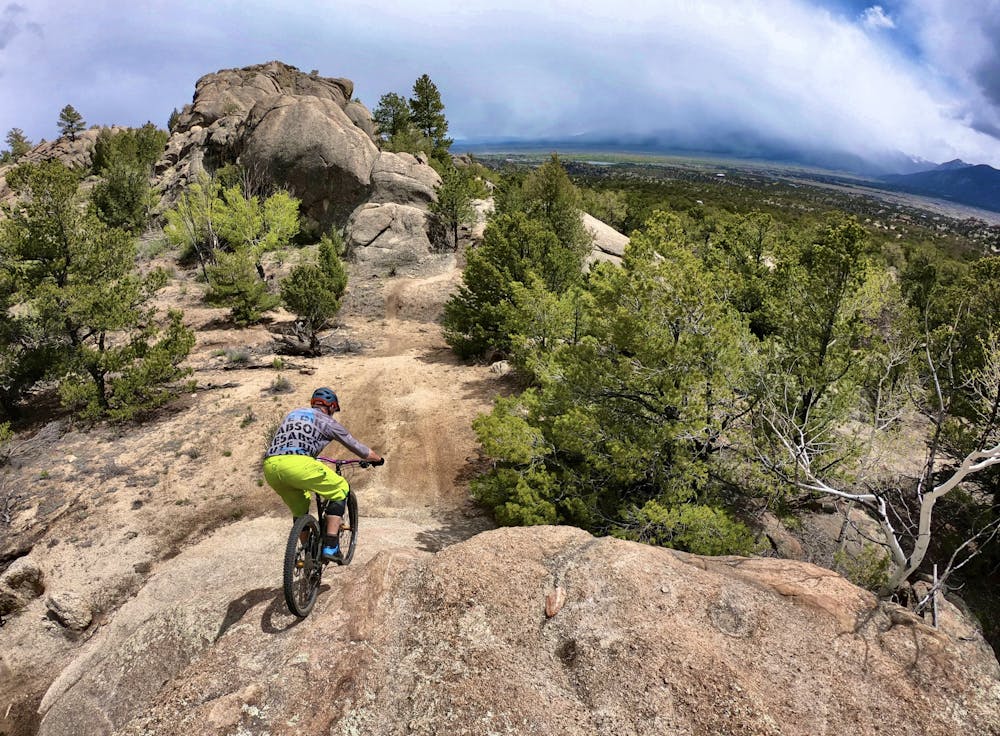
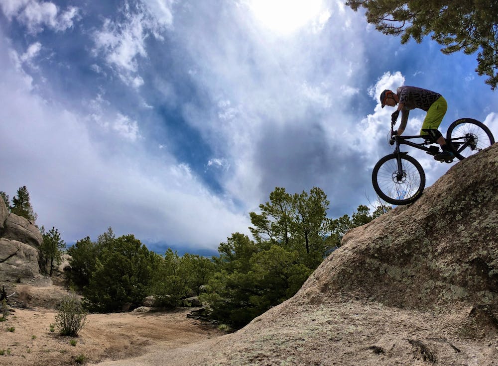
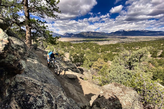
The singletrack roughly follows the spine of a rock ridge from high in the mountains, eventually ending down in the river bottom. This rogue trail alignment incorporates all manner of uber-technical rock features, such as massive slickrock rolls, rock gardens, drops of all sizes, ledgy stair steps… and even more rocks. While most of the sections can be rolled, a few are extremely tight, techy, or just plain big, and will make most riders carry their bike. Optional lines can expand the difficulty dramatically, turning what might be a rock roll feature on the lefthand side into a 10-foot drop on the righthand side.
Choose your own adventure, and try not to drop anything blind!
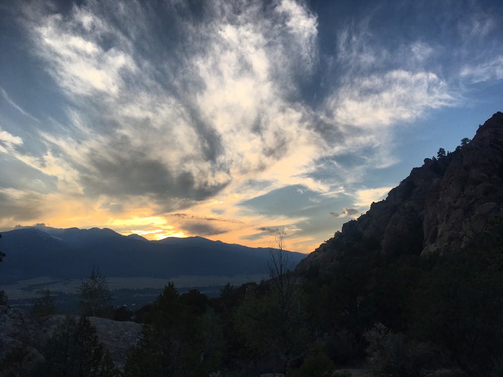
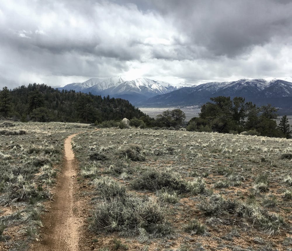
In addition to the incredibly challenging technical character, the views from this rocky ridgeline are simply stunning. With vistas in all directions, riders will enjoy views of the Sawatch Range, the Buffalo Peaks in the Mosquito range, and the rolling hills of the Fourmile Area.
Vitamin B can be shuttled using CR 375 if the gate is open, or it can be ridden as a loop with the road as shown here. While technically the singletrack is open to traffic in both directions, riding up this trail is basically impossible.
Extreme
Very steep, difficult, narrow singletrack with widely variable and unpredictable trail conditions. Unavoidable obstacles could be 15in/38cm tall or greater, and unavoidable obstacles with serious consequences are likely to be present. Obstacles could include big rocks, difficult root sections, drops, jumps, sharp switchbacks, and more. Ideal for expert-level riders.

Some trail sections are extremely exposed where falling will almost certainly result in serious injury or death.

Away from help but easily accessed.
3.8 km away
The best high-desert singletrack trails in Buena Vista (as of 2018) combined into one ride.
Difficult Mountain Biking
3.8 km away
A gravel ride through iconic “spaghetti western” terrain.
Easy Mountain Biking
3.8 km away
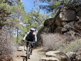
This logical close-to-town loop is still a technical mountain biking challenge.
Severe Mountain Biking
3.8 km away
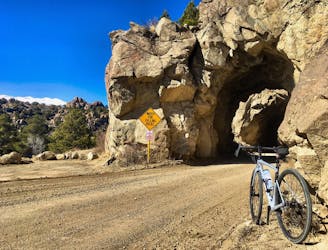
A beautiful riverside pedal on an old railroad grade, complete with tunnels!
Easy Mountain Biking
3.8 km away
Freshly-built tech-gnar constructed in 2019 that's sure to punish you.
Extreme Mountain Biking
3.8 km away
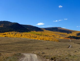
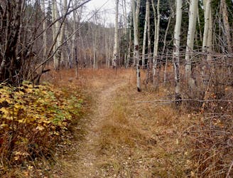
Pedal through a massive aspen grove on the side of a beautiful ridge.
Easy Mountain Biking
7.1 km away
An OG Buena Vista Ride looping the Midland Trail and dirt roads in Four Mile.
Moderate Mountain Biking
7.1 km away

An OG Buena Vista ride on the Midland Railroad Grade.
Moderate Mountain Biking
7.1 km away
One of the flowy few: an easy mountain bike ride in Buena Vista.
Moderate Mountain Biking
8.2 km away
This faint singletrack trail runs through a remote zone right on the border of the Buffalo Peaks Wilderness.
Difficult Mountain Biking

25 routes · Mountain Biking
5 routes · Mountain Biking
5 routes · Mountain Biking

20 routes · Mountain Biking