1 m away
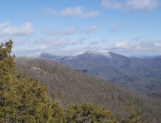
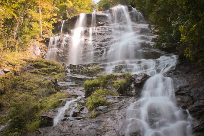
Amicalola Falls: AT Approach Trail
The 8-mile approach to the southern terminus of the Appalachian Trail.
Difficult Hiking
- Distance
- 13 km
- Ascent
- 959 m
- Descent
- 358 m
A loop pairing the AT Approach Trail and East Ridge Trail to Georgia's tallest waterfall.
Hiking Difficult

What this hike lacks in length, it makes up for in elevation and immense beauty. Nearly 2 miles total, the Amicalola Falls Loop is a must-do hike and a great day trip for anyone in Atlanta.
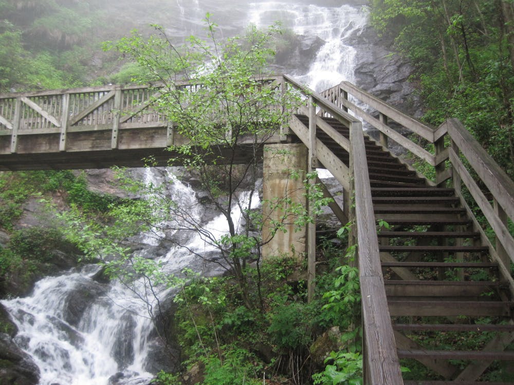
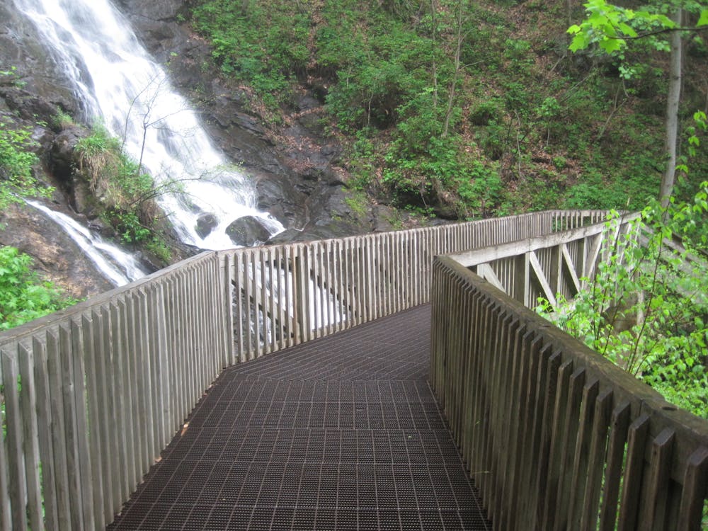

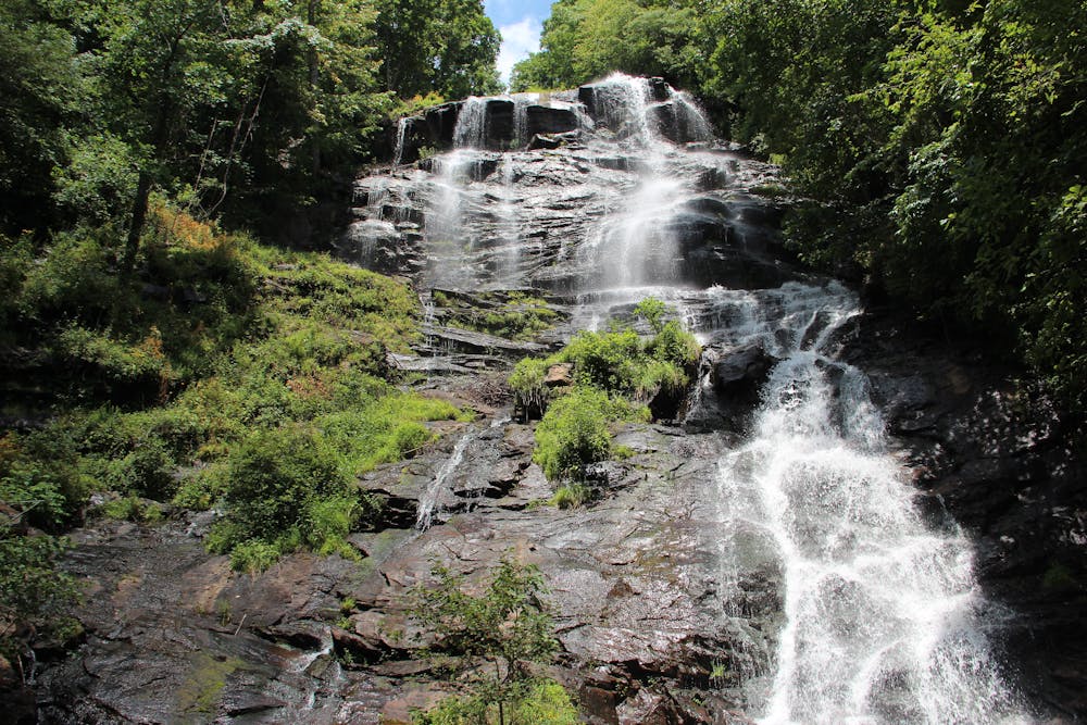
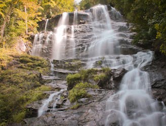
Starting at the Visitor Center, the hike follows the East Ridge Trail to the top of the massive 700'+ waterfall, where you'll be welcomed with phenomenal views of the largest waterfall in Georgia. The return trip follows a series of stairs and bridges as it descends along the waterfall on the official A.T. Approach Trail - an alternative way to begin the 2,200 mile hike instead of driving to Springer Mountain.
Popular year round, atlantatrails.com suggests "the waterfall is particularly beautiful in autumn, framed against a vibrant backdrop of fall leaves, when the surrounding trees explode into vibrant autumn color." Locals affectionately refer to it as "leaf season" and a quick Google search will yield the most up-to-date information on its timing each year.
This hike is difficult by most standards due to the elevation gain. That said, being short in length, it is still great for the entire family, even the dog! Between the beautiful hardwood forest and the waterfall, you'll have plenty of opportunities for photos along the way.
https://www.atlantatrails.com/hiking-trails/tumbling-waters-hiking-amicalola-falls/
Difficult
Hiking trails where obstacles such as rocks or roots are prevalent. Some obstacles can require care to step over or around. At times, the trail can be worn and eroded. The grade of the trail is generally quite steep, and can often lead to strenuous hiking.

Some trail sections have exposed ledges or steep ascents/descents where falling could cause serious injury.

Close to help in case of emergency.
1 m away
The 8-mile approach to the southern terminus of the Appalachian Trail.
Difficult Hiking
9.2 km away

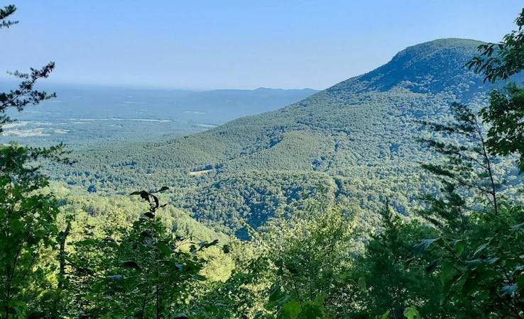
Named for the creator of the Appalachian Trail, this lesser-known alternative route through the Southern Appalachians links scenery that's just as wild.
Difficult Hiking
9.2 km away
The southern terminus for the world-renowned Appalachian Trail.
Difficult Hiking

58 routes · Hiking
10 routes · Hiking
11 routes · Hiking · Trail Running