5.2 km away
Adelmann Mine
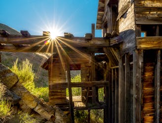
Reach an abandoned gold mine with buildings still standing, by walking up a rough road through mountainside meadows.
Moderate Hiking
- Distance
- 7.2 km
- Ascent
- 392 m
- Descent
- 392 m
A very steep hike near Boise with incredible views, great for early season peakbagging and mountaineering training.
Hiking Difficult

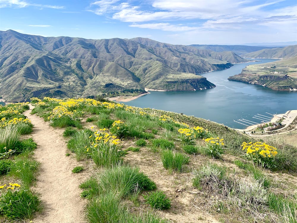
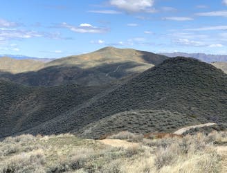
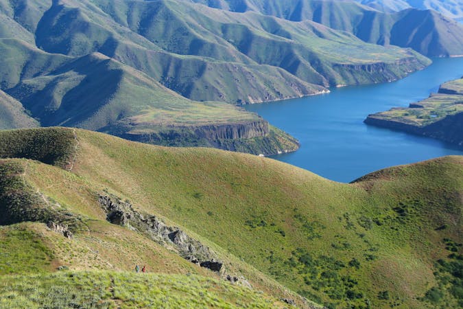
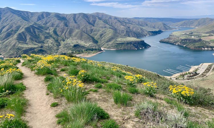
Cervidae Peak is one of the many mountains rising above Lucky Peak Reservoir just east of Boise. It’s counted among the four Grand Slam Peaks, named by guidebook author Tom Lopez as Boise’s best mountains for spring-season peak bagging. Of these, Cervidae presents the shortest hike and an easy drive from town. It’s a real leg burner, though, gaining a lot of elevation in a very short distance. Cervidae doesn’t have an official trail or trailhead, but the route is easy to find and follow from Spring Shores Road (FR 269). You’ll park at a large dirt pullout, then cross the road and walk around a gate to find a path among the sagebrush.
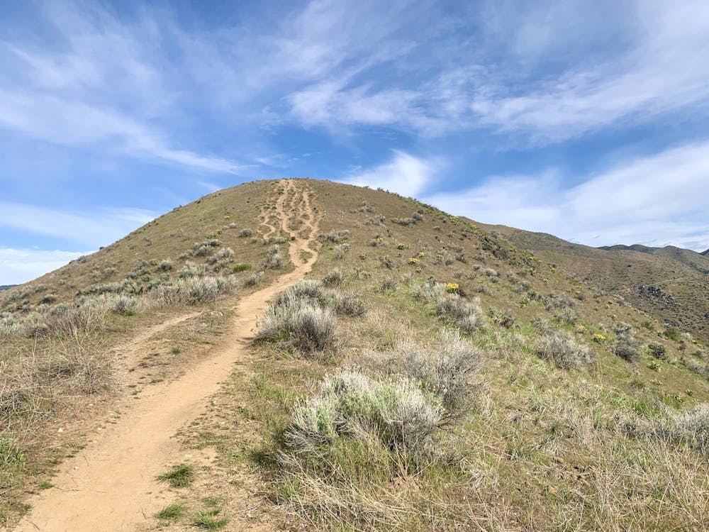
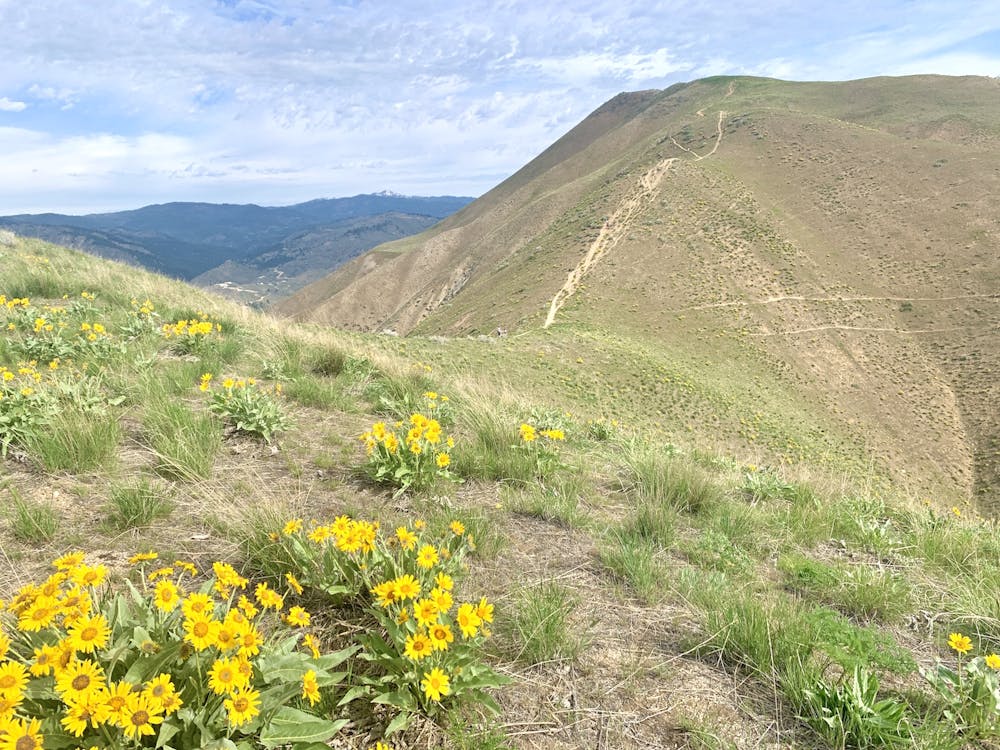
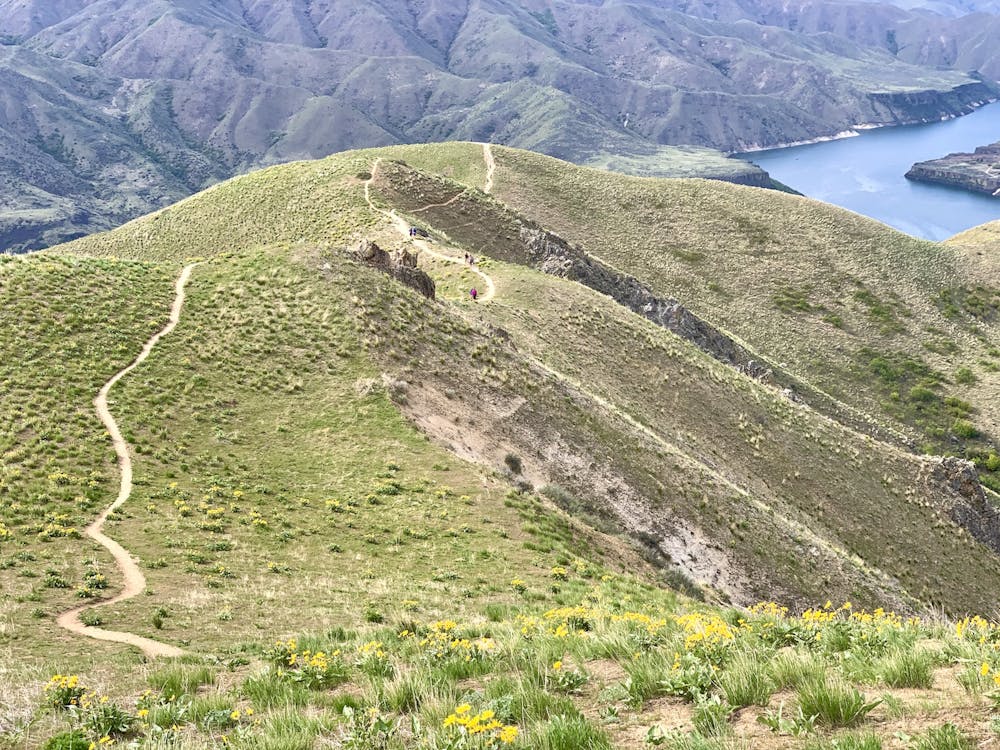
It goes up gradually at first, but after rounding the corner onto the ridgeline, it tips dramatically upward. This is not a maintained trail, but a well-worn path along the crest leading to the summit. The volume of hikers over the years has left a wide and loosely eroded track. Please do what you can to avoid worsening this erosion. It’s best to keep off when the ground is muddy, both for the good of the trail and for your own safety. Some parts are so steep that a fall might be hard to stop when the surface is slick. You should also try to stay in the established tracks even though they are rutted in some places, to keep from trampling vegetation which stabilizes the soil.
As you go up, you’ll enjoy incredible views the whole way––that is when you can pause and look up from your feet. The vantage gets better and better over the lake, the mountains on the other side, and the Treasure Valley beyond. You might even see deer or elk––members of the scientific family Cervidae for which the peak is named. Eventually, you’ll reach a false summit of the mountain, which makes a good turnaround point if you’ve had enough. The top is still about a mile away and a few hundred feet higher. If you make it all the way there, you’ll find the truly supreme views, plus a summit register stuffed full of names.
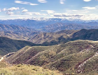
This hike is best in the spring and fall, when temps are cool and the weather is dry. Snow is usually gone from the ridgeline by early March, but it can stay muddy for longer than that. The road stays open for much of the winter, allowing for snowy ascents of the peak as well. Keep in mind that there is no shade or shelter anywhere up here, so it’s no place to be in bad weather.
Sources: https://www.idahoaclimbingguide.com/bookupdates/peak-4987-cervidae/ https://www.summitpost.org/cervidae-peak/155243
Difficult
Hiking trails where obstacles such as rocks or roots are prevalent. Some obstacles can require care to step over or around. At times, the trail can be worn and eroded. The grade of the trail is generally quite steep, and can often lead to strenuous hiking.

The trail contains some obstacles such as outcroppings and rock which could cause injury.
Away from help but easily accessed.
5.2 km away
Reach an abandoned gold mine with buildings still standing, by walking up a rough road through mountainside meadows.
Moderate Hiking
9.9 km away
A short summit hike on a prominent mountain east of Boise.
Moderate Hiking
9.9 km away
A stunning ridgewalk close to Boise, featuring views over the city, reservoirs on the river, and endless mountains on the horizons.
Difficult Hiking
10 routes · Hiking
8 routes · Hiking · Trail Running