5.2 km away
Cervidae Peak
A very steep hike near Boise with incredible views, great for early season peakbagging and mountaineering training.
Difficult Hiking
- Distance
- 7.2 km
- Ascent
- 588 m
- Descent
- 588 m
Reach an abandoned gold mine with buildings still standing, by walking up a rough road through mountainside meadows.
Hiking Moderate

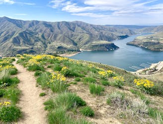
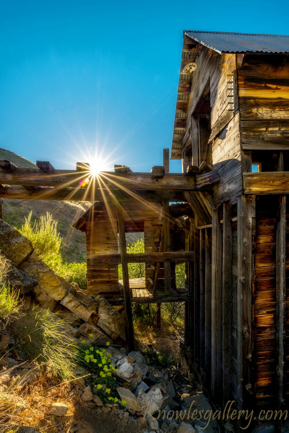
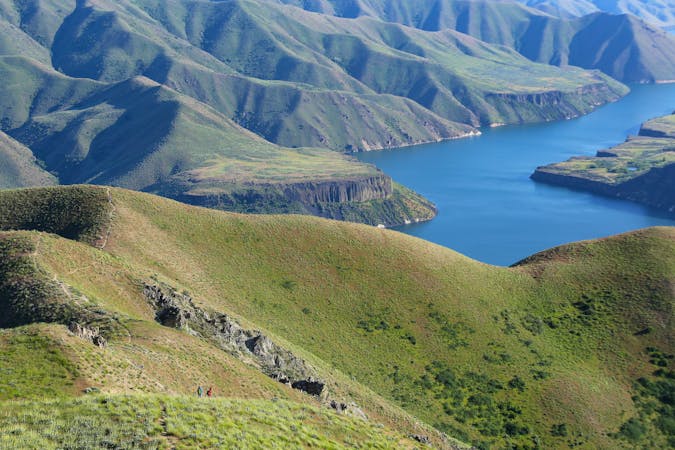
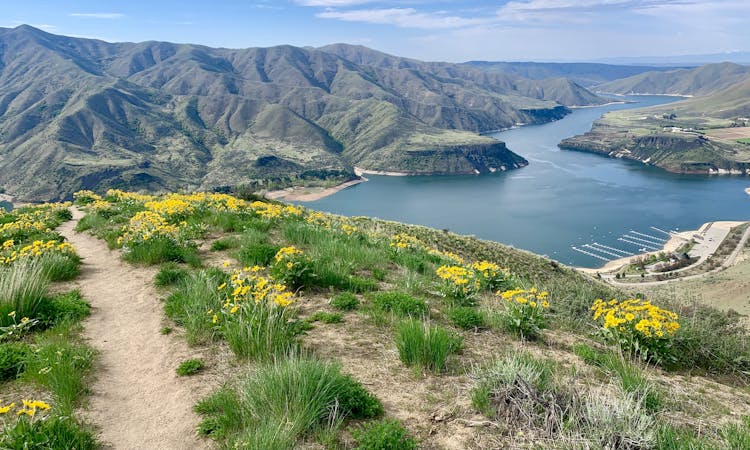
The Adelmann Mine is an interesting but relatively unknown bit of Boise history. The site was mined for gold more than a century ago, and several structures plus machinery still stand, today in various stages of decay. The mine buildings make a striking scene, tucked into a rocky gulch on the side of Lucky Peak, overlooking the Boise River valley and reservoir below.
The hike to get there is enjoyable as well, ascending the gulch through meadows of sagebrush and spring wildflowers, and near a trickling stream. Views get really good as you go up, of Lucky Peak Reservoir and the Danskin Mountains beyond, plus the much higher Trinity Mountains on the horizon. You may see deer or elk grazing the hillsides, or birds of prey soaring overhead. Once at the mine, you’ll likely see the resident marmots, who seem to have claimed this real estate in the absence of humans.
Around the site you’ll see an old mine shaft which is now collapsed. You can also find rails and pipes that were used to transport ore, and of course there’s the large mine building where the ore was processed. It’s possible to enter the structure, but use extreme caution because some parts are unstable. You’ll likely notice some graffiti and etchings on the walls. Please don’t add to these, and don’t remove anything historic from the site. The spectacle of the mine is the main attraction of this hike, so it ought to stay preserved for years to come.
This is public land administered as a Wildlife Management Area. Thus, it is open to hiking for most of the year (may be closed during fall hunting seasons), but it’s a bit of an odd location for a few reasons. First of all, this is not an official trail, but a service road through the management area. You’ll walk among some maintenance buildings and equipment to start the hike, then continue through a more remote setting. You may also notice, by sight or by smell, a roadkill pit where carcasses are sometimes left to rot. If you have a dog you may want to keep it on a leash.
The third major drawback is the parking situation. There’s no real parking lot, just a dirt clearing between the highway and a locked gate. This is a popular hike, so the lack of parking is unfortunate. Please be courteous when you park, leaving as much room as possible for other cars and not blocking the gate. If there are no spots you might consider hiking somewhere else, and saving this one for another day. It's best to come in spring, when flowers are blooming and before it gets too hot, because the entire hike is exposed to the sun.
Moderate
Hiking along trails with some uneven terrain and small hills. Small rocks and roots may be present.

The path is on completely flat land and potential injury is limited to falling over.

Away from help but easily accessed.
5.2 km away
A very steep hike near Boise with incredible views, great for early season peakbagging and mountaineering training.
Difficult Hiking
5.9 km away
Explore Boise's east foothills with this linkup of trails in a wildlife refuge.
Moderate Hiking
7.4 km away

A steep hike through prime wildlife habitat, and with exceptional wildflowers in spring.
Moderate Hiking
8.6 km away
Educational walk along the actual path of the Oregon Trail in Boise.
Easy Hiking
10 routes · Hiking
10 routes · Hiking
8 routes · Hiking · Trail Running