
25 routes · Mountain Biking
An epic length point-to-point route that breaks above treeline, providing breathtaking views.
Mountain Biking Difficult

The “epic” in the name “Osberg Ridgeline Epic” comes from at least three aspects:
Despite requiring a significant shuttle from downtown Ketchum to reach the trail’s starting point, this route still requires over 3,000 feet of uphill pedaling. That 3,000 feet of climbing gets you 5,500 feet of descending, along with a sweet 15-mile ridge traverse with the epic views this trail is renowned for!
The views from the top feel like they’ll never end as you pedal around one bald corner and then another, with mountain ridges marching off into the distance until they slowly fade from view.
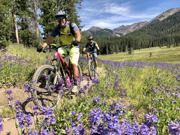
The views wouldn’t be nearly as pervasive without a recent wildfire that decimated the forest throughout this area. As you pedal through blackened tree trunks, a sea of brilliant wildflowers will keep the atmosphere from being too depressing.
Overall the singletrack around Ketchum is buff and flowy, with technical obstacles few and far between. That said, the Osberg Ridgeline trail throws one or two steep, techy descents at you. In fact, Osberg is home to one of the few moderately technical stretches of trail in the greater Sun Valley area… but don’t let that keep you from riding your hardtail, as it will serve you well on 90% of this trail.
Once the singletrack drops off the top of the mountain, it descends quickly into a narrow valley that was protected from the wildfire. Here, old growth pines tower high above, providing a welcome respite from the sometimes-brutal Sun Valley sun.
A few different options exist to finish the Osberg Epic and return to Ketchum—some more difficult than others. Depending on how you’re feeling at this point, you can tailor the difficulty of trail to your fitness level, or pop out onto the highway and coast back to town.
Difficult
Mostly stable trail tread with some variability featuring larger and more unavoidable obstacles that may include, but not be limited to: bigger stones, roots, steps, and narrow curves. Compared to lower intermediate, technical difficulty is more advanced and grades of slopes are steeper. Ideal for upper intermediate riders.

The trail contains some obstacles such as outcroppings and rock which could cause injury.

Little chance of being seen or helped in case of an accident.
25 routes · Mountain Biking
5 routes · Mountain Biking

10 routes · Mountain Biking

10 routes · Mountain Biking