1.9 km away
Polecat Gulch Loop

Singletrack loop in the hills, convenient to Boise and Meridian.
Moderate Trail Running
- Distance
- 10 km
- Ascent
- 261 m
- Descent
- 261 m
One idea for a hilly training loop in Hillside to Hollow Reserve.
Trail Running Moderate

Hillside to Hollow Reserve is one of the more popular recreation areas in Boise. It has a rather complex web of trails draped over steep hills of sagebrush prairie. Even though the views are wide open, the abundance of trails and lack of signs can make it all pretty confusing. You can follow the route mapped here for a guaranteed good workout, without the guesswork of where the next turn leads.
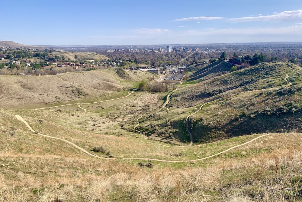
As mapped, the run starts from Hillside Park on the west side of town. This is the quieter end of the reserve, as opposed to the popular Harrison Hollow near downtown. You could easily start from that side instead, if it's more convenient, and quickly access the loop via other trails on the map.
The trails on this loop are all well-traveled but rarely crowded. You'll enjoy burning climbs and fast descents with rewarding views over the city and the mountains. The ridge top does get super steep in short sections, but for the most part the trails are well graded. Note that the tread becomes especially slick when wet, and is easily damaged. So please avoid these trails when muddy. And because there's no shade, this run is best saved for the milder days of the year.
Moderate

The trail contains some obstacles such as outcroppings and rock which could cause injury.

Close to help in case of emergency.
1.9 km away
Singletrack loop in the hills, convenient to Boise and Meridian.
Moderate Trail Running
4 km away
One of Boise's best local trail run loops.
Moderate Trail Running
4.1 km away
Efficient climb up Hulls Gulch and a scenic return on Crestline and Kestrel Trails.
Moderate Trail Running
5.8 km away

A scenic workout in Boise's Military Reserve park.
Moderate Trail Running
10 routes · Trail Running